Welcome to
Young's Photo Gallery
James W. Young, Professional Photographer
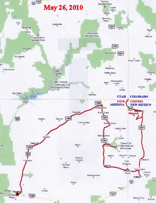
May 2010 Trip
On May
23, I departed Wrightwood on a
four-state photographic trip into Arizona,
Utah, Colorado, and New Mexico. The weather
was ideal, with
especially clear and
cool atmospheric conditions. My initial
goals were to photograph
Monument Valley and
Arches National Park at night, with moonlight
illuminating the
landscape. However, I
was able to do much more than originally
anticipated.
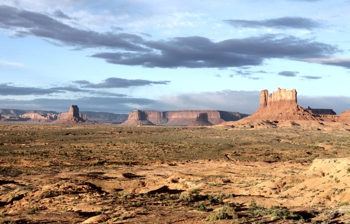
state of Arizona. It is officially "Monument Valley Navajo Tribal Park", and lies
within the Navajo Indian Reservation. I arrived after dark, with a bright moon.
On this first day, my only images were of the Monument Valley area at night.
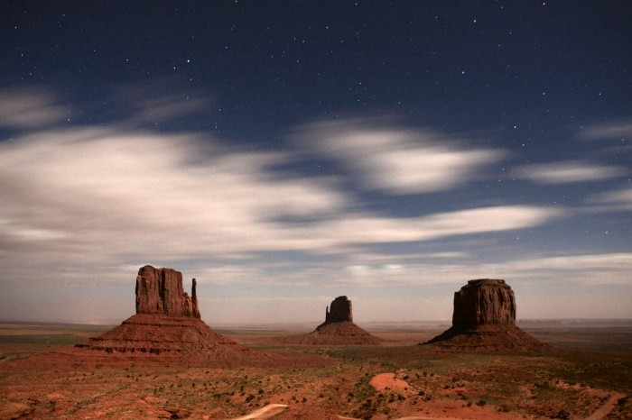
These three buttes are known as the 'Three Mittens': The left one is known as
West Mitten Butte; the one in the center is East Mitten Butte, and the one on
the right is Merrick Butte. These rise about 1000 feet above the valley floor.
This view is looking nearly due east from the visitor center.
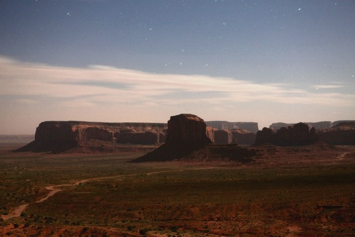
Elephant Butte is in the center, with Spearhead Mesa in the left background.
Camel Buttes are to the right of center.
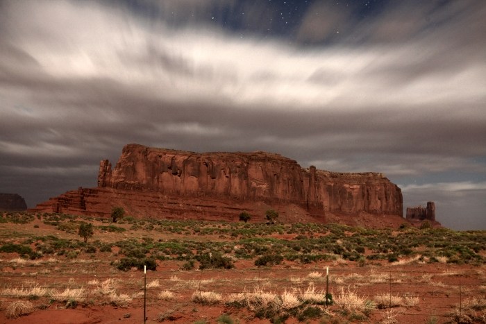
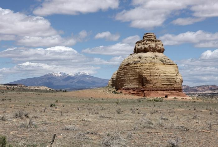
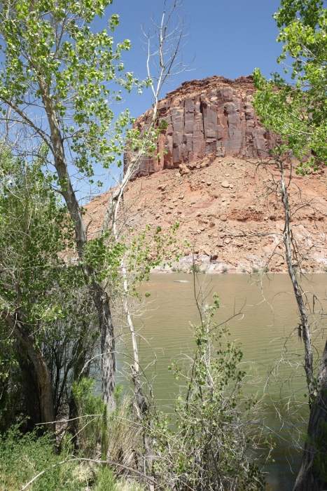
This is Sentinel Butte, located just across the state border in Utah.
........................................................................................
After sleeping the night at the border, I headed north toward Natural Bridges
National Monument on May 24, 2010. During this second day, I first visited
Goosenecks State Park, then Natural Bridges NM, Monticello, and eventually up
to Arches NP.
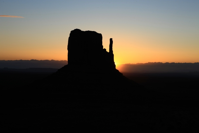
West Mitten Butte at sunrise.
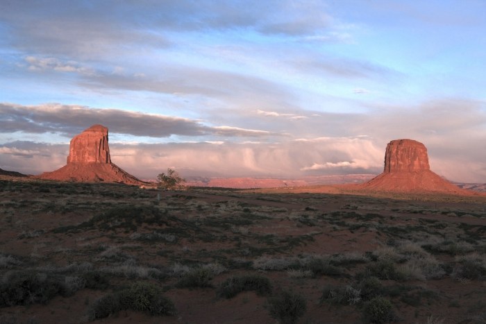
Looking southwest at an approaching storm front, still in Monument Valley.
Looking south into Monument Valley from Utah, on US Highway 163.
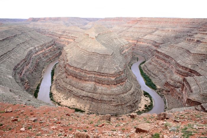
Looking southwest from Goosenecks State Park, west of Mexican Hat, Utah.
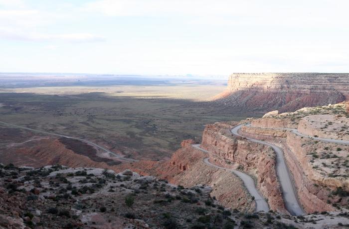
A place called 'Moki Dugway' on Utah Highway 261, rising out of the Valley of the
Gods, to the top of Cedar Mesa, with Monument Valley on the horizon to the south.
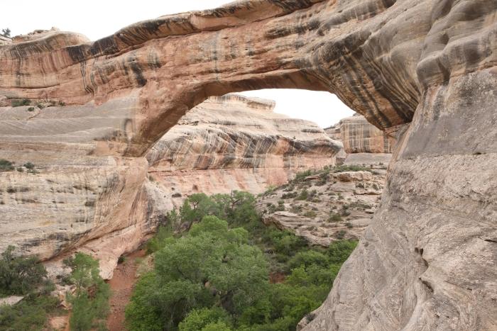
Sipapu Bridge in Natural Bridges National Monument, at the west end of
Utah Highway 275.
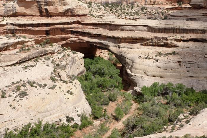
Kachina Bridge in Natural Bridges NM.
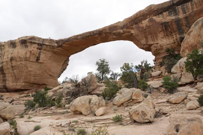
Owachomo Bridge in Natural Bridges NM.
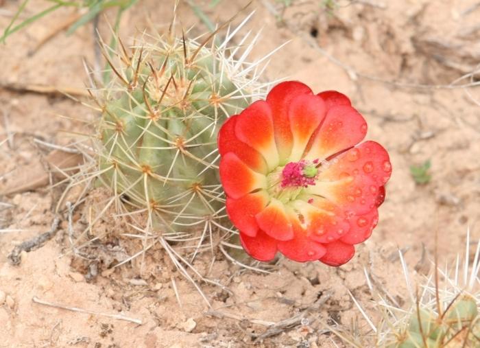
Cactus bloom in Natural Bridges NM.
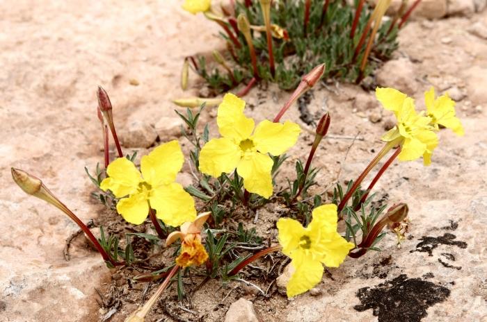
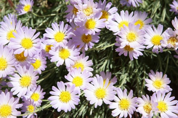
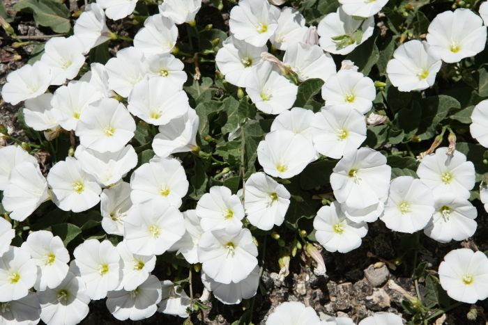
Flowers in Natural Bridges NM.
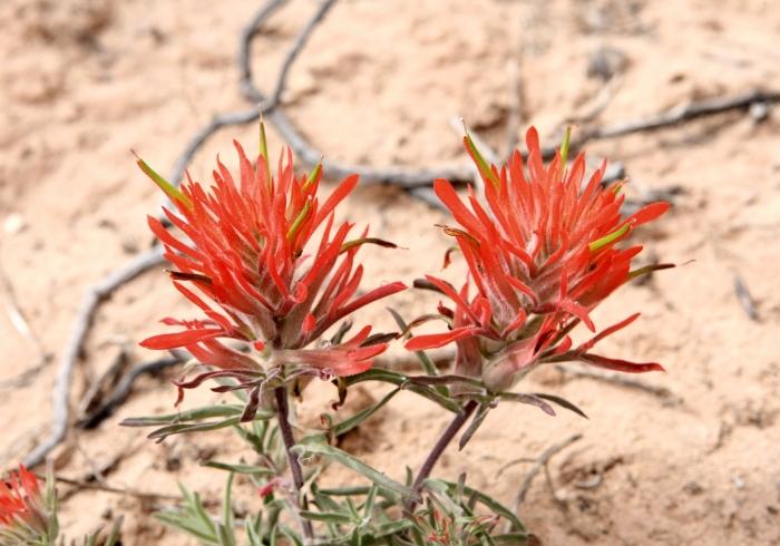
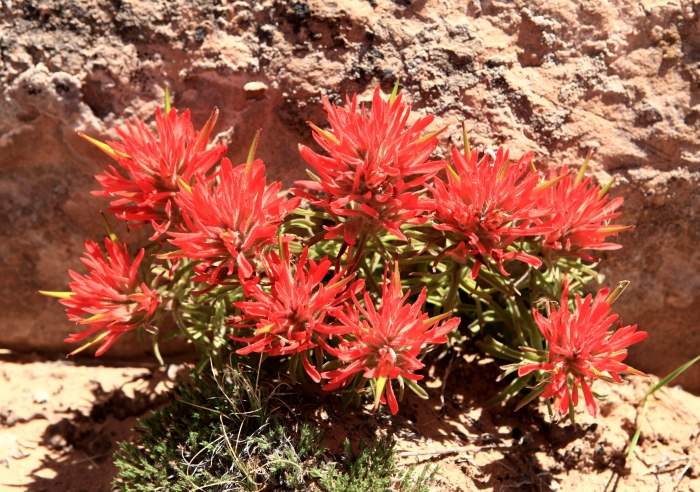
Indian Paint Brush in Natural Bridges NM.
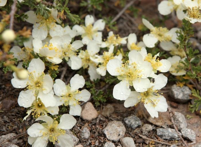
Flowers in Natural Bridges NM.
Flowers in Natural Bridges NM.
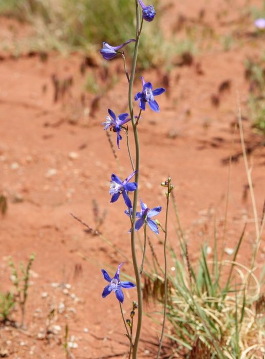
Lupine in Natural Bridges NM.
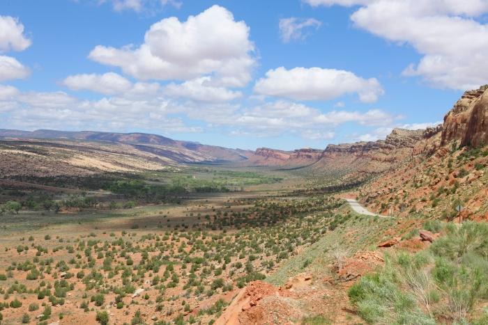
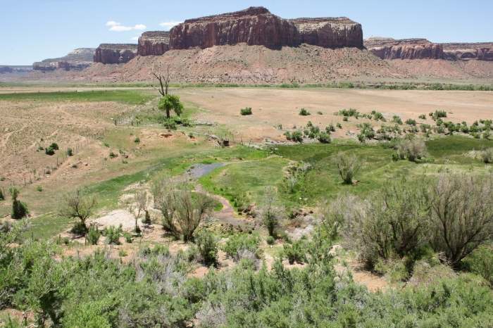
An area called 'Comb Wash' on Utah Highway 95 southwest of Blanding, Utah.
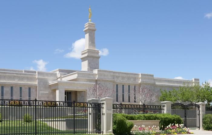
A temple of the Church of Jesus Christ of Latter-Day Saints located in Monticello,
Utah, on Highway 163/191.
Church Rock, with the La Sal Mountains in the background, east of Canyonlands
National Park on US Highway 163/191.
Wilson Arch, located on US Highway 163/191 south of La Sal Junction, Utah.
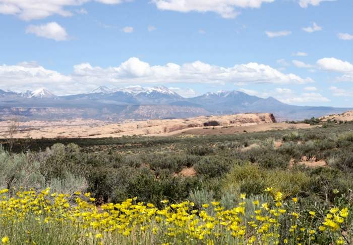
The La Sal Mountains from Arches National Park, north of Moab, Utah.
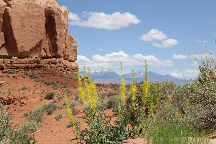
The La Sal Mountains from near the Courthouse Towers in Arches NP.
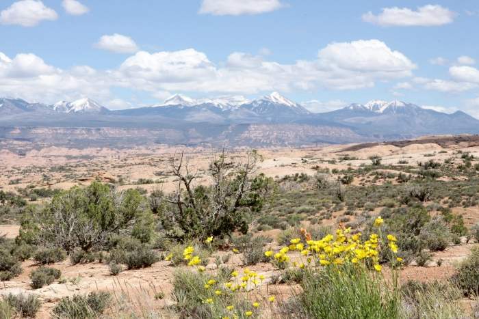
The La Sal Mountains from Arches NP.
The La Sal Mountains from Arches NP.
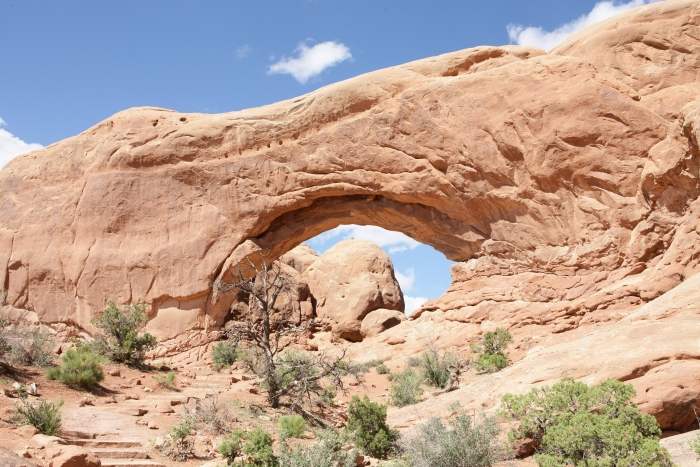
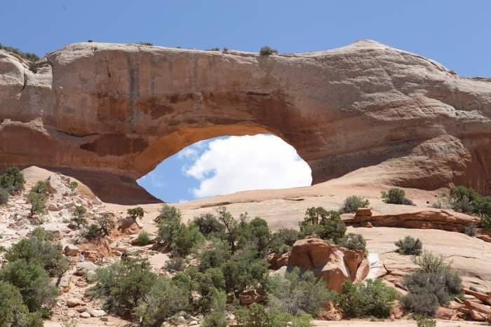
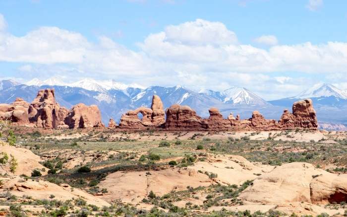
The 'North Window' in the Windows Section of Arches NP.
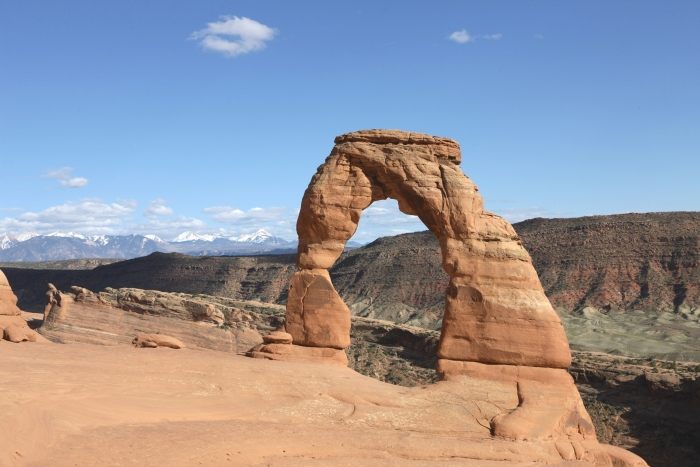
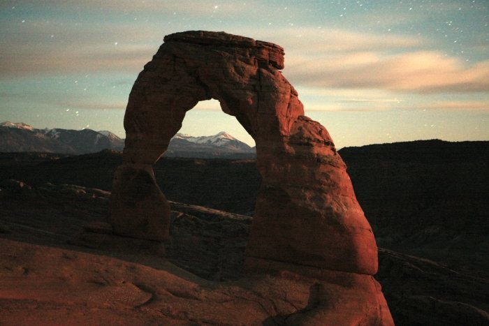
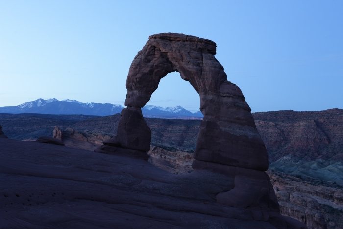
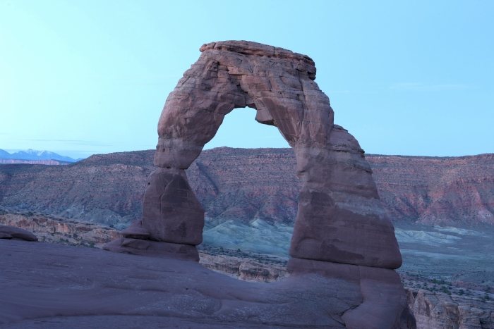
Delicate Arch, with the La Sal Mountains in the background. This is undoubtedly
the most famous arch in Arches National Park. To get to this arch, one has to
hike a 3 mile round-trip trail, partially over open slick rock, with some exposure
to heights and drop-offs.
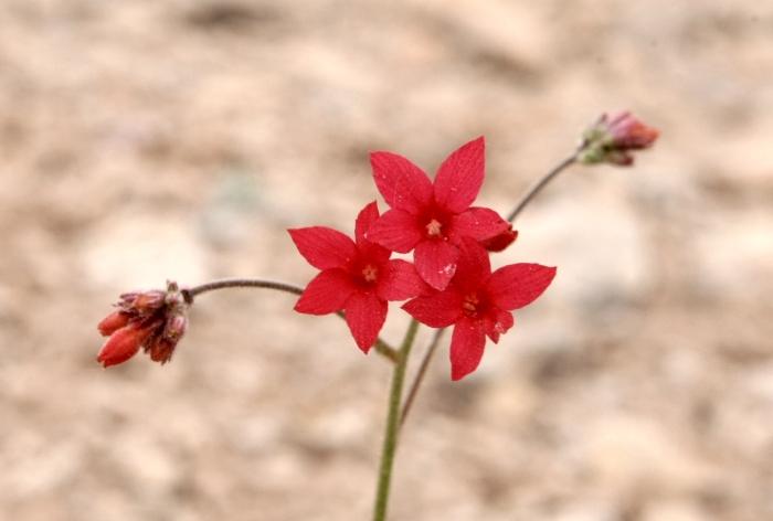
Indian Paint Brush in Arches National Park.
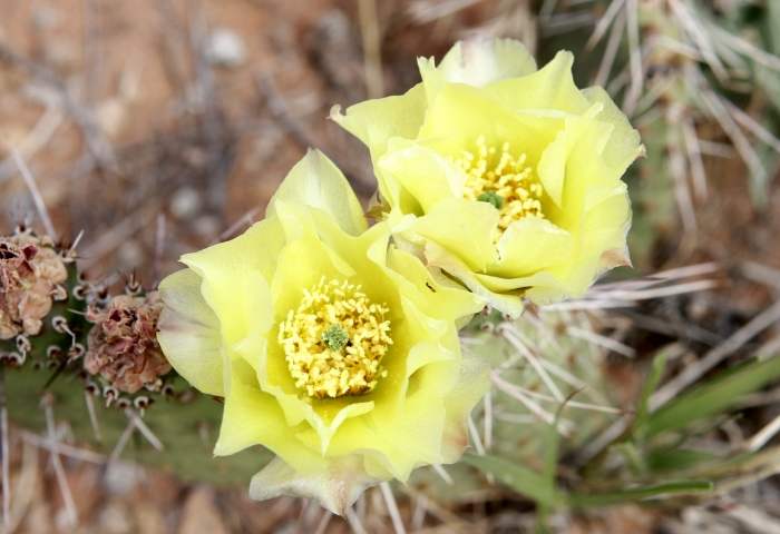
Yellow cactus bloom in Arches NP.
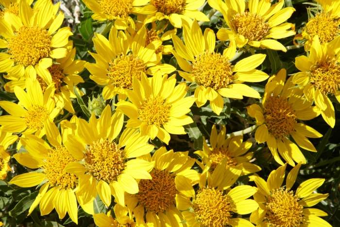
Yellow flowers in Arches NP.
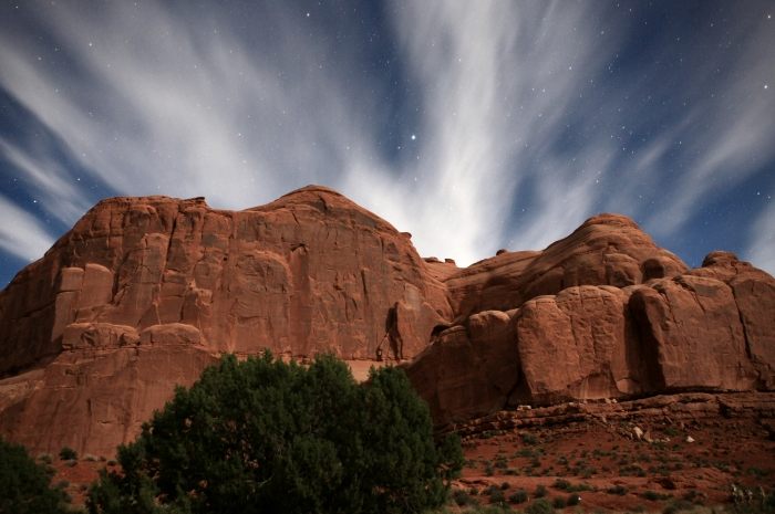
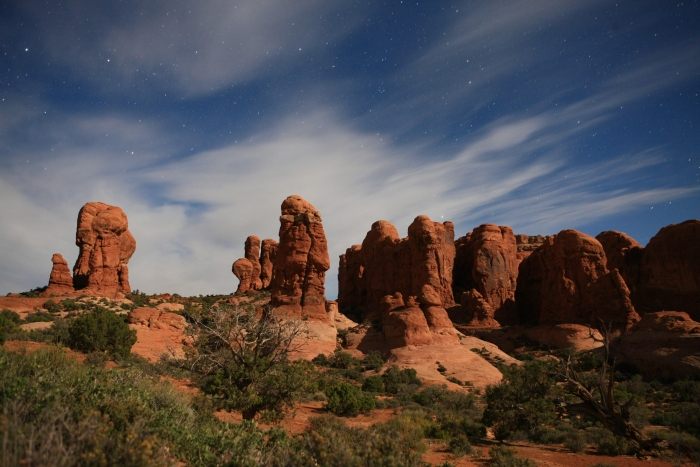
The following seven images were taken at various locations during the evening of
May 24 in Arches National Park. The landscape is bathed in bright moonlight,
along with clouds and stars above.
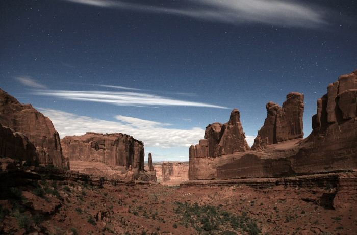
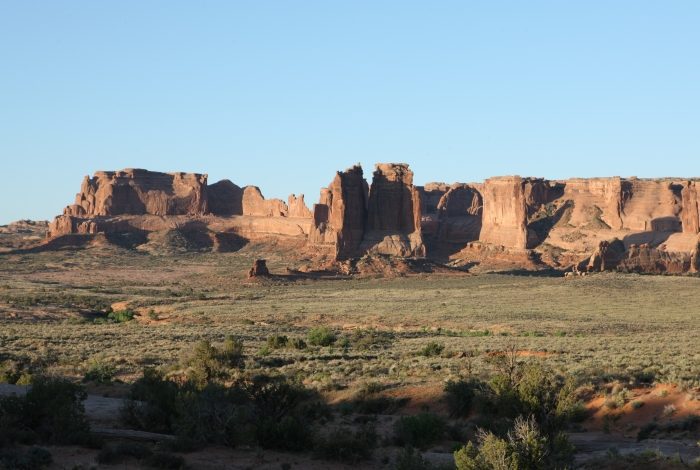
From the 'Courthouse Towers' area.
From the 'Courthouse Towers' area.
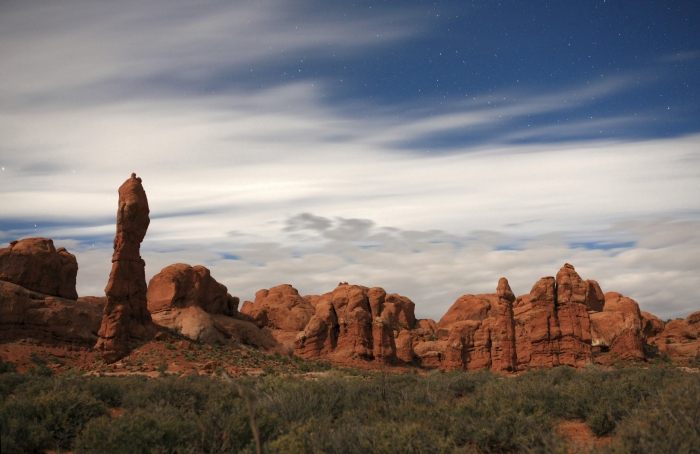
From the 'Rock Pinnacles' area.
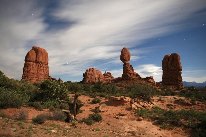
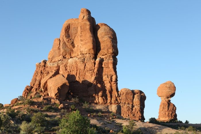
Balance Rock (right center).
The 'Garden of Eden' area.
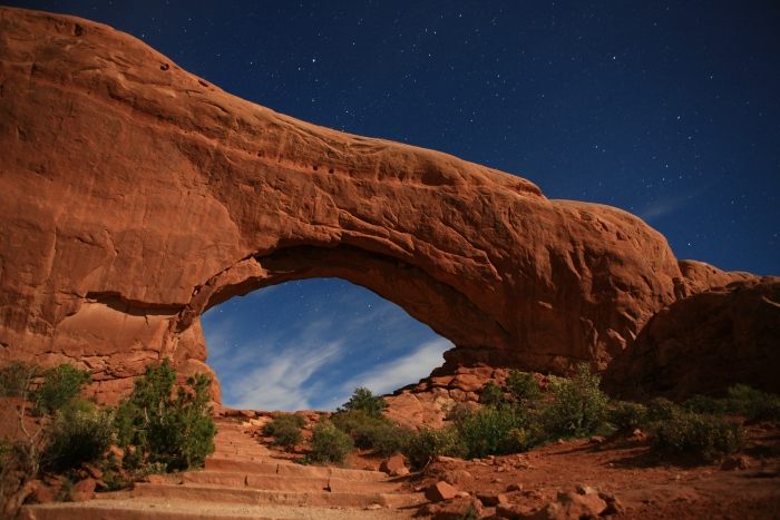
The North Window in the 'Windows Section' area
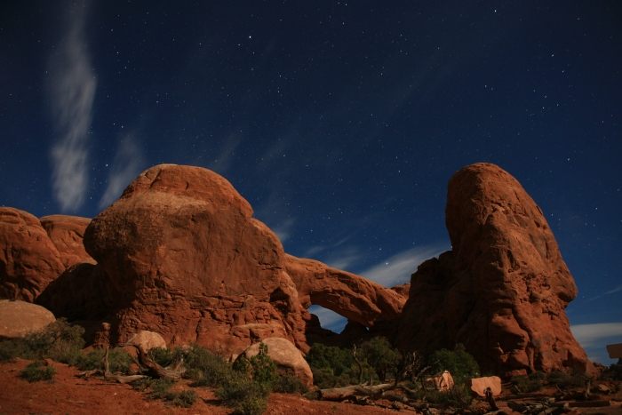
The South Window in the 'Windows Section' area.
........................................................................................
I slept at the Delicate Arch trailhead until 2:20AM, May 25, 2010. I hiked the
trail by flashlight, losing my way after the slick rock face climb, and I lost nearly
40 minutes re-finding the trail! By the time I arrived at Delicate Arch, I had only
a few precious minutes to image the arch in moonlight. I have been up this trail in
daylight several times, including the previous afternoon, but still lost my way. This
part of my trip was the real purpose of coming to Arches NP; everything else prior
to and after was merely frosting on the cake, so to speak.
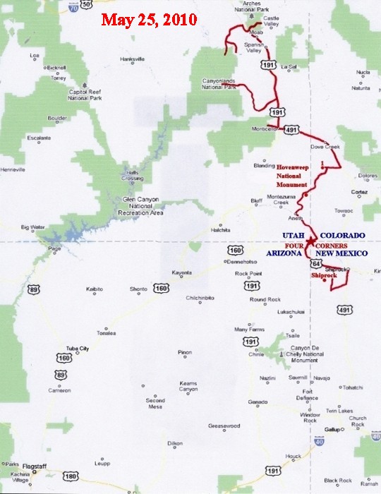
After leaving Arches NP,I headed to upper Canyonlands NP, as well as Dead Horse
Point State Park, then the lower Canyonlands NP and Indian Creek. I went into
Colorado to the Canyons of the Ancients National Monument, Hovenweep NM (just
inside the Utah border), then to Four Corners,where the Arizona, Utah, Colorado,
and New Mexico borders meet at a single point (it was closed, unfortunately), and
on to Shiprock, New Mexico.
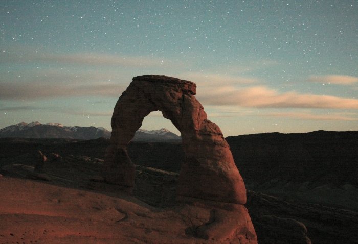
The La Sal Mountains through the arch in moonlight.
The last moonlight image of the arch.
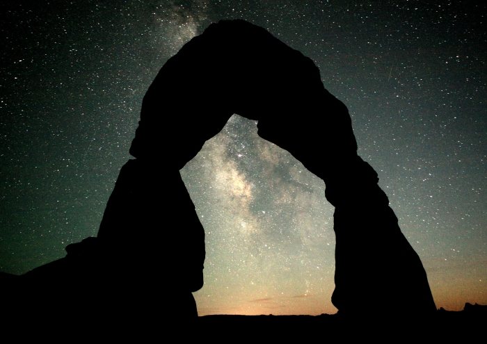
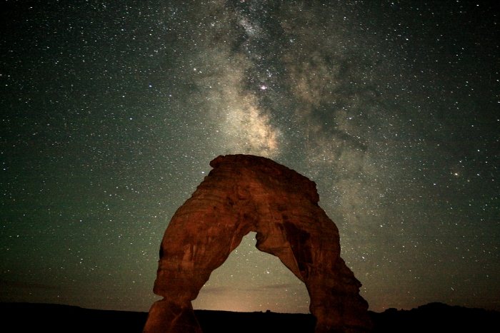
The Milky Way through the arch after moonset.
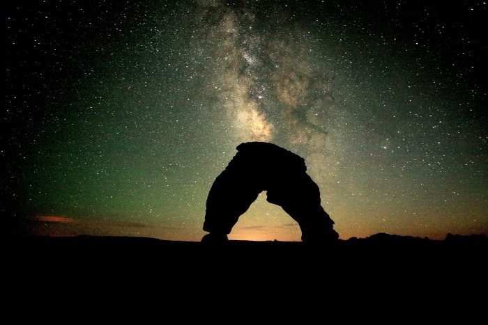
The Milky Way and Delicate Arch.
A little flashlight illumination on the arch.
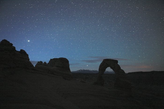
The beginning of twilight, with Jupiter at left, and the star Fomalhaut just over
the La Sal Mountains.
20 minutes before sunrise.
10 minutes before sunrise.
After sunrise, Balanced Rock (right).
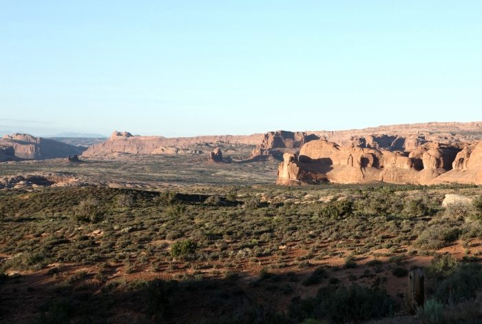
Looking south toward the Courthouse Towers, with Moab Valley on the far left.
The north side of the Courthouse Towers area.
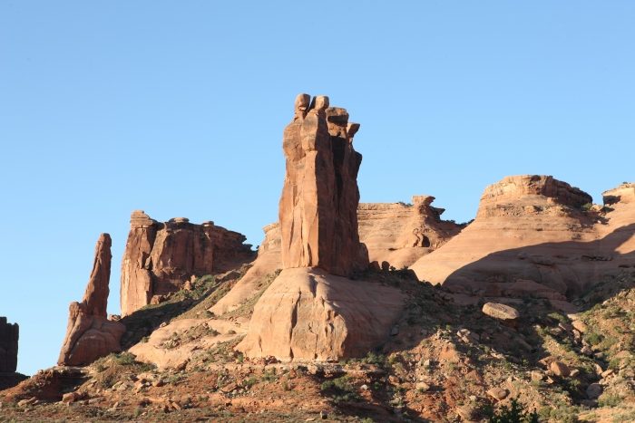
The 'Three Gossips'.
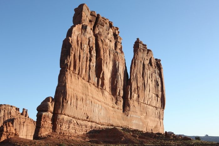
'The Organ'
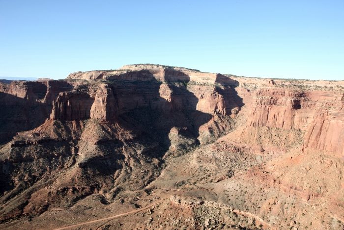
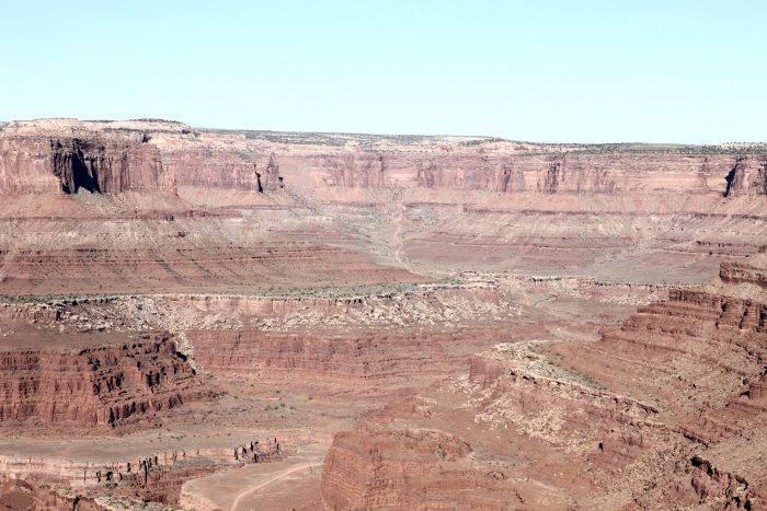
Shafer Canyon overlook in Canyonlands National Park.
The north rim of Shafer Canyon in Canyonlands NP.
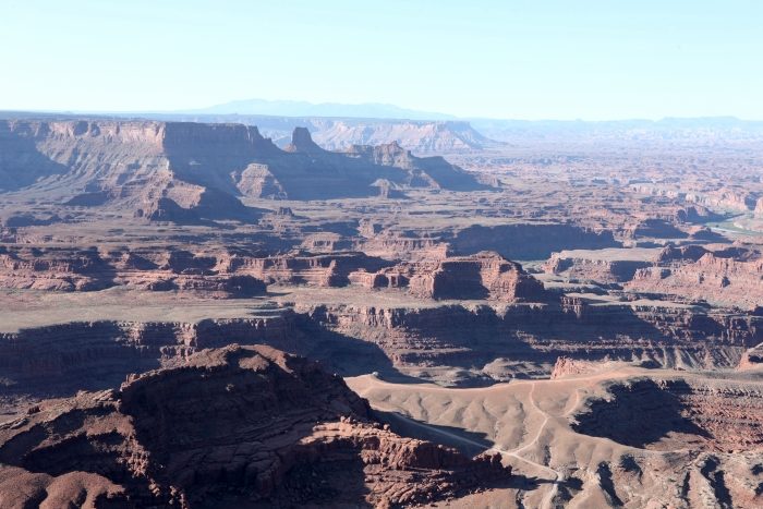
The overlook from Dead Horsepoint State Park, looking south.
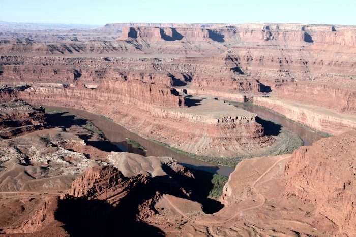
The 'Gooseneck' of the Colorado River: Dead Horsepoint SP, looking southwest.
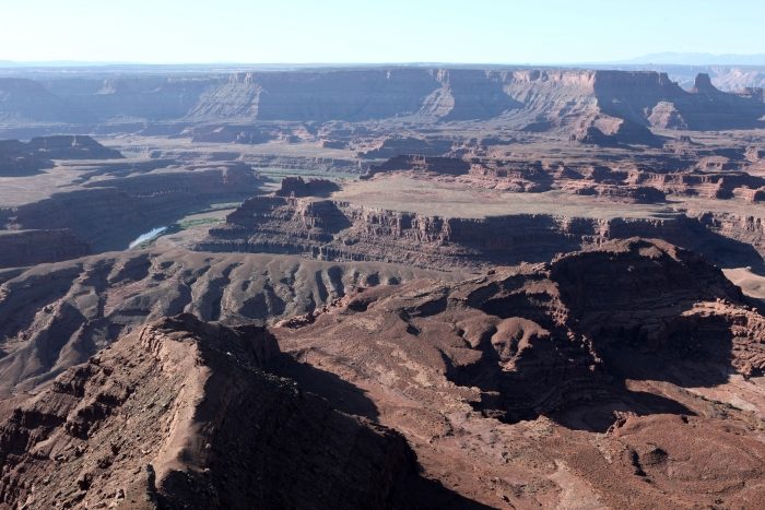
Looking southeast from Dead Horsepoint SP.
Looking west into Shafer Canyon in Canyonlands NP, from Dead Horsepoint SP.
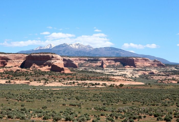
Looking north-northeast toward the La Sal Mountains, from US Highway 163/191.
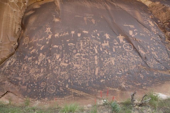
'Newspaper Rock' in the Indian Creek Valley along Utah Highway 211.
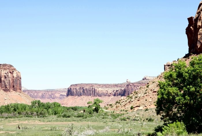
Indian Creek Valley, looking northwest along Utah Highway 211
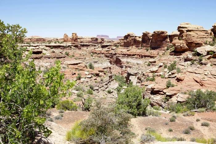
Near 'Pothole Point' at the end of Utah Highway 211, in the southern part of
Canyonlands National Park.
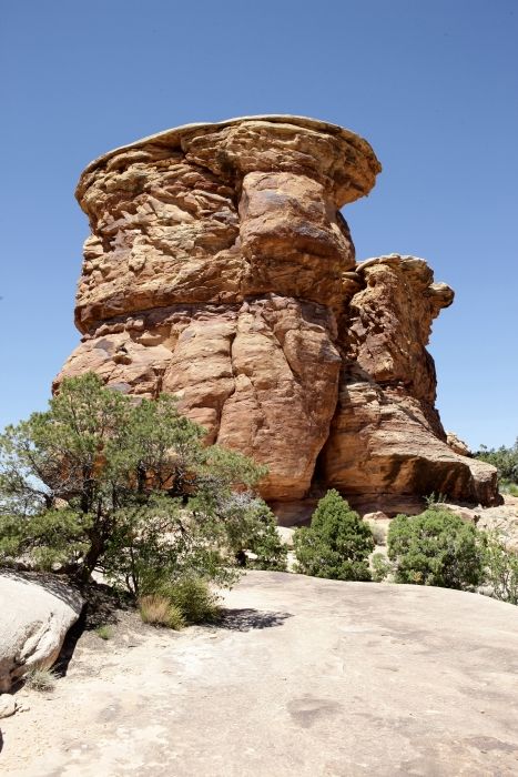
At the end of Utah Highway 211 in Canyonlands NP.
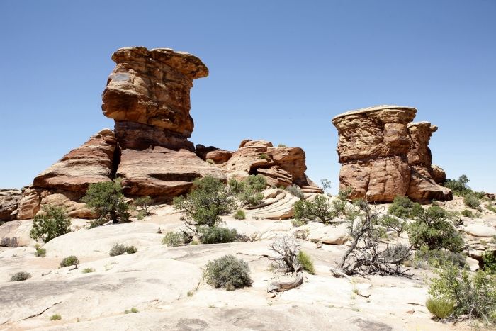
At the end of Utah Highway 211 in Canyonlands NP.
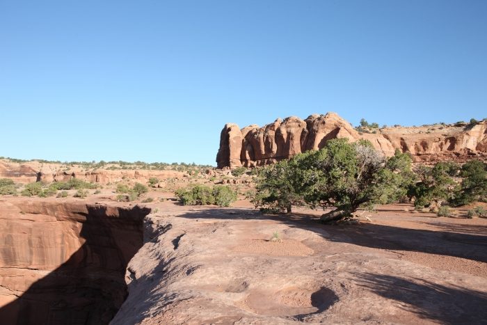
North Six-Shooter Peak just outside of Canyonlands NP.
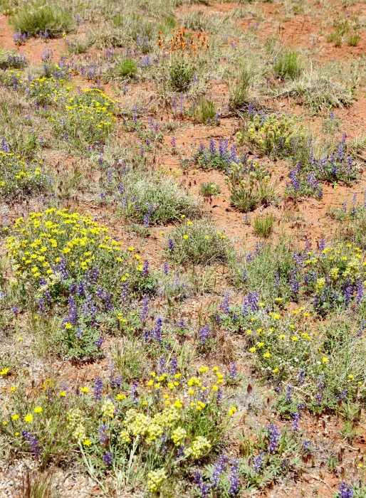
Flowers along Utah Highway 211 in Indian Creek Valley, including the
next five images.
A small reservoir along Utah Highway 211 in Indian Creek Valley.
Looking at Bridger Jack Mesa from within Indian Creek Valley.
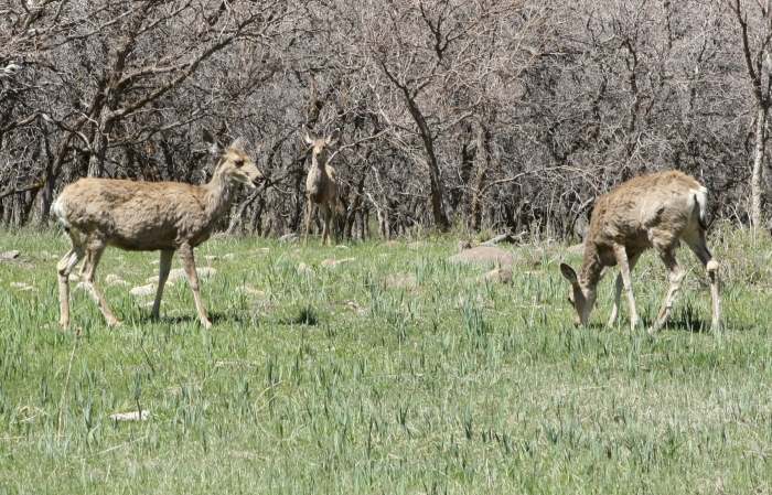
West from Monticello, Utah, along the North Creek Road in the Abajo Mountains,
I found these three deer grazing along the road.
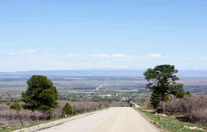
Looking east toward Monticello on the North Creek Road, I could see into Colorado
and the distant mountains some 80-100 miles away.
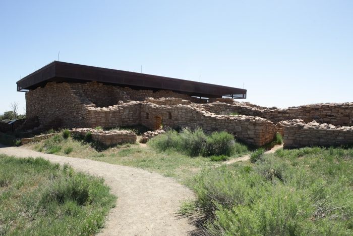
The Lowry Pueblo in the Canyon of the Ancients National Monument, located to
the northwest of Cortez, Colorado on Montezuma County Road. Part of the
pueblo is covered to protect the inside structure.
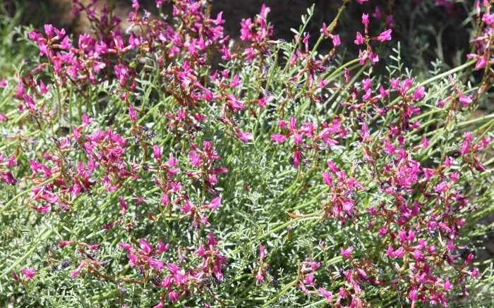
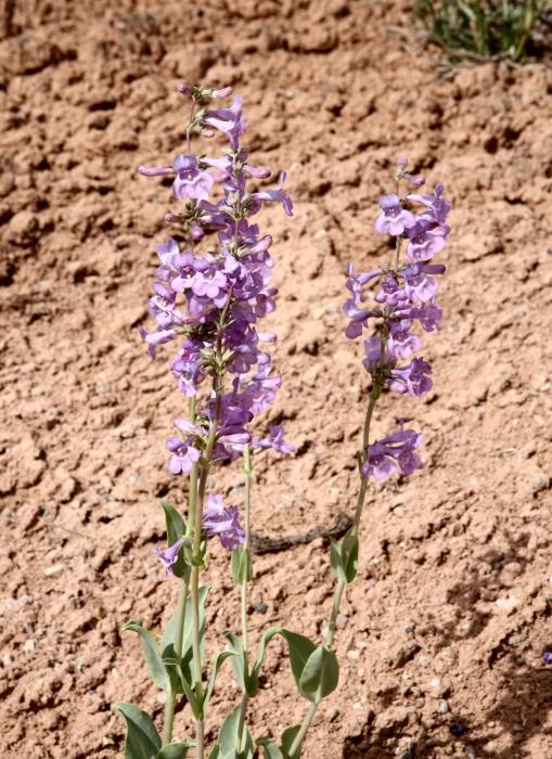
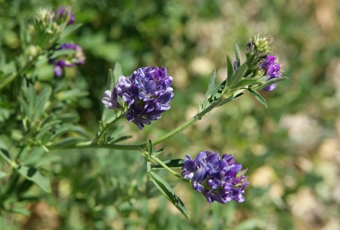
Flowers near the Lowry Pueblo.
A pinkish colored lupine near the Lowry Pueblo.
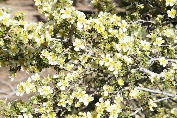
A Canyon Rose bush at Hovenweep National Monument just inside Utah along the
Hovenweep Road from Colorado.
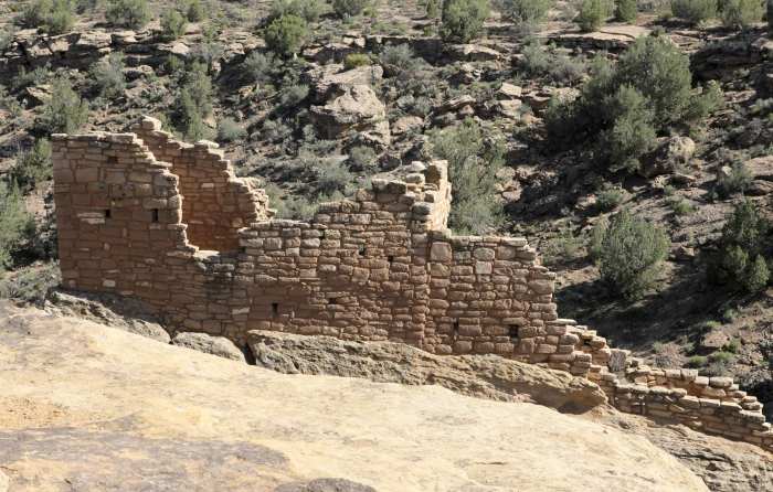
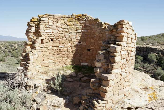
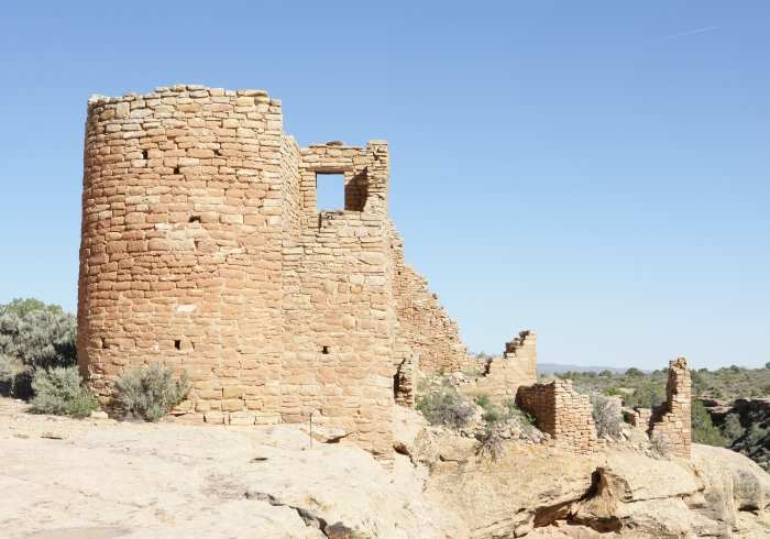
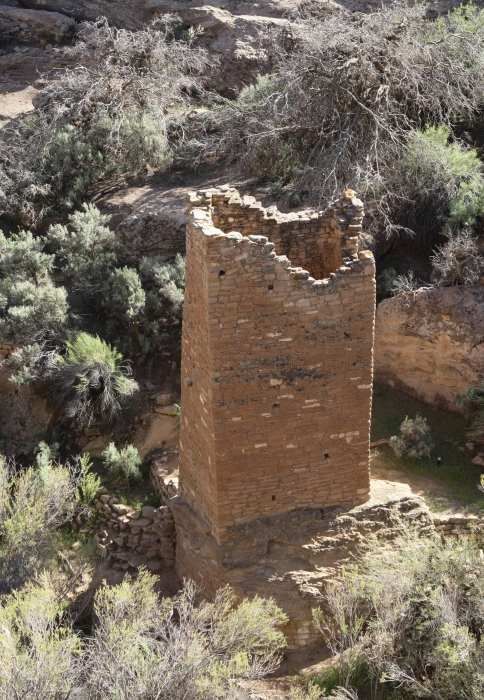
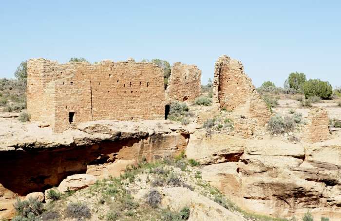
The next five images are of various houses, towers, and castles in the Hovenweep
National Monument.
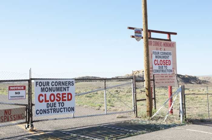
The gate leading to 'Four Corners'. There is a major renovation being made of
the actual monument that sits directly on the four corners of New Mexico, Utah,
Arizona, and Colorado (600 feet northwest of this gate).
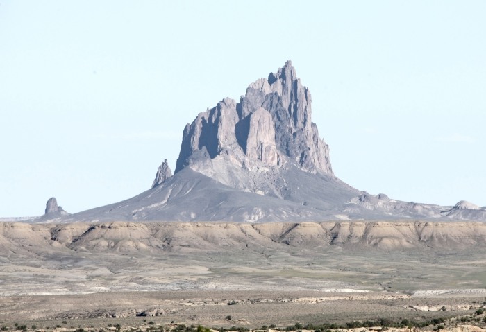
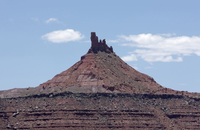
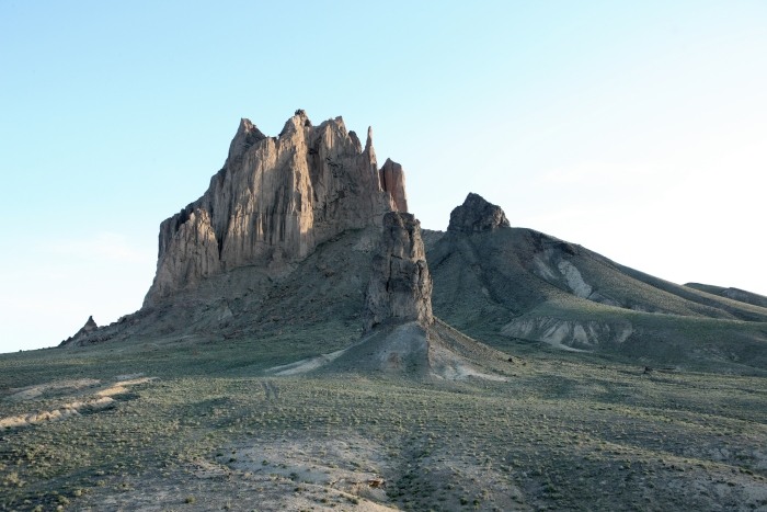
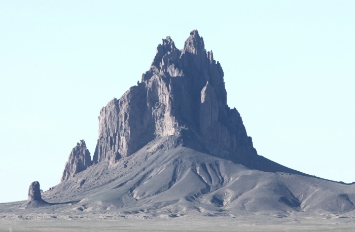
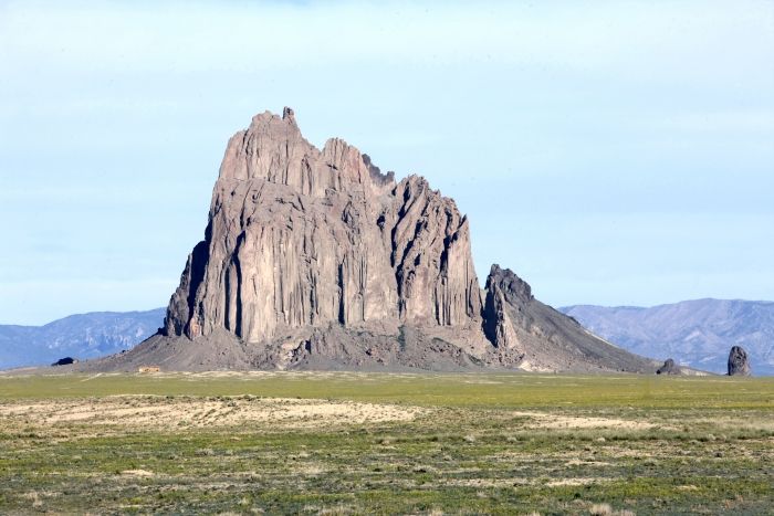
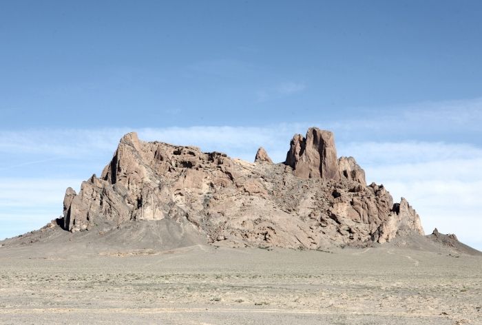
Shiprock seen from US Highway 64, looking 13 miles to the southeast.
Shiprock seen from US Highway 64, looking 11 miles to the south-southeast.
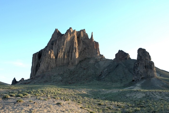
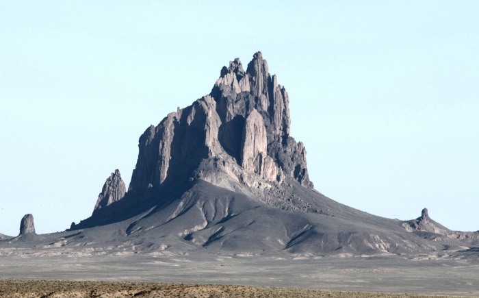
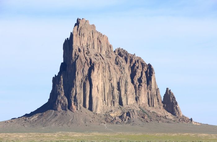
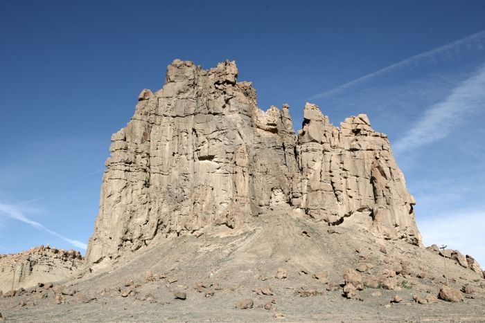
Shiprock seen from less than 1 mile, looking to the north.
Shiprock from above the ground (on a steep outcropping).
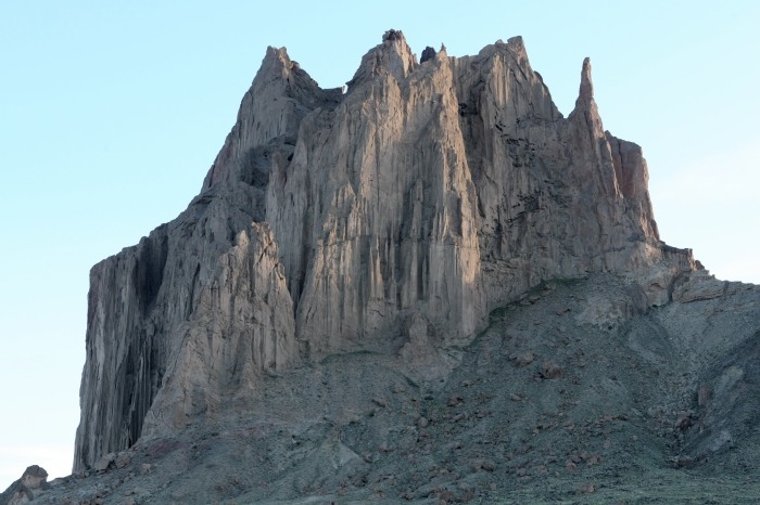
The top area of Shiprock.
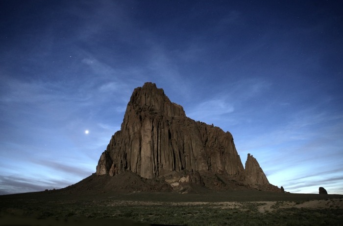
Shiprock from about 1 1/2 miles to the southeast at sunset, bathed in moonlight.
Venus is to the left.
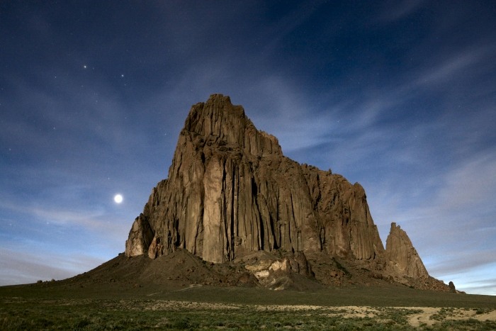
Shiprock seen 30 minutes later, with Castor and Pollux in the upper left, while
Venus is just to the left of the rock.
........................................................................................
I slept at Four Corners for the night.
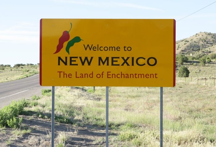
Entering New Mexico from Arizona near 'Four Corners'.
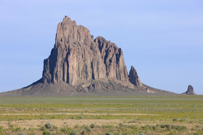
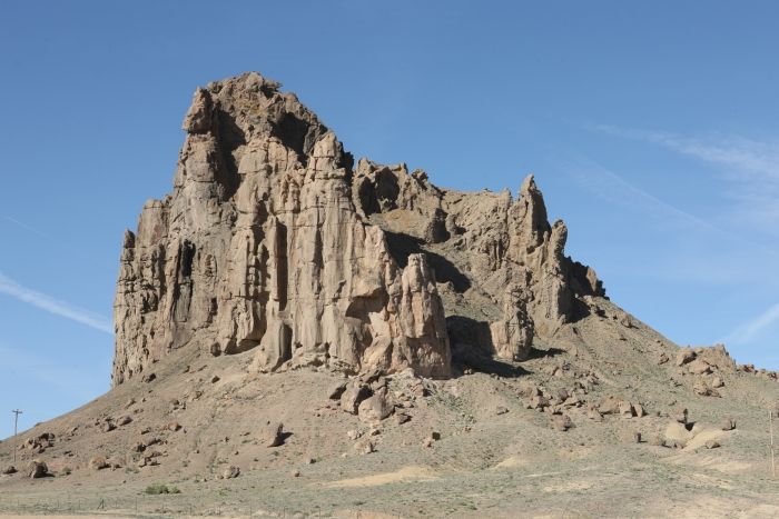
Shiprock taken from US Highway 64, 10 miles to the north.
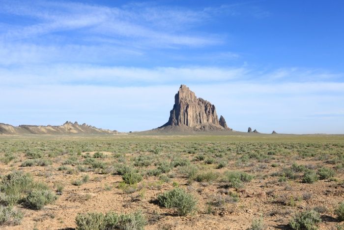
Shiprock taken from 4 miles to the southeast along New Mexico Highway 13.
Shiprock taken from 3 miles south-southeast along New Mexico Highway 13.
Shiprock taken from 2 miles south.
Wide angle shot of Shiprock, showing uplifted rock wall to the west and south.
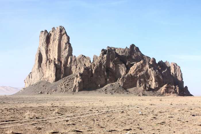
Decaying rock butte south of Shiprock on US Highway 491.
Same rock as above.
Another decaying rock butte near Newcomb, New Mexico on US Highway 491.
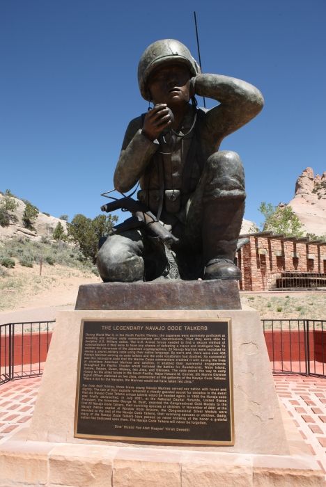
Memorial honoring the Navajo "Code Talkers".
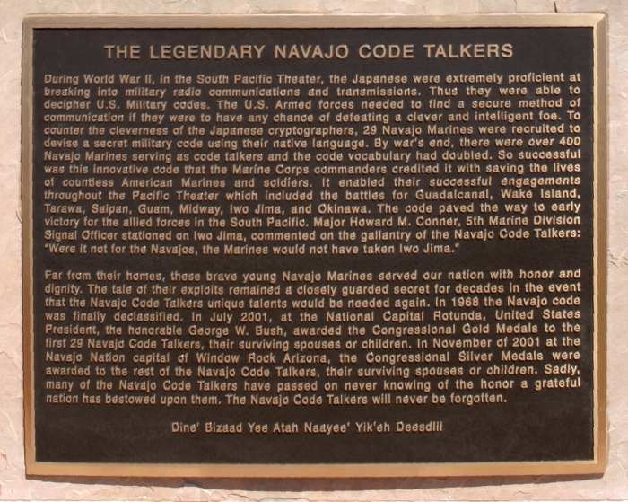
Plaque honoring the Navajo "Code Talkers".
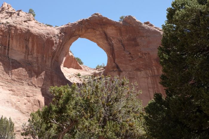
Window Rock, Arizona, site of the Navajo Nation Tribal Headquarters.
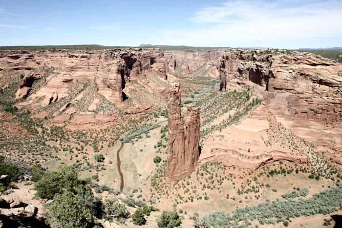
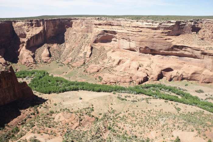
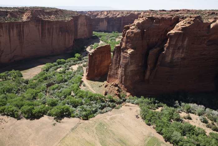
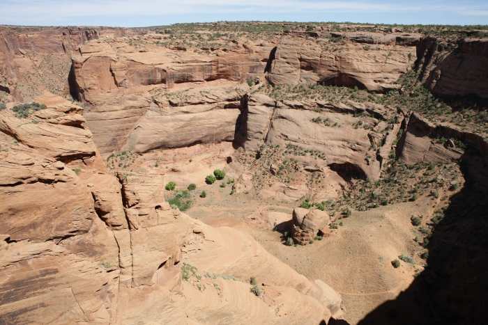
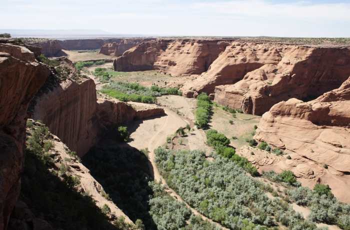
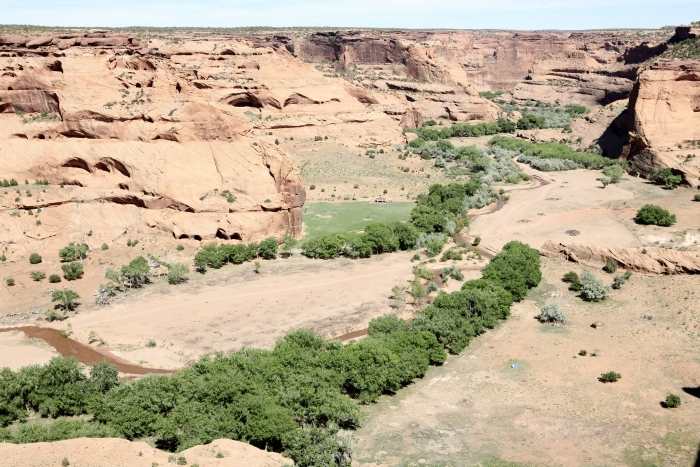
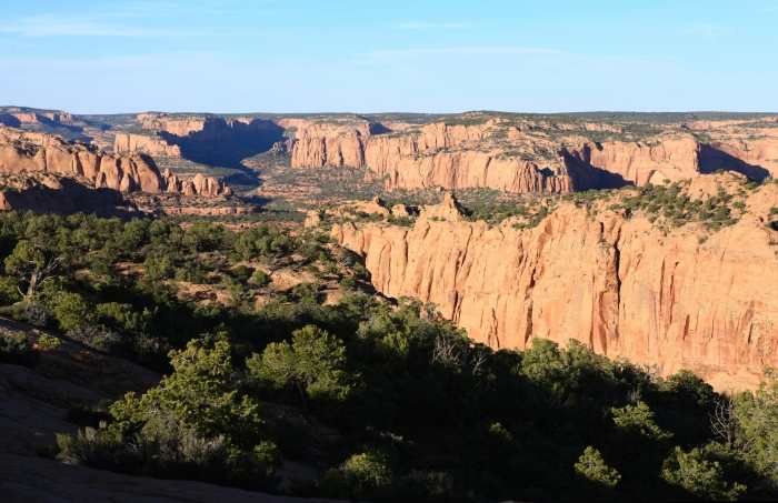
The next 15 images were taken along the south rim of Canyon de Chelly National
Monument. The Chinle Wash runs through the canyon floor from east to west.
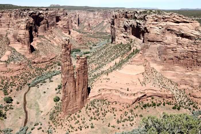
Spider Rock
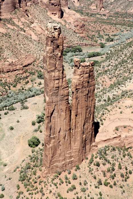
Spider Rock
Wide angle shot of the Spider Roak area.
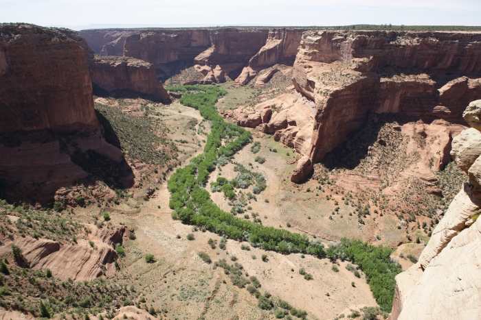
Looking west down the canyon from Spider Rock.
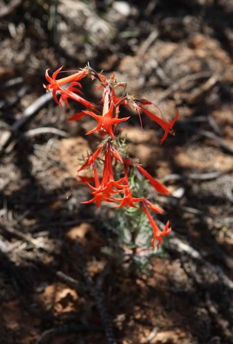
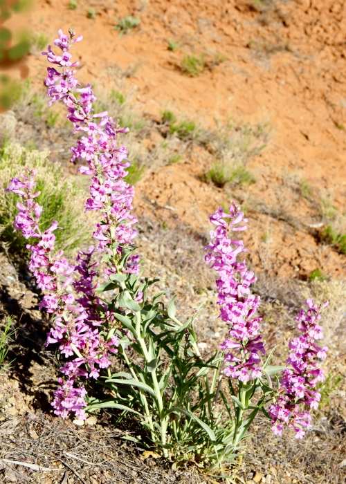
Canyon rim flowers.
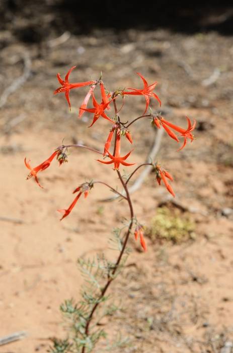
Canyon rim flowers
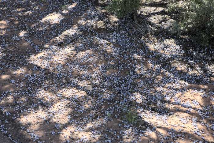
Juniper berries
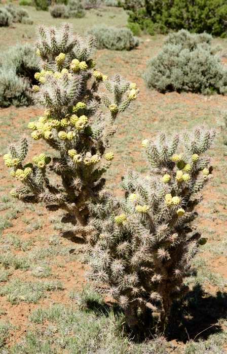
Canyon rim cactus
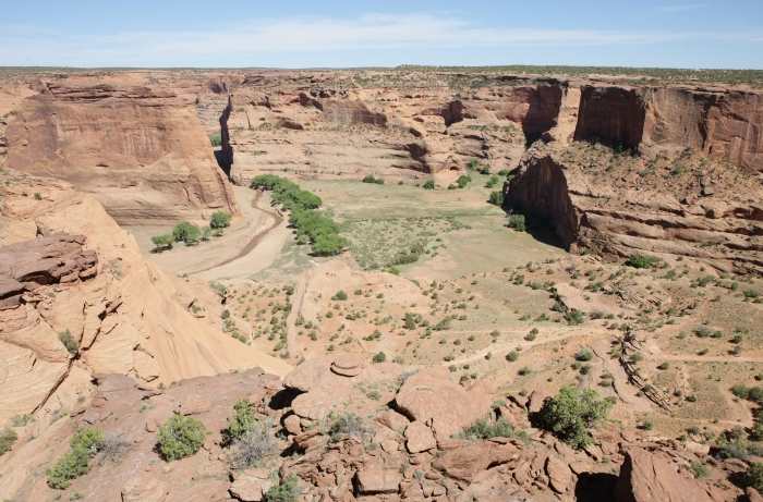
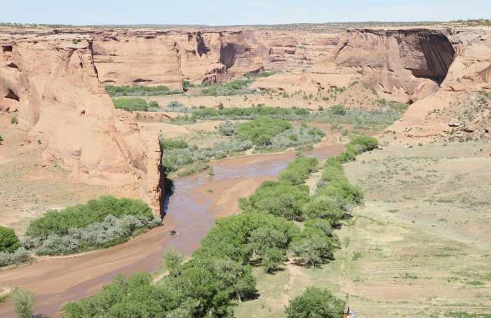
There is a 4-wheel drive vehicle crossing the wash.
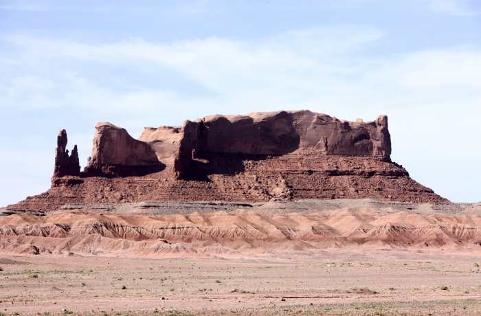
Round Rock Butte along US Highway 191, near Many Farms, Arizona.
Another decaying 'rock' butte along US Highway 191 in northern Arizona.
Navajo National Monument in northern Arizona off of US Highway 160.
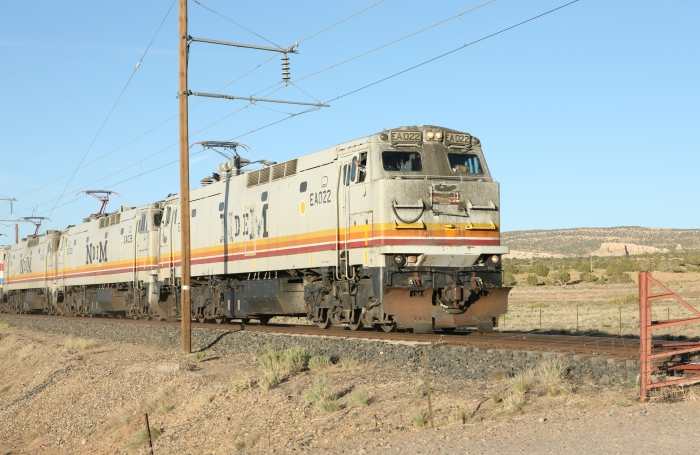
An electric train carrying coal to the large power generating plant in Page, Arizona.
This is listed as the 'Black Mesa & Lake Powell' line running through Klethla Valley
along US Highway 160 in northern Arizona. I got ahead of the train, and used dirt
road crossings, twice, to photograph the train on the sunlight side.