Welcome to
Young's Photo Gallery
James W. Young, Professional Photographer
Tillamook
Rock Lighthouse Aerial Imagery
I have
made two specific aerial trips to the
lighthouse; one in 1993, and the
other in 2014.
I chartered a Cherokee 140 plane out of Seaside
on August 3, 1993. I also
took an old friend, Gil DeGuerre, and my 14-year
old daughter, Eileen along
for the ride. Since I had a better view
from the back window, Gil and I sat
in the back seats. I had the pilot fly us
out to the lighthouse at an altitude
of around 1200 feet, so I could obtain a few
images of the 'rock'. The pilot
allowed Eileen to basically fly the plane while
we were out over the ocean as I
took images of the both the coastline and
lighthouse. I was using film back in
those days, and without any telephoto
lens, so the imagery is only poor to fair.
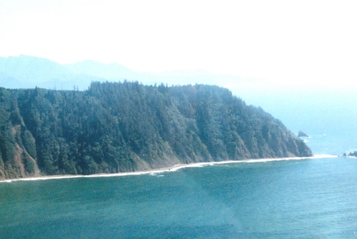
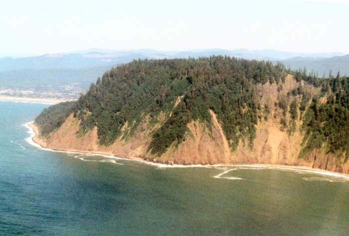
Tillamook Head, looking south.
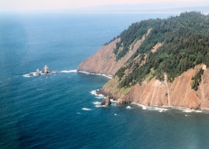
Looking toward Tillamook Head, with 'Three
Finger Jack' in the upper left.
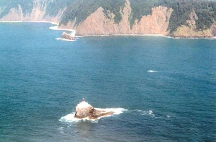
This image is looking east northeast. The
Hiker's Camp viewpoint is at the
very top right center with Bird Point just to
its right.
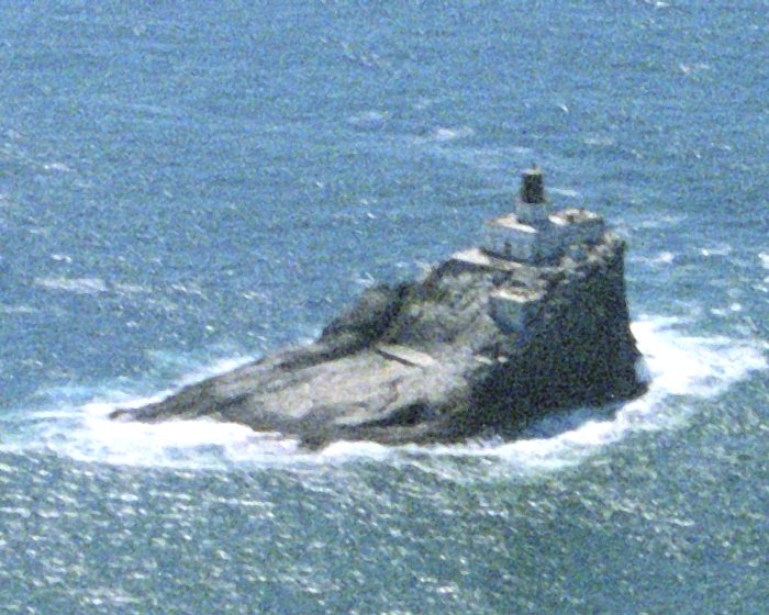
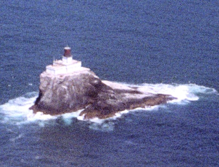
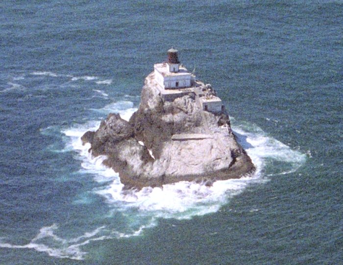
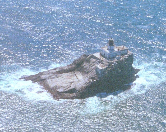
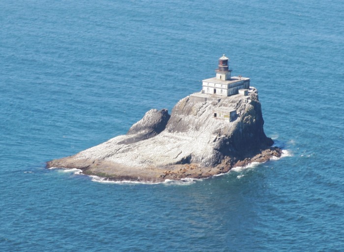
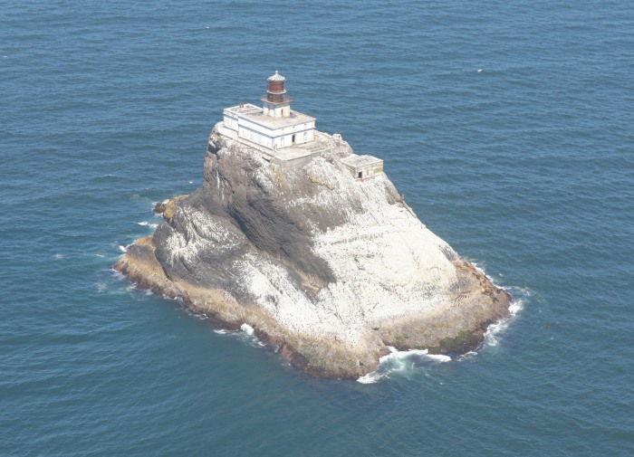
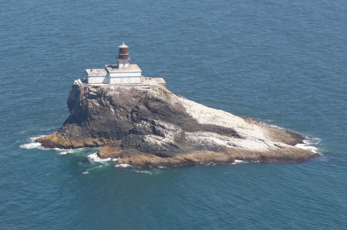
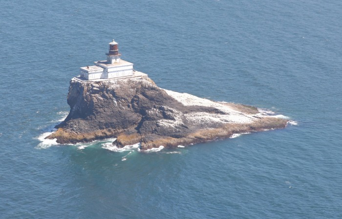
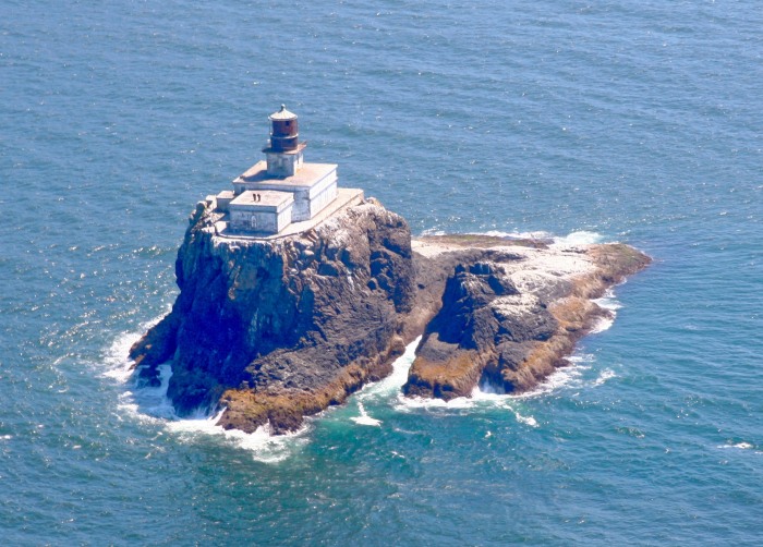
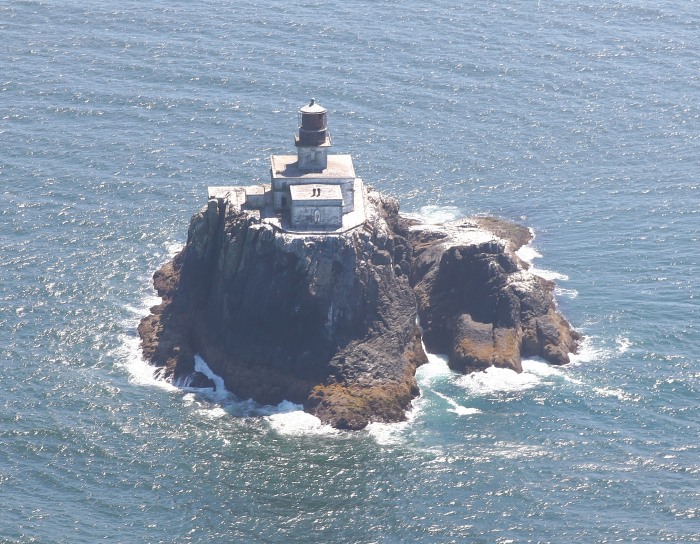
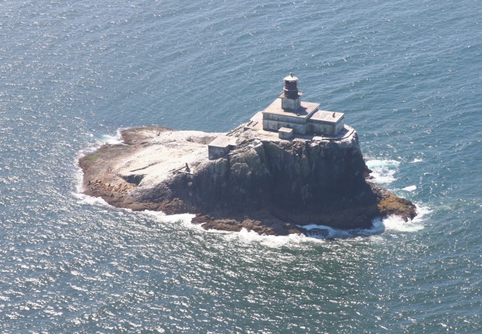
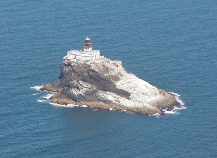
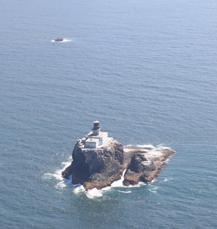
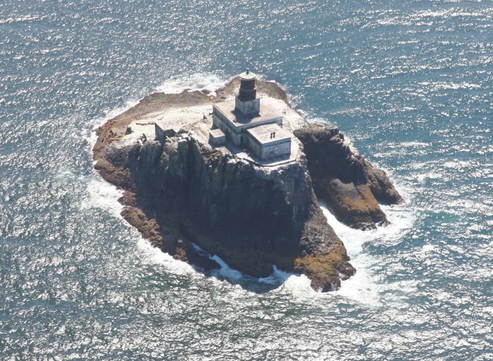
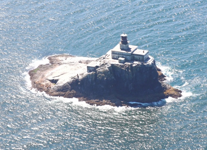
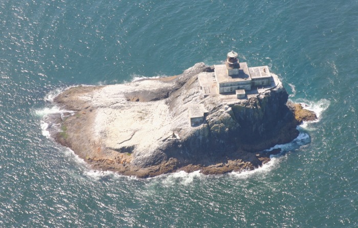
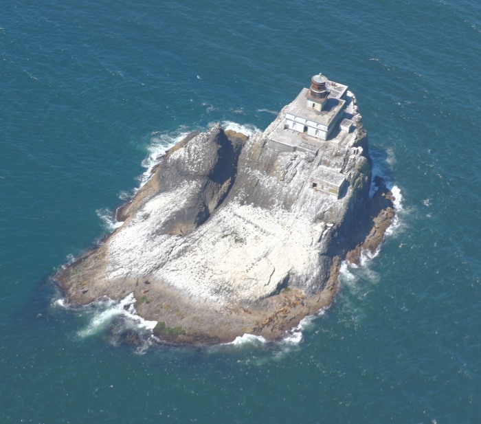
The only four closeups of the lighthouse.
West Point to the far left, with Seaside in the
far left background.
'Three Finger Jack' on the left, with Bird Point
in the center. The viewpoint
from the Hiker's Camp is between these two
areas, and hidden from view in
this image behind the ridge of Bird Point.
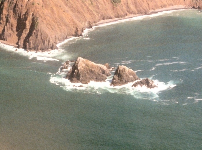
Close up of 'Three Finger Jack'.
----------------------------------------------------------------
On July 31, 2015, I chartered a Cessna 172 at
the Astoria airport, and had
the passenger door removed for the best possible
imagery with my. My pilot
took us out to the lighthouse for several
fly-rounds, then along the coast for
coastline imagery.

----------------------------------------------------------------
Some
pictures of the shoreline and Tillamook Head
during this same trip.
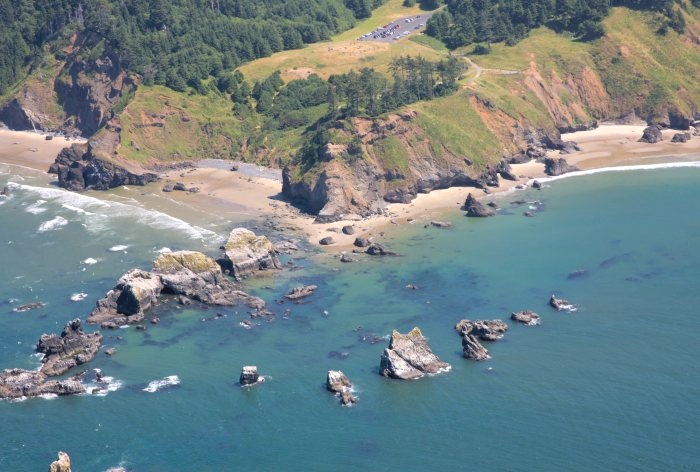
Ecola Park with Ecola Point in the center, and
parking lot above.
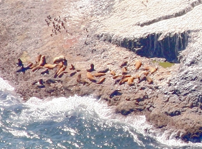
Sea Lion Rock off from Ecola Point.
Indian Beach, with Submarine Rock right center
(just in the water, left of
Bald Point (far right).
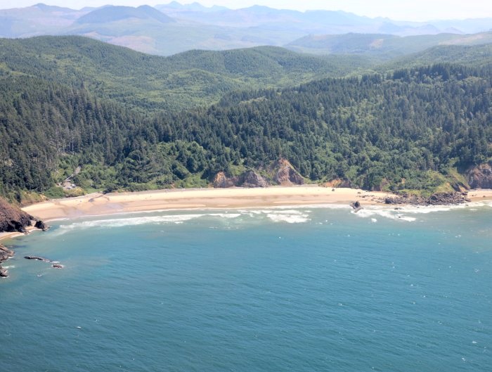
The north end of Indian Beach with Indian Point
in the center. The trail from
Indian Beach to the north (left), up and over
Tillamook Head, starts from the
parking lot (just visible right center).
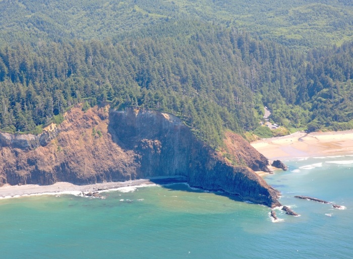
The shoreline just south of Bird Point on
Tillamook Head.
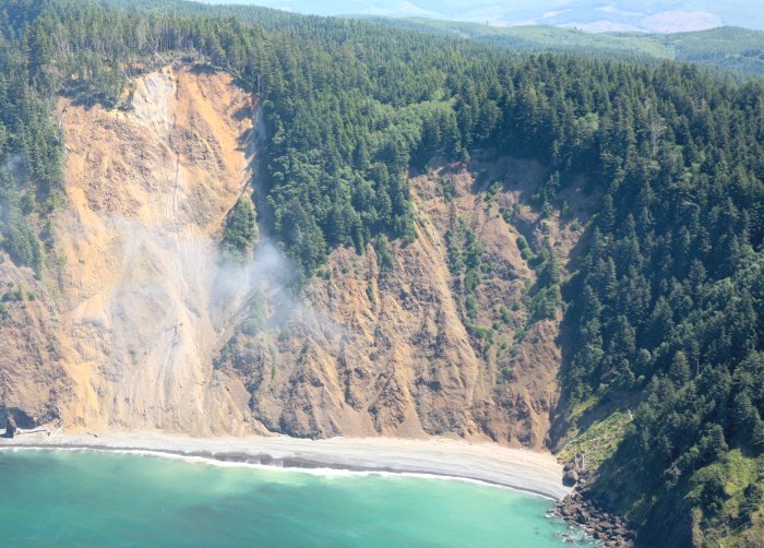
Tillamook Head, between Bird Point (right), and
a major slide. The Hiker's
Camp viewpoint is just above center right.
See next image...
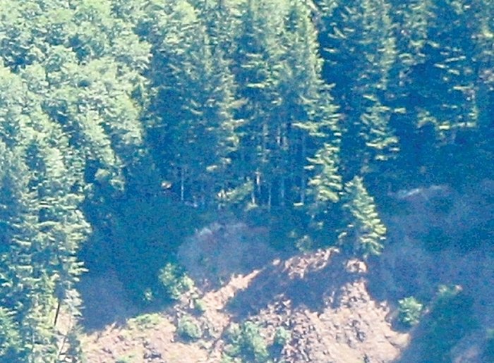
Hiker's Camp Viewpoint (center)
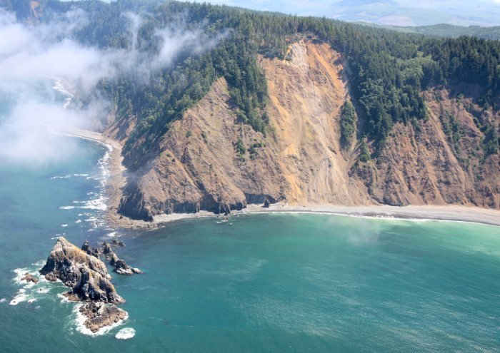
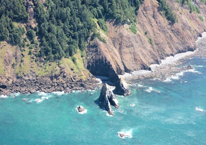
Tillamook Head, with the Hiker's Camp viewpoint
upper far right, and the rocks
of 'Three Finger Jack' bottom left. At
especially low tides, one could hike to
the shoreline adjacent to these rocks from
Seaside (three hours). Attempting
to go further south (right) is not
recommended!!!
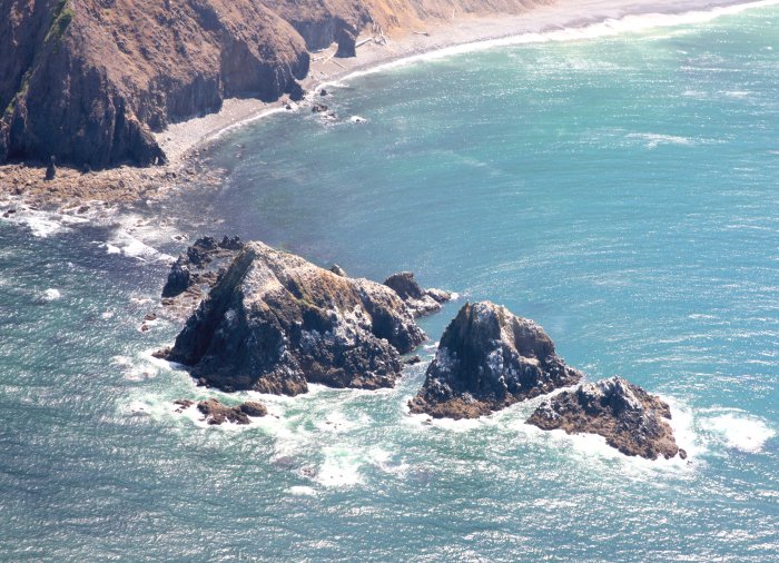
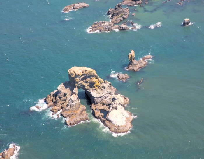
The rocks of 'Three Finger Jack'
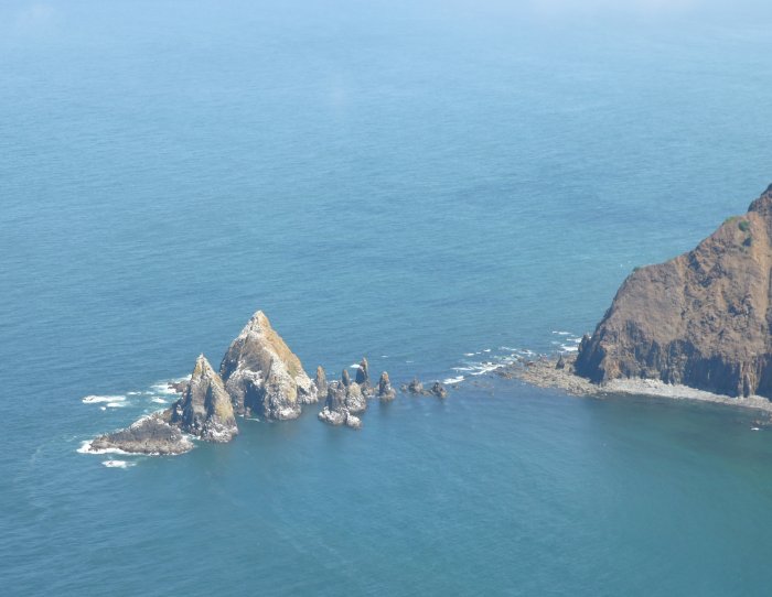
Looking north northeast across 'Three Finger
Jack' toward Seaside.