Welcome to
Young's Photo Gallery
James W. Young, Professional Photographer
Photographic History of Table Mountain
Observatory
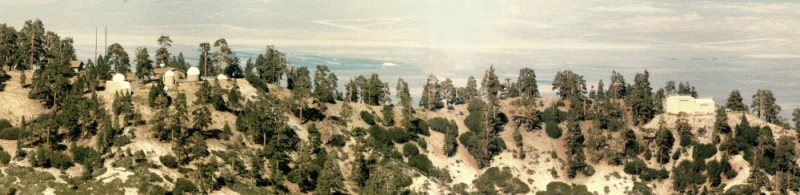
Part 1: Smithsonian Institute and Site Development
By James W. Young
retired astronomer from Table Mountain Observatory
Introduction
“Table Mountain? I’ve heard of that. Isn’t that somewhere in South Africa?” Yes indeed, but not
this one! There are a gazillion ‘Table Mountains’ around the globe, a term used to describe a flat top
mountain just about anywhere. The most famous one is that found in Cape Town, South Africa, but
there are many others much less known. Among those there are a number of such named mountains
in the states of Washington and California, and in particular, this one in Southern California about
which this history shall focus on.
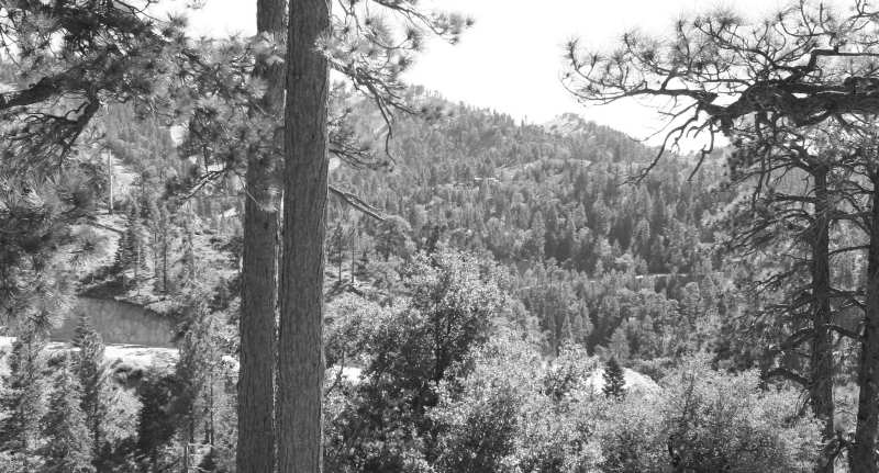
Table Mountain (TM) lies on the northeastern slopes of the San Gabriel Mountain range, only 41 airline
miles due northeast of downtown Los Angeles. TM is actually a three mile long relatively flat ridge
(above 6000 feet) running WNW to ESE. This ridge is the northern boundary of the Swarthout Valley,
wherein the small mountain community of Wrightwood lies. This valley has a slightly higher boundary to
the south named Blue Ridge, with these two separate ridges approximately one mile apart. The two ridges
are closest together three miles west of Wrightwood at a place named ‘Big Pines’ (not the same as 'Big
Pine’ in the Owens valley), at an elevation of 6862 feet. California Highway 2 (the Angeles Crest Highway)
runs east-west through the Swarthout Valley, through Wrightwood, and cuts between the two ridges
at Big Pines. This road continues west through the San Gabriels exiting the mountains some 60 miles
later in the La Canada/Flintridge communities near the Verdugo Mountains. Although getting to TM from
the greater Los Angeles area can be made by a multitude of different ‘road’ ways, somewhere along
the line you will access Highway 2, if not for only a short distance. The average of these various distances
is around 80 miles.
TM’s elevation is 7516 feet above sea level, with a secondary peak (named Mt. Peltier) having an elevation
of 7473 feet, just over a mile to the east. Blue Ridge’s elevation ranges from around 7800 feet near Big
Pines, to over 8500 feet (Wright Mountain) about four miles to the south-east of TM. At Big Pines, the
‘Table Mountain Road’ extends 1 ¼ miles to the top of TM from Highway 2. This road curves past the old
Big Pines Ski Clubhouse, through McClellan Flat, then past the Table Mountain Campground entrance, and
finally to the ski and toboggan play area parking lot. A small controlled access road extends further up
to the east and ends at the Jet Propulsion Laboratory’s “Table Mountain Facility”.
This historical study will include the roads, communities, and reasons for the development of Table Mountain
for the purpose of scientific studies of the sun, solar system, and earth’s atmosphere since the mid-1920’s.
Names of important people associated with all aspects of Table Mountain’s history, along with extensive
photographic records of each step to the present twenty-first century use, will develop as an ongoing
project from the author.
Credits and Acknowledgments
Institutions, Organizations, etc.
b
Smithsonian Institute Archives (Ellen Alers), Washington DC - SIA
Jet Propulsion Laboratory (Ray Newburn), Pasadena, CA - JPL
California Institute of Technology, Institute Archives (Loma Karklins), Pasadena, CA - CIT
Jones & Stokes Associates, Inc. (Sharon Hoepker), Sacramento, CA - JSA
Wrightwood Historical Society (Terry Graham), Wrightwood, CA - WHS
Camp McClellan Improvement Association (Dan Ziol), Pasadena, CA - CMIA
University of Southern California, Archival Collections, Los Angeles, CA - USC
Frasher Fotos, Pomona Public Library, Pomona, CA - FF
Los Angeles Public Library, Los Angeles, CA - LAPL
Huntington Library, San Marino, CA - HL
Hults & Whittlesey, Realtors and Appraisers (Ralph Hults & Stephen Whittlesey), Pasadena, CA - HW
Note: Photo credits are to those initials above, in white. All others not identified are those of the author.
Books, Magazines, Newspapers, etc.
Wrightwood and Big Pines, Arcadia Publishing, 2004; Pat Corpe Krig, Barbara Van Houten
A Trip Into Wrightwood's Past, Mountaineer Publishing, 1977; Pearl Comfort Fisher
Wrightwood's Past, Barry Anklam (B&A Design Group), 2000; Pat Corpe Krig
The Mountaineers, San Bernardino County Museum Association, 1972; Pearl Comfort Fisher
The San Gabriels, Gem Guides Book Co., 2001; John W. Robinson
Long-Range Forcasting is Scientists' Objective, San Bernardino Daily Sun, 1941; Howard C. Heyn
Astronomer Returns to Table Mt. to Resume 50 Year Work, Wrightwood Mountaineer, 1977;
Susan Gates
Outline of Activities, the Planet Group, paper, 1940; James B. Edson
Venus Sunset Photographed by Group from Caltech, Los Angeles Times, 1940; William I. Barton
Eight Caltech Students Map Weather on Mars, Los Angeles Times, 1941 (author unknown)
Mars Weather Observed by Caltech Men, The Pasadena Post, 1941 (author unknown)
Richfield Travel Guide of California, Highway Automobile Map, H. M. Gousha Co., 1952
Shell Highway Map of California, Highway Automobile Map, H. M. Gousha Co., 1947
San Bernardino County, Highway Automobile Map, Automobile Club of Southern California, 1943
Angeles National Forest, US Dept of Agriculture, Forest Service, 1915
Topography, California, San Antonio Quadrangle, US Geological Survey, 1903 (reprinted 1910),
Reprinted by Novacell Technologies, 2007
Geological Survey, California, San Antonio Quadrangle, US Geological Survey, 1941 and 1947
Geological Survey, California, San Antonio Quadrangle, US Geological Survey, 1956 (photorevised 1968)
Wrightwoodcalifornia.com, Internet Web Site, 1999-2010, Walter Feller
Individuals
C Preston Butler (1904-1985)
Alice Butler Ronald (1941- )
Aden B. Meinel (1922- )
Priscilla Edson Greenwood (1938- )
Anders Greenwood
Patricia Edson Tombaugh (1913- )
Annette Tombaugh Sitze (1940- )
Alden Tombaugh (1945- )
Patricia Corpe Krig
Barbara Ballard Van Houten (1941- )
Thomas Pinard
Douglas Milburn
Rich McCutchan
Virginia Capen
Pamela Templeton Schloesser (1931- )
Terry Graham
Larry Webster
Shari Waag Hedden
Allen & Bonnie McAlister
Susan Blakeslee
Shawn Lawler Troeger
Special Thanks!
Karen Ann Young (wife); proof reading and editing
Barbara Van Houten (local historian); reference and proof checks
Preface<>
Researching the history of just about anything, there are seldom enough answers for all the questions one
puzzles over. Rather than avoid all the unanswered questions, I will pose some up front to you readers.
Who first named this mountain? Who were the first to stand on its summit? Several years ago, I posed
the following scenario to those who would listen; “I’ll bet someone climbed to the top of (this) Table
Mountain with a picnic lunch in an old wicker basket, sat down amongst the trees, ate their sandwiches and
admired the sprawling desert view below them!" Although I have never done exactly that, I have gazed out
across the broad Mojave Desert north to Mt. Whitney (160 miles), northeast to Charleston Peak in Nevada
(170 miles), and southeast to Mt. San Jacinto (70 miles) for the last 47 years. It had to be quite a sight
to the early Serrano Indians/explorers, and potential picnickers coming up from the greater Los Angeles
area. Then I found this picture, much to my surprise and amazement!
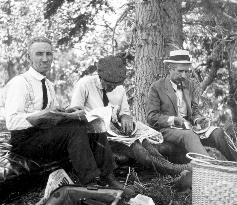
This image was taken of the first Smithsonian people to come to Table Mountain in the early 1920’s,
including Dr. Charles Greeley Abbot, on the right. They seem to be enjoying watermelon, out of a
wicker basket. SIA
These men were looking for a better field station for Smithsonian Institute's ongoing solar studies.
Abbot, along with other Smithsonian researchers were engaged in an active solar research program
at Mt. Wilson Observatory (about 25 miles to the southwest) during the 1910-20's period. Although
Mt. Wilson was quite easy to access, Abbot wanted a better 'field station'. Someone (unknown
name and date) at Mt. Wilson suggestion to Abbot that “. . .Table Mountain was 2000 feet higher,
and much drier.”
Who told Abbot about TM? Someone had to have access to a very current (1900’s) USGS survey
map with names and elevations on it. And where did they come to know TM had a much drier climate?
With these additional questions the author is still pursuing more facts, documents, and pictures.
Have some answers? Write me at 'astroyoung@verizon.net'.
Just Where Does One Start….After 84 Years of History?<>
Before we begin at the beginning, the following story may enlighten the reader to show what can come
from ‘looking into the past’. The author spent 47 years at TM, and finds the following recent series
of events most intriguing and noteworthy, especially into how his own career parallels some of the
following circumstances.
Early in 1940, a Caltech professor and a number of graduate students formed the "Planet Group"
specifically to study the atmospheres of Venus and Mars at a remote location. The professor was
James B. Edson (1908-2001), and one of the his grad students was Aden Meinel (1922 -). Edson
knew about Smithsonian’s ‘Field Station’ at TM, and contacted Preston Butler (1904-1985), then
the station director. “May we use your site to conduct observations of the inferior conjunction of
Venus in June (1940)?” This question is a purely hypothetical one, but in principle was the basis
for the Planet Group’s successful Venus observations, as told by Meinel to the author in 2008.
Meinel gave the author some logbooks and observational notes, along with several pictures of their
1940 telescope setups at TM . . . but those will come later. Aden went on to graduate from the
University of California, Berkeley in 1949, with his Ph.D. The author first met Aden at TM in the
late 1970s and again in 1989. With the history of the site now fully kindled in my mind to examine
and write about, I searched the internet for Dr. Meinel and found him residing in the state of
Nevada. After I was able to contact him, an invitation for him to once again visit TM was extended,
all to ask him, first hand, about his visits to TM in the early 1940s. Aden visited TM in late 2008,
and enjoyed reminiscing his ‘Planet Group’ days! “But, why not get in direct touch with James Edson?"
he asked me. "Is he still alive?" I asked.
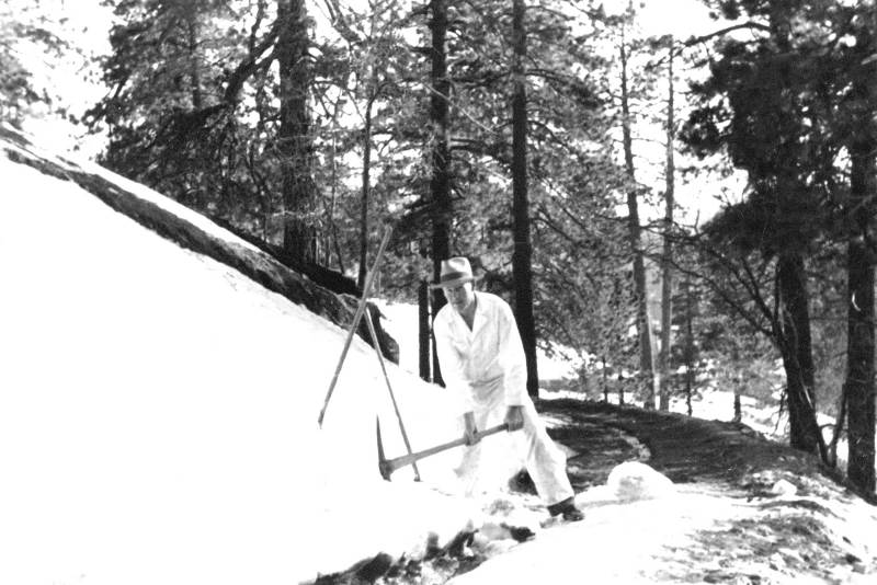
Preston Butler in 1940, clearing the dirt road to the top of Table Mountain. Delilah Butler (his wife)
took the photograph.
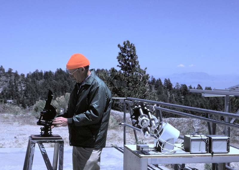
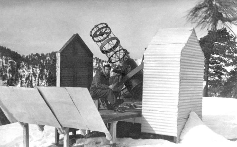
Here is Preston Butler back at Table Mountain in 1977, running some of the original Smithsonian
instrumentation he ran in the early 1940s while the field station director. He obtained similar results
in 1977 as he had done so in the 1940s for the solar constant.
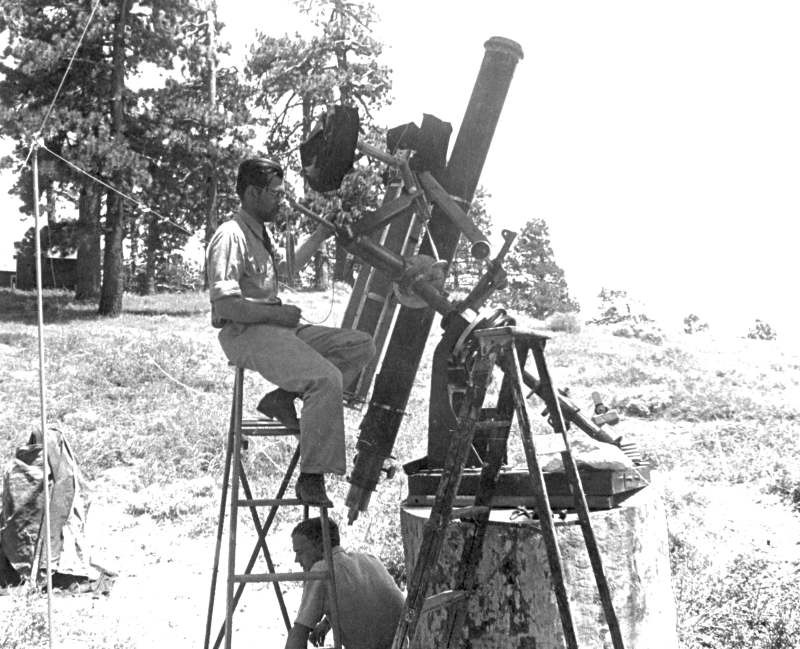
James Edson at the telescope in June 1940, during the "Groups" inferior conjunction observations
of Venus. Unknown photographer.
Aden Meinel at the 20-inch telescope in late 1940, in preparation for Mars observations to be made
into the spring of 1941. Unknown photographer.
Going back on the internet, I ‘googled’ “James B. Edson”, and got several hits. One was the alumni
page from the University of Kansas in Lawrence. Edson was listed as retired, but there was an
address and phone number in Colorado Springs, CO. I called. The number had been disconnected.
I called information, and got a different number and address. I called with a similar result - "no
longer in service". I then e-mailed the U of K alumni contact person, and a few days later received
a response with yet, another different address, but with no phone number. The address also had
‘floor 400’ so I assumed it was some sort of complex, maybe a retirement home. On the phone, I
called information for Colorado Springs, but the operator said, “absolutely can not do," as I asked
for a reverse address search to get a telephone number. Now what?
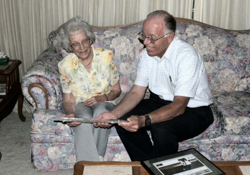
Aden Meinel visited Table Mountain Observatory in October 2008.
Back to the internet, I went to 'Google Maps', and typed in the address. Wow! There was a big
building (as seen from above) on the southwest corner of the closest intersection to the address.
And to my surprise (since I had never used it) there was also the new ‘street view’ to use. Instead
of looking down, I could now see the building as I panned 360 degrees, and there was a telephone
number on the building corner! I zoomed in, but alas, the resolution was just not good enough. I
panned all around the intersection until I found the name of a business on the northeast corner:
a Chinese restaurant, with its name in big bold letters. I called information and got the phone
number for them. Now, just how does one go about asking for the telephone number of the
building across the street? The woman who answered was definitely Chinese but knew English
well enough to converse with me. When I asked her what I wanted, she snickered and talked to
someone else in the restaurant, all in Chinese, with considerable amount of laughing. I tactfully
pleaded with her to stay with me, and that this was not a prank call. I gave her some additional
details, and again asked her to please get the telephone number off the building. She was busy
then. “Call me back in 60 minutes” was her answer, and she hung up. How long is 60 minutes?
A very long time!
I called after an hour and the phone rang, and rang, then she was there. She gave me the phone
number, laughing and talking to others in Chinese, but I thanked her as best I could. I called the
number, and a woman answered, “Medalion East” (a retirement home). I was in!
Asking for Edson, she said I needed to talk to Isabella in ‘records’, and I was transferred
upstairs. After inquiring about Edson, Isabella said Jim and his wife Lilly had lived there for
many years, but that Jim had died in 2001, with Lilly passing away some years later. It was very
disappointing after all that had been done, only to come up empty-handed. But, wait - she said
the Edsons had a daughter, Priscilla, and Isabella knew her and how to contact her. So I gave
her my name, telephone number and e-mail address, all to forward to Priscilla, since Isabella
couldn’t actually give out information to a perfect stranger (even after I told her who I was,
and what I was doing). This was all in mid-October 2008. I waited, and waited. . .
After Thanksgiving, I called Isabella and told her that Priscilla never contacted me. Then we
thought of another method. I would write a letter with details of what I was actually trying to
do, along with phone numbers and e-mail addresses, all to send to Isabella for her to forward
to Priscilla. My letter went to Isabella the next morning, with a JPL envelope and postage. All
Isabella had to do was put on Priscilla’s address and mail it. Much to my astonishment, the
envelope came back (to me) as an ‘unknown address’. Neither myself nor Isabella thought about
the possibility that an incorrect address would, unfortunately, bring the envelope back to me
(the sender, with TM’s return address), all with Priscilla’s full last name and location (which
Isabella wasn’t supposed to reveal). I talked to Isabella and explained I would not pursue
anything, to protect Isabella’s promise to Priscilla of not disclosing her last name and address.
Isabella was busy, had no other address, and I was not going to try locating her myself, for the
moment. I needed to think on this. I dropped the issue, still very disappointed.
Early in January 2009, I received an e-mail from Priscilla Edson Greenwood (1937 -) along with
her telephone number! Seems the original e-mail message Isabella sent her in October was
misplaced, and Priscilla just found it. I called her that very evening at her suggestion. We had
a long conversation, with her being excited at the thought someone was interested in her dad!
She told me her son Anders had most of his grandfather’s papers, along with pictures, etc.,
and Priscilla wanted to donate this material to my research! (We met at her son's place in May
2009). Then, near the conclusion of our conversation, she asked me very nonchalantly if I knew
about Patricia. “Patricia, who?” I asked. “No.” Who was this, I thought? Priscilla then said,
"Patricia is my father's sister!” I responded, “And this is important?" “Maybe, or maybe not"
she said. "Patricia, or Patsy as many know her, was married to Clyde . . . Clyde Tombaugh."
Clyde had discovered Pluto in 1930 at Lowell Observatory! Small world, indeed!
The author traveled to Union City CA, in May 2009, and met with Priscilla, her son Anders, and his
family. They spent an entire day going over numerous documents, and with many pictures, were
able to confirm much of the sketchy history I had accumulated from many other sources as well as
from Dr. Meinel.
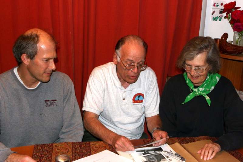
Anders Greenwood, the author, and Priscilla Edson Greenwood in Union City CA, in May 2009. This
image was taken by Anders' wife.
The following weekend I traveled to Las Cruces NM, to meet with Patricia Tombaugh, now age 94,
along with her son Alden, and daughter Annette. Here the four of us went over all of the material
acquired from Priscilla (and Annette through e-mails) again to confirm that all facts were correct.
The working relations of Edson and Tombaugh will be touched on later, as well as the first JPL
astronomer hired at Table Mountain in 1962, Charles Capen, who worked with Tombaugh earlier
at New Mexico State University in Las Cruces.
Patricia (Patsy) Tombaugh and the author in her home in Las Cruces NM, in May 2009. This image
was taken by Alden Tombaugh
End of story? Well, not really. Smithsonian’s TM Field Station director, Preston Butler, and his wife
Delilah (1903-1993), had a baby girl, Alice, born on Thanksgiving Day 1941, while at TM. There were
twelve foot snow drifts that day, and Delilah was taken out of the residence's second story window,
to a waiting 'snow cat', transported down to the highway, and driven to San Bernardino for delivery
of little Alice. Alice doesn't remember, of course!
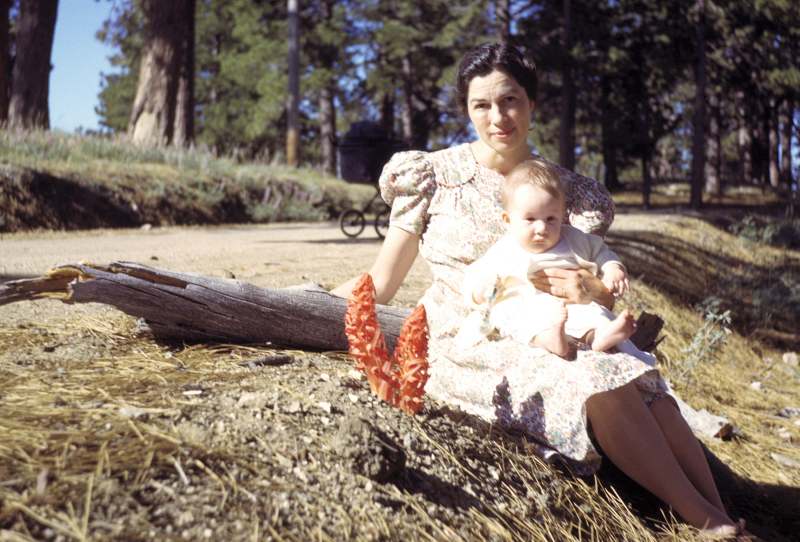
Delilah Butler, with 6 month old Alice just outside the main gate to Table Mountain, in May 1942.
Yes, those are 'snow plants' next to Delilah. Photograph by Preston Butler.
The author, having known Pres (short for Preston) Butler from Butler's 1977 visit to TM, knew of
Alice, and had already corresponded with her on numerous occasions about her father's involvement
at Table Mountain as a 'field director' for the Smithsonian Institute.
Alice had supplied me with numerous pictures and articles about her father at TM back in the early
1940s. After my initial contact with Priscilla, I related this previous story to Alice, wherein she then
added the following note: After the Butlers and Edsons moved on to different endeavors, separated
by different job and career changes, they coincidentally ended up in the Washington D.C. area in the
late 1940s. Here, the Butlers and Edsons lived and worked, but still managed to socialize and get
together for dinner and other events occasionally. Well, are we done? Well, actually we’re not. It
seems very ironic and extremely coincidental that when I was hired by JPL in 1962, I started work at
Table Mountain on November 12, and my first assignment was to assist in observations of the Venus
inferior conjunction, occurring that very day! In less than 3 months, I would find Pluto for the first
time, not yet knowing all this history to be later uncovered!
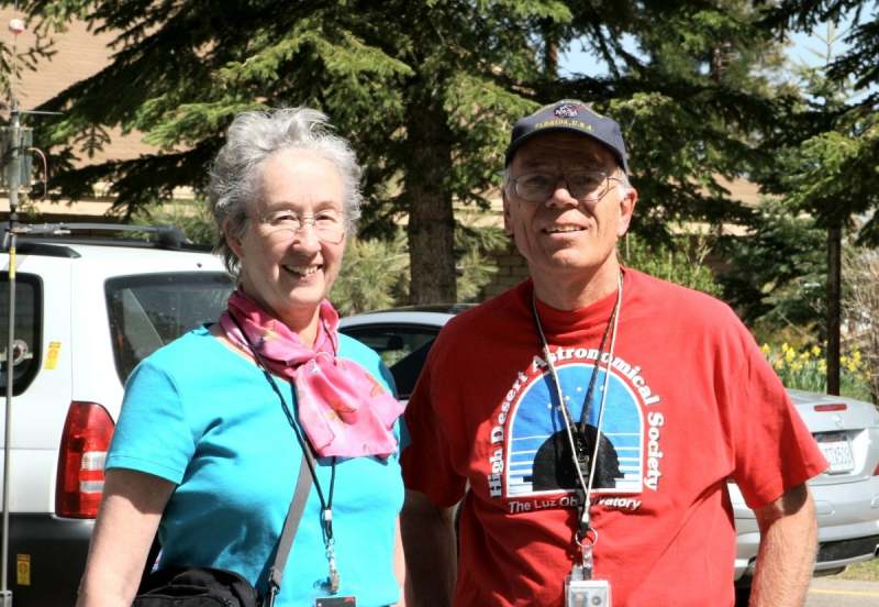
Alice Butler Ronald and the author at Table Mountain in May 2008. Photograph taken by Bruce Ronald.
Smithsonian Astrophysical Observatory's (SAO) Research Field Stations
The Smithsonian Institute's interest in solar research began before 1900, but soon thereafter, Charles
Greely Abbot became the driving force into the development of 'field stations' to conduct research
far away from the environs of Washington, DC. Just exactly what the sun was sending into space in the
form of all kinds of radiation was the interest. Was the sun stable in this outpouring of solar radiation in
the various wavelengths then being studied? To make it plain and simple, this was called the solar constant;
a measure of flux, or the amount of incoming solar electromagnetic radiation per unit area. The smallest
variations due to pollutants and moisture is minimized by finding high elevation sites that are dry and far
from pollution found in large cities. The haze, moisture, and other pollutants never permitted careful
and statistical anaylsis of minute changes made from the sea level circumstances of Washington, DC.
Abbot established many worldwide field stations over the next two decades in Asia, Africa, South
and North America. One attempt was to go all out by building a facility atop Mt. Whitney in California.
In 1909, with donations and grant funds, a building was constructed on the very summit of Whitney,
to house a full array of various instruments. Abbots primary purpose was to study the atmosphere
of Mars from this site, as well as the earth's atmosphere. The trouble was getting there, and even
staying there. It was soon abandoned.
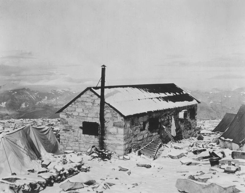
The original 'hut' built for Smithsonian's atmospheric studies on the summit of Mt. Whitney in 1909.
Smithsonian Institute Archives photograph. SIA
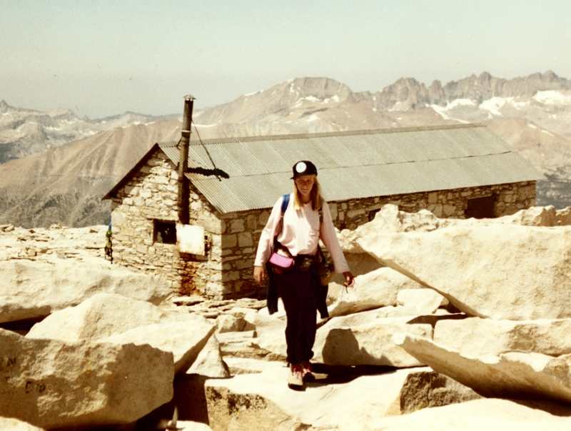
Here is an image of that same 'hut' taken in 1991 by the author. The author's daughter, Eileen is
in the foreground.
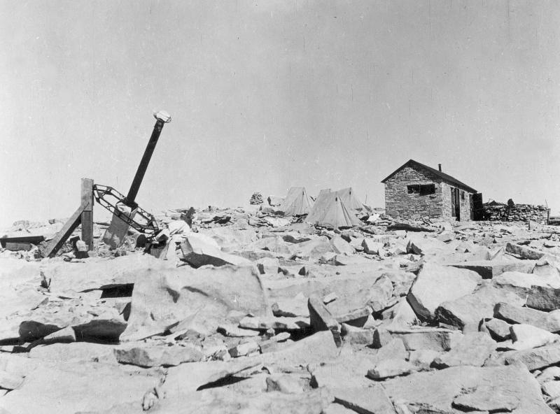
With the 'hut' on the right, several tents and instruments are seen in this image also from 1909.
Smithsonian Institute Archives photograph. SIA
During the 1910s, Abbot was very involved with the newly established Mt. Wilson Observatory in
Southern California. Again, they conducted solar research using several facilities at their disposal.
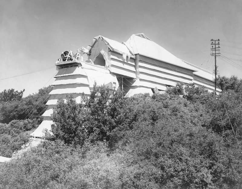
The Mt. Wilson 'Snow Telescope' in the early 1910s. It was completed in 1904, and George Abbot
used this facility during many of his visits to the mountain. The white coverings helped control the
temperature inside the long narrow 'tunnel' where the solar radiation instruments were located.
SIA
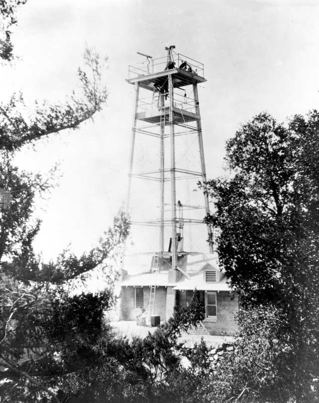
The 60-foot solar tower at Mt. Wilson. This was built and completed in 1908, affording additional
methods for conducting solar radiation research. The instruments were well above ground, to
keep heat waves and ground radiation at a minimum. SIA
Although Mt. Wilson was used during the early 1910s, other facilities that proved very effective
were constructed in Chile, Egypt, and the southwest United States.
The 'field station' at Montezuma, Chile in the early 1920s. SIA
The 'field station' at Mt. Harquahala, Arizona in the 1920s. SIA
The above mentioned 'field stations' are significant to the eventual development of the facility
at Table Mountain. The site at Montezuma had been the SAO's most useful and prolific data gathering
station in the quest for pinning down an accurate number for the solar constant. But always looking for
improvements in the calibration of data, a second station was needed to produce data of similar statistical
accuracy for confirmation. Such a station was established at Mt. Harquahala, Arizona, about 90 miles to
the west of Phoenix.
The Montezuma station was doing extremely well, until a mining company began operations very near
to the SAO facility. This created a pollution problem that showed up in their data, and from then on the
Montezuma facility no longer could be used effectively. On top of that serious problem, the Harquahala
station suffered severe problems due to the yearly summer monsoon activity that came from the Gulf of
Mexico in the form of thunderstorms. Abbot and the SAO researchers were continually looking for some
additional sites in the southwest United States. One was Clark Mountain, near the Nevada border with
California (near where Interstate 15 is today). As mentioned earlier, Abbot had been advised of Table
Mountain, which was just a mile or so up from the newly developed 'Big Pines-L.A. County Camp'. The Los
Angeles County Board of Supervisors had purchased considerable acreage from local ranchers in the
upper, or west side of Swarthout Valley. The old road through the valley had been re-graded through
Lone Pine Canyon, making passage more tolerable up the steep grade from the Cajon Pass out of San
Bernardino.
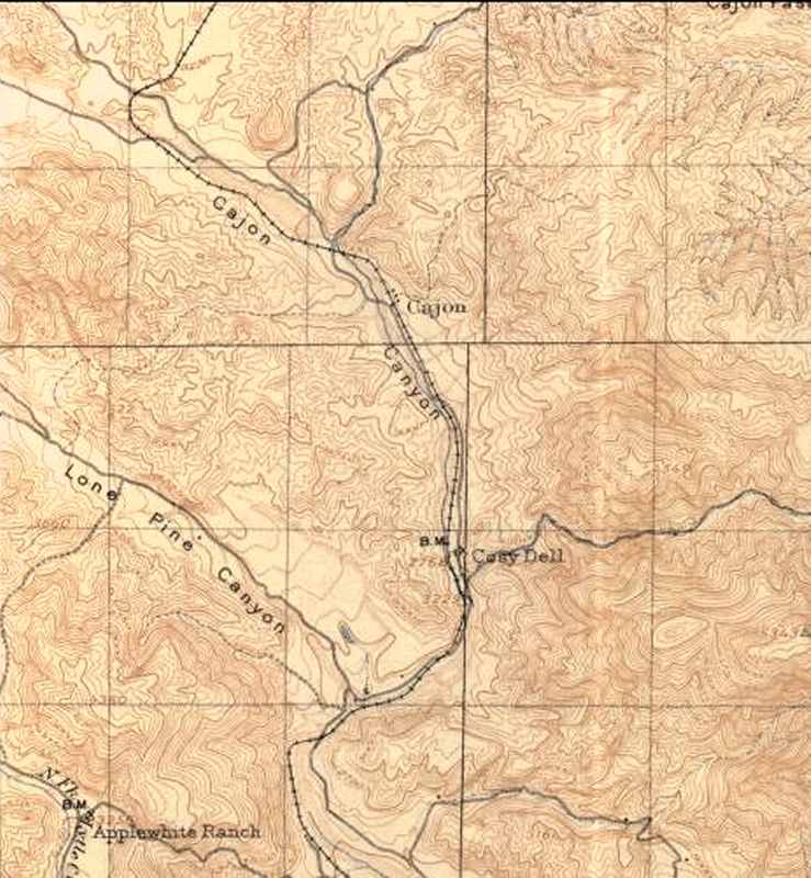
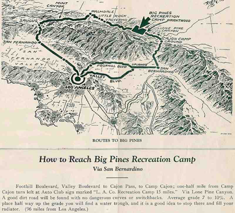
This is a copy of a 1912 USGS topo map of the then 'Cajon Pass' area. The railroad was already
in place, and the roads were primitive, but passage up Lone Pine Canyon was possible in the cars
of the early 1920s. Along Lone Pine Canyon Road, were placed water stops to fill car radiators
as needed. Cars would usually have to stop half way up to cool, and get their radiators filled!
The road was full of ruts, especially after the winter storms. Rocks were placed at the side of
the road for 'chocking' car wheels on the steep grade while their engines cooled.
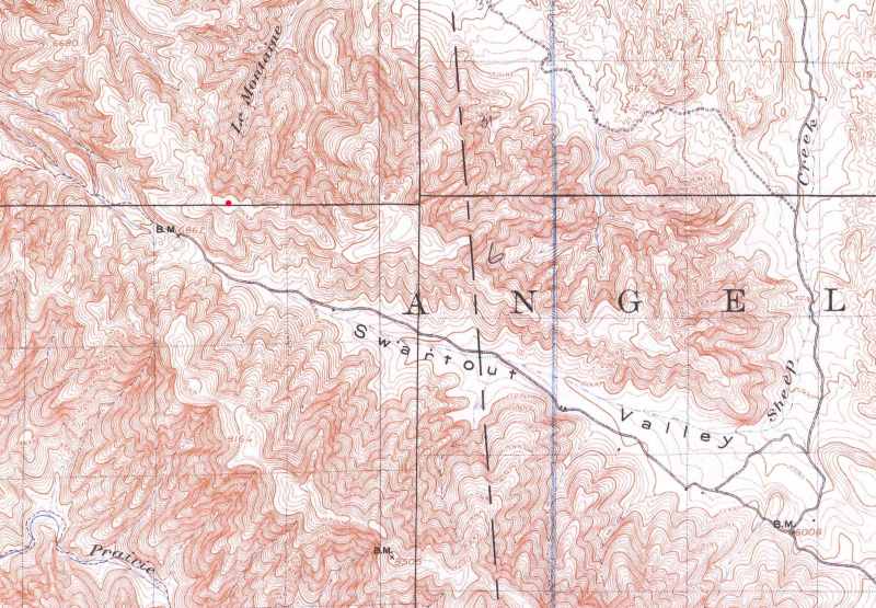
This is a 1903 USGS map (with 1910 revisions) showing the top of Lone Pine Canyon on the extreme
lower right, and extending into the 'Swartout Valley'. Notice the incorrect spelling of Swarthout.
The 'bench mark' (BM) in the upper left says 6862, and was located at Big Pines. Table Mountain
was only a little more than a mile up a steep and rut-strewn access road to near the top. The author
has placed a small red circle at the actual summit of Table Mountain. This USGS map shows an
elevation contour line of 7500 feet.
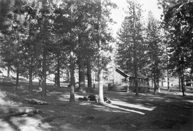
The Big Pines-L.A. County Camp was initially started in 1922-23, and by the late 1920s, had facilities
for skiing, tobogganing, and ice skating in winter, and full campgrounds, playgrounds, and cabins for
rent year-round. There was a large lodge, restaurant, shops, gas station, and even a post office.
This large amount of activity far out-shined the small community of Wrightwood, then developing
three miles to the east.
When Abbot was told about Table Mountain sometime in the late 1910s from someone at Mt. Wilson,
(as mentioned earlier) he traveled to the area to see if this area could be a replacement site for the
ineffective Mt. Harquahala, Arizona site suffering from weather related problems. The travel from
Wilson to Table Mountain took appoximately five hours! Once again, here is the picture taken during
his initial visit with a few of his partners, unidentified.
Charles Abbot on the right, with a few partners, eating watermelon near the top of Table Mountain
in the fall of 1924. SIA
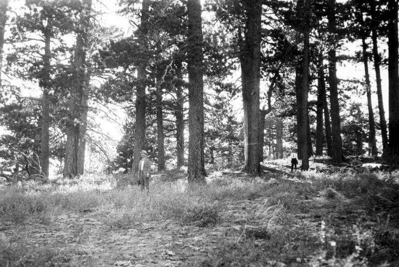
Abbot and partners survey the top of Table Mountain here and the next four images (1924). SIA
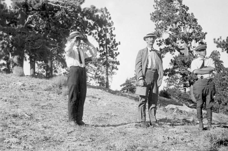
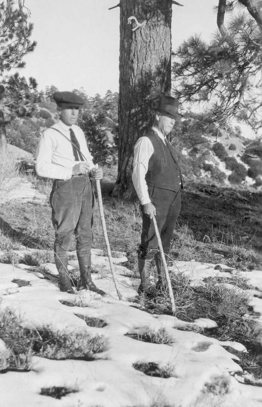
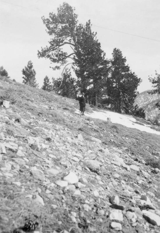
This, and the next two images appear to have been made later, with snow on the ground. There is no
indication who the gents are, but the one on the left was with Abbot during the initial visit in 1924. SIA
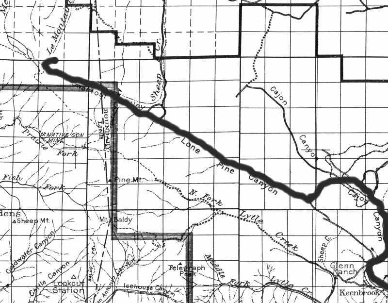
In this 1915 map, the route used by most travelers to the Big Pines Camp (and Table Mountain), is
highlighted. The newer route bypassed the lower Lone Pine Canyon out of Kennbrook, by going past
Camp Cajon in the Cajon Canyon area. USDA Forest Service Map.
This is the Camp Cajon area, taken sometime in the 1920s. Somewhere at the top of this picture,
a road goes across the wash on the extreme upper left into Lone Pine Canyon. Some sort of wash
barrier is seen above and to the left of the camp to protect the area when the wash was especially
active during severe rain storms. FF
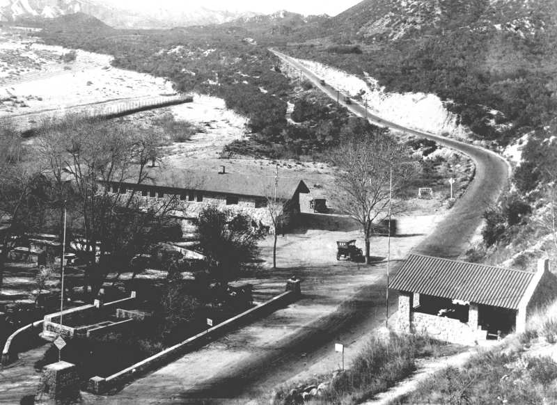
The author spent the better part of two days locating the area from where the previous picture had
been taken. In the lower center is the original roadbed seen here about where the main entrance to
Camp Cajon was located. Note the historical marker, with the author's car next to it. With the
extensive changes to Interstate 15 through the Cajon Pass in 1972, much of the land and nearby
hills were either removed or 'shaved off' to accommodate the widening freeway and 'truck stop'.
This was the closest place the author found that duplicated the previous location used in the 1920s
picture.
When Abbot and his partners arrived in the upper Lone Pine Canyon, they saw this mountain peak.
This is now known as Circle Mountain, and is located at the eastern edge of Swarthout Valley. This
image was taken by them, and they even considered it (see note below). Although there were trees,
there was no water whatsoever, and Table Mountain then became their prime interest. SIA
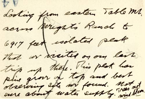
This is a note Abbot sent back to Smithsonian, and refers to what is Circle Mountain. His quote of
an elevation of 6917 feet means he had access to a then-current USGS topo map, which indeed, does
show "6917", however, current maps show a true elevation of only 6875 feet. SIA
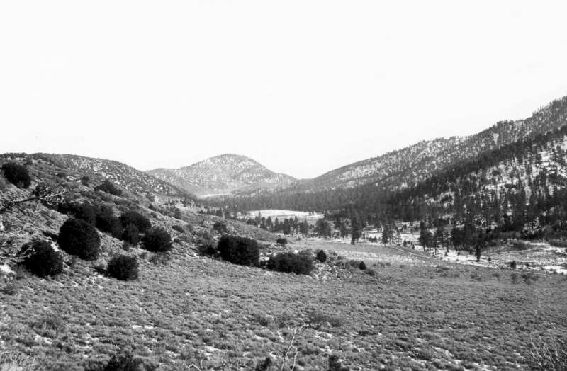
In this image taken by the early SAO visitors, this photograph of the Swarthout Valley from well
west of the valley center, Circle Mountain is the predominate landmark in the center. Blue Ridge
is off to the right (south). The primitive road can be seen from the center of this image running
off to the right side. SIA
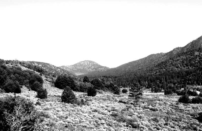
The author spent a day in the spring of 2007 locating the same spot where the previous picture was
taken from. The actual spot has too many trees in this direction, so the above image is about 30
feet higher and to the left of the original one.
By late 1924, Abbot decided to use Table Mountain for the new 'field station' to replace the one
at Harquahala, Arizona. The following images are from additional trips to the mountain to prepare
for building the site to house the field director, his assistant, and various instruments. They show
the developing Big Pines Camp, road, and the new cabin area at McClellan Flat a half mile up Table
Mountain Road.
Here is the road leading west out of Swarthout Valley to the Big Pines Camp area in the early 1920s.
Photo courtesy of Rich McCutchan
The sign above reads:
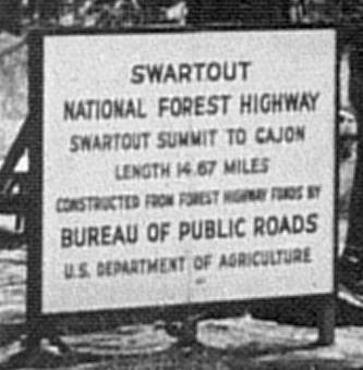
"...Length 14.67 miles..."
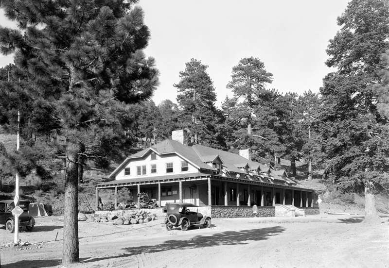
This is the Big Pines Lodge, constructed in 1924, and prior to the expansive development soon to
come with the addition of the arch over the road (about where the tree to the left stands). The
tree on the extreme right also was removed. HL
This image taken in 1926 shows the road above Big Pines, just before McClellan Flat (to the left of
the image). This image was taken 200 feet southwest of Cabin 13 (later described), and is looking
due south with the north western slopes of Blue Ridge in the background. Photo found on 'eBay',
dated, but with no other information.
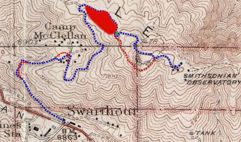
The 1926 Table Mountain Road had a jog in the far west end (left on map) that can clearly be seen
in the picture above this map. The blue colored line is the best estimate of the original road to the
top of the mountain, and the road bed can be traced in parts of McClellan Flat (noted herein as
'Camp McClellan'). Looking forward four images, you will find a closeup of a map of the McClellan
Flat area. You will note the jog just west of Cabin 1 on that map. The road then follows a north
side approach to the general topography to the 'Smithsonian Observatory'. No documentation can
be surfaced as to when the three changes were made (as shown in red), but the large parking lot
was made in the 1950s to accomodate the skiers after the Ski Chalet was built in 1954 (green dot).
In researching all the 'paper' material at the Smithsonian Institute Archives, there are a few small
excerpts that talk about the road change to the south side of the summit area, and although no date
is mentioned, the reference leads to the late 1930s. It is the author's opinion that this change was
made because of the terrible snow drifting during winter on the north side. The author can add his
47 years of on-site experience to that fact alone!
This image the author acquired in October 2008 from virtually the exact same spot as the image
above (82 years later)! Note Highway 2 (The Angeles Crest) in the right center on its way up to
Inspiration Point.
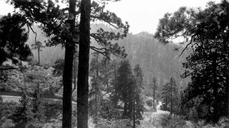
Part of the road just before McClellan Flat, looking southwest with Mt. Baden-Powell in the center.
Unknown Source.
The early development of McClellan Flat: The original 13 cabins were built for the Los Angeles
County Board of Supervisors and their families, using some used wood from torn down buildings in
other parts of the county. Unknown Source.
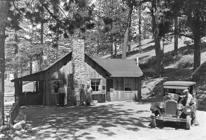
Here is an image of Cabin 8, also with a house tag number of '617', the significance is unknown. USC
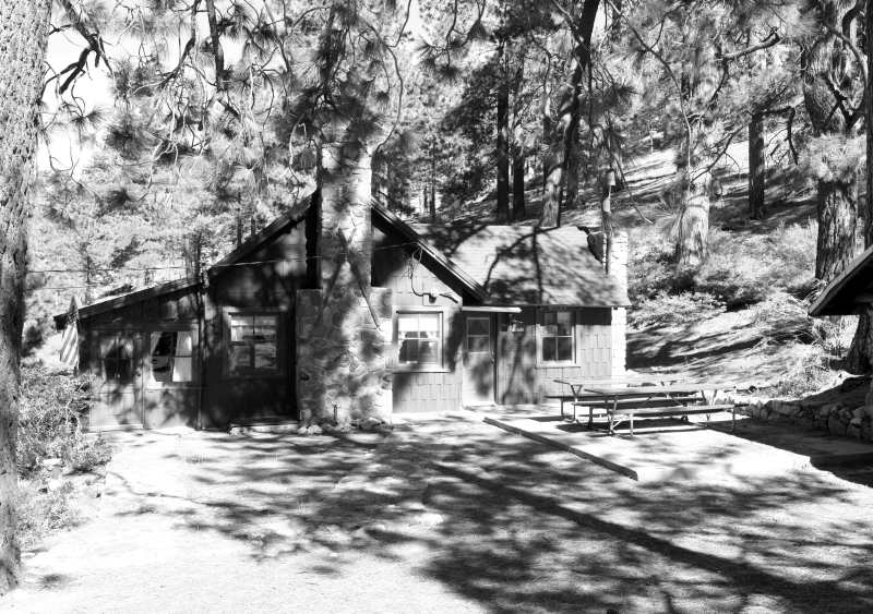
Here is Cabin 8 as it stands in the year 2010.
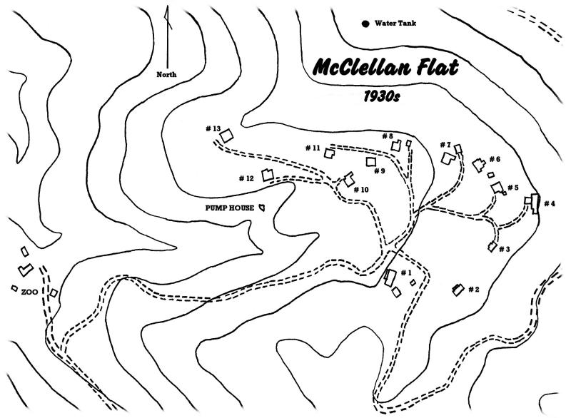
This is a copy of an original drawing (cleaned up, with identified cabin numbers) of the McClellan
Flat area, with cabins and out-buildings (garages and storage sheds). The original Table Mountain
road, coming up from the lower left side, enters the area and fans out to the various cabins. An
extension of the road swings around cabin 1 to the south, and swings around to the northeast and
eventually to the northwest (upper right corner) on its way to the top of Table Mountain. JSA
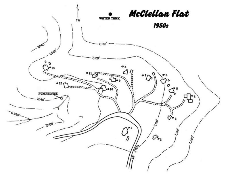
This is a reconstructed map of McClellan Flat as it appeared in the 1950s (and still is today). Table
Mountain road was altered somewhat in the time since the 1930s, but for the most part follows the
same path as the original. Note the small building to the east of cabin 8, as it is a garage, and its
significance will later be described. Look again at the image of cabin 8, and you will see the very
edge of the garage (with a curved roof line) on the far right side. JSA
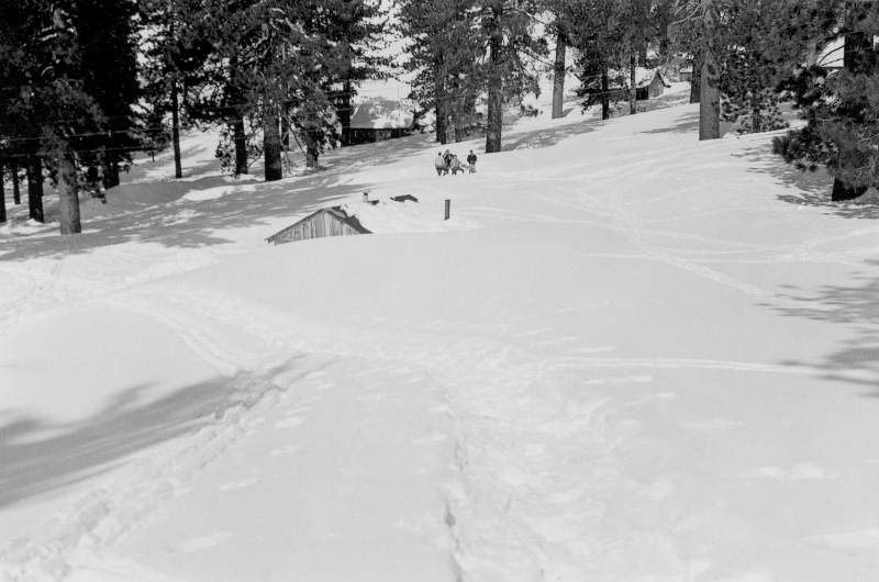
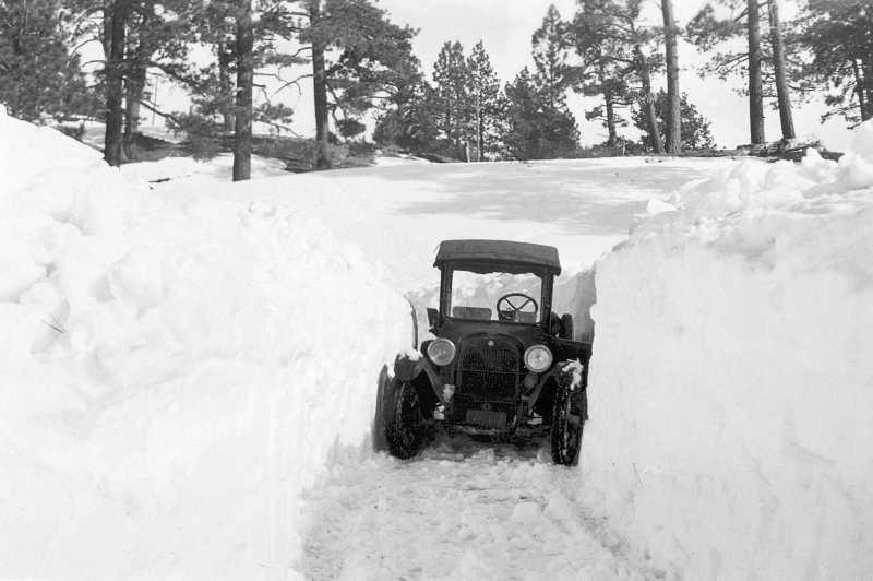
In the wintertime, getting up Table Mountain was just not possible for most automobiles. Here, one
can see the tracks of snowshoes that had to be used by SAO personnel to walk for supplies and the
mail at the Big Pines Camp area. SIA
This is the road just above McClellan Flat showing Mt. Baden-Powell in the background. USC
Before making a final decision, tests of the sky clarity, moisture content, and other measurements
were made during early spring of 1925. After concluding the site was perfect for their new field
station, Smithsonian purchased part of the Big Pines-L.A. County Camp property, namely the summit
of Table Mountain, from Los Angeles County. The LA County Board of Supervisors also helped with
the road improvements from McClellan Flat to the top. Table Mountain was then surveyed for the
building placements by additional trips of SAO personnel to the summit in the late spring of 1925.
The Smithsonian records do not actually indicate where all the wood was obtained for the buildings,
but one could presume it came from local woodcutters, located in Saw Mill Canyon in the Swarthout
Valley. Local wood had been used for many of the buildings at the Big Pines Camp, and certainly
could have been used for the field station buildings on Table Mountain.
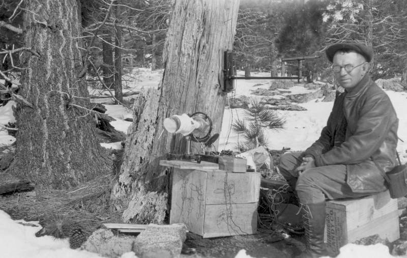
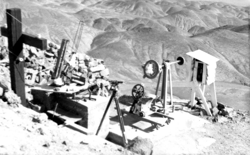
An unknown Smithsonian researcher made initial tests on the summit of Table Mountain during the
winter 1924 to spring of 1925. SIA
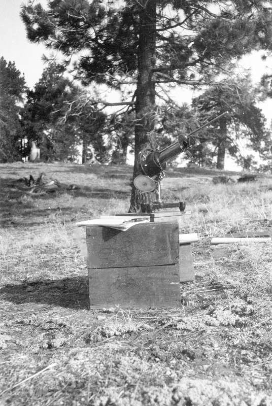
An additional piece of test equipment used in 1925. SIA
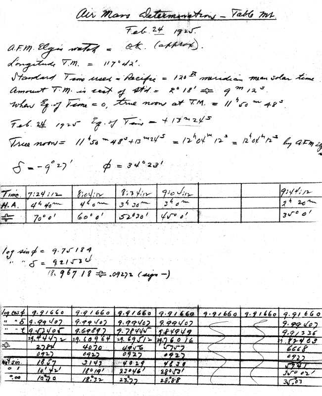
One of the first dated documents made from Table Mountain data. SIA
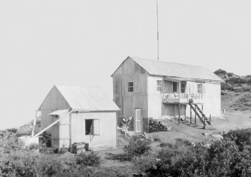
Now it was time to build the necessary facilities for the new field station at Table Mountain. In
the summer of 1925, A. F. Moore of Smithsonian took charge of the construction of five separate
buildings; two residences, a garage, a shop, and a tunnel 'bunker' for the instruments. As with
all previous field stations, the site director and assistant were expected to live on the mountain,
year-round. The road was plowed in the winter for access to the site, and the snowplow needed
to be housed in a garage. A shop/office for computations use was also constructed. A water
pumping facility and storage tank was also necessary. These images will be shown in Part 2.
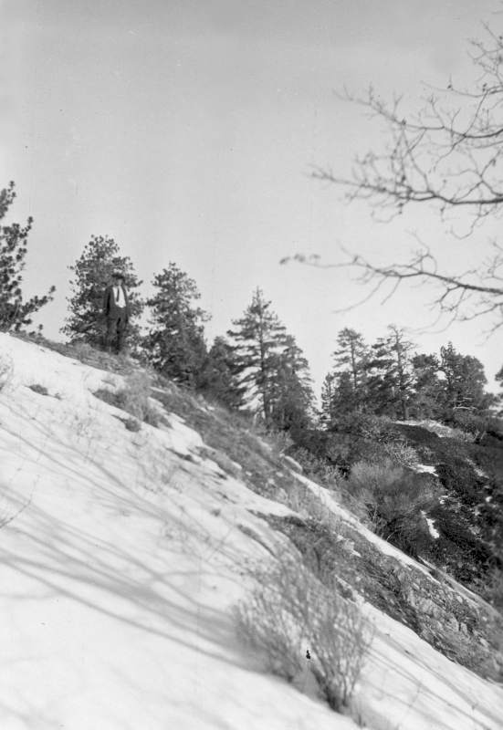
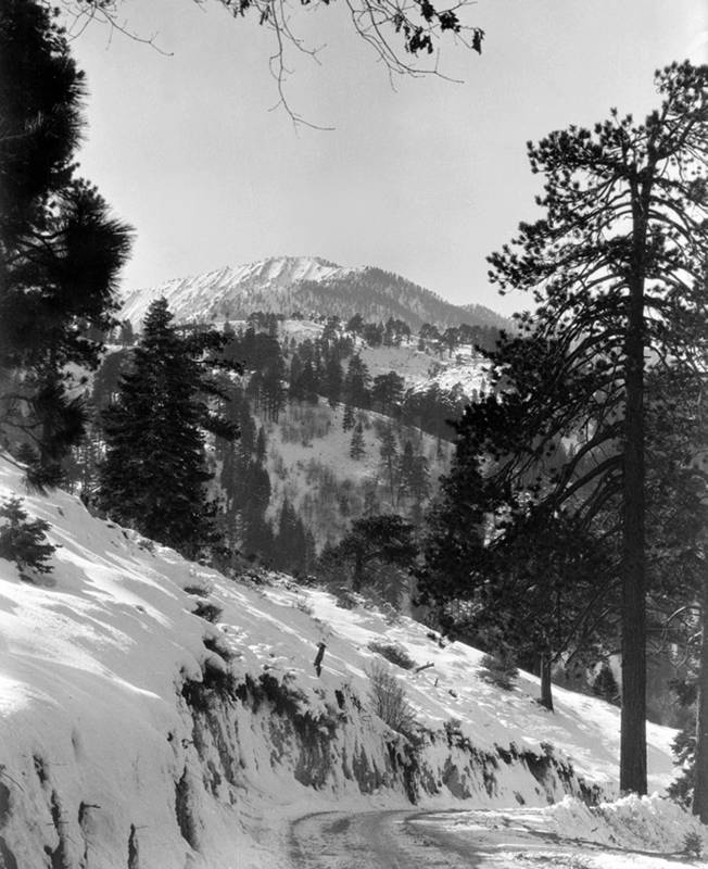
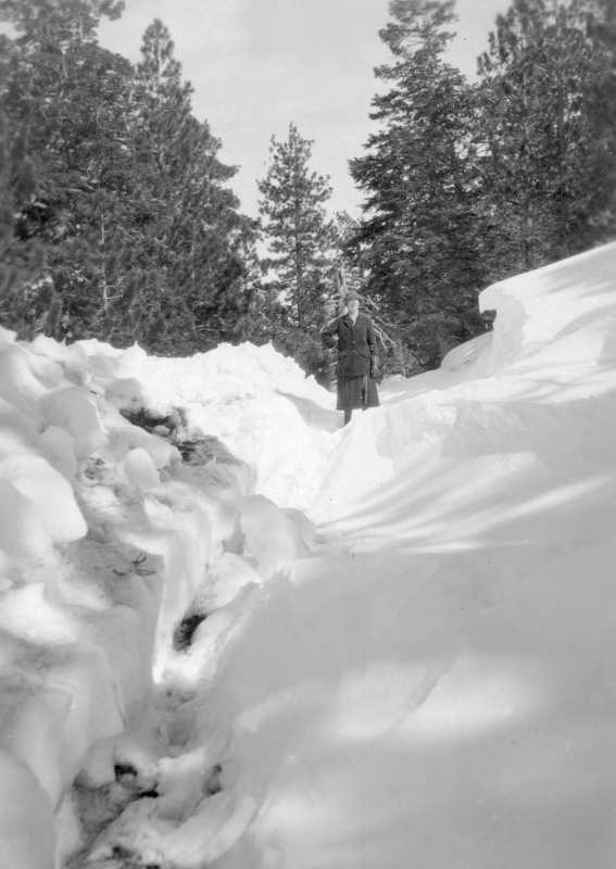
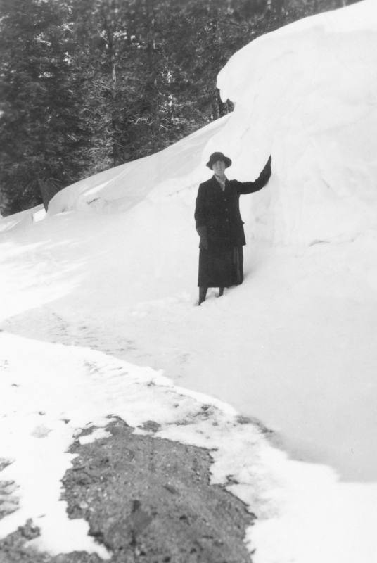
Sometime in the 1930s, after much difficulty with winter snows completely covering the access
road on the summit's north slope, a new route was chosen around to the south side of the final
summit climb. The following four SIA images show some of the winter snow difficulties there.
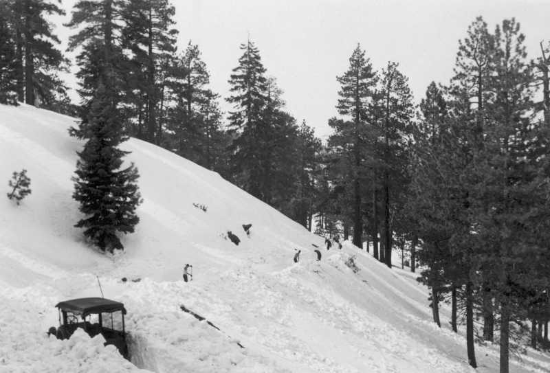
Looking for a better road to the top of Table Mountain
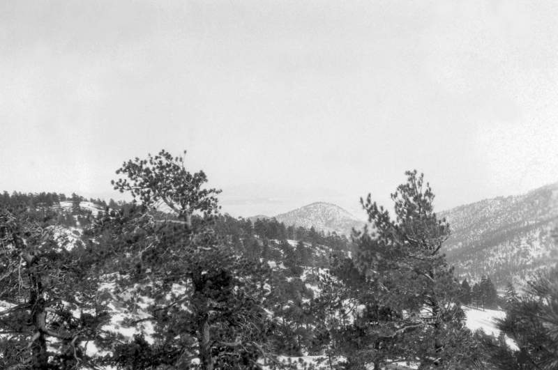
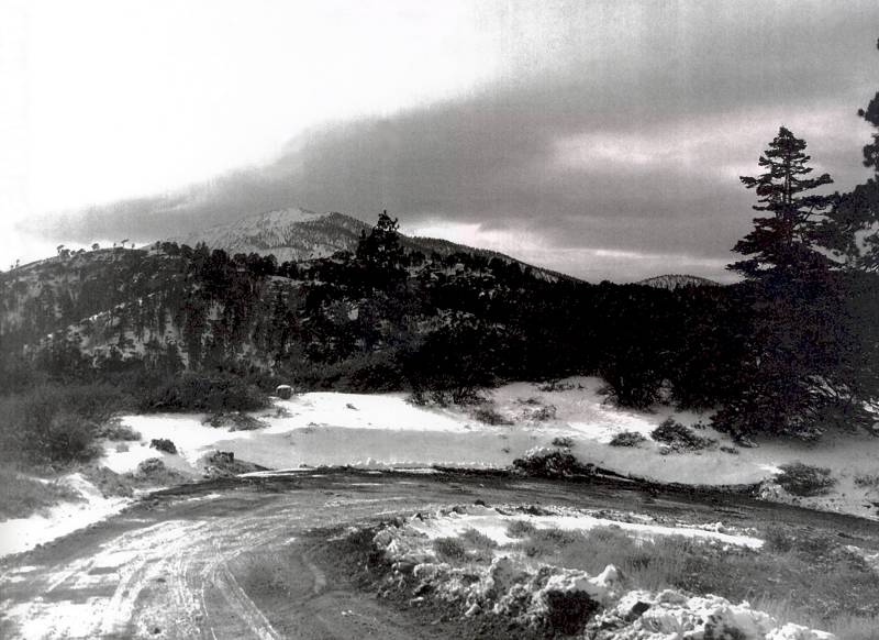
The south facing slope contains much less snow. SIA
This picture shows the area where the current road arrives at the summit of Table Mountain. It
is looking northeast, with the site entrance itself at the far right. SIA
This is a year 2010 image of the previous picture.
Before we get into the further development of Table Mountain by Smithsonian, we shall look at some
additional maps and notes concerning methods of getting to the site.
In this 1931 map of unknown origin, the distance from Los Angeles to Wrightwood is listed as 90 miles.
Courtesy of Rich McCutchan

The extension road from Highway 138 at 'Mountain Top' into Wrightwood was completed in 1937.
This is a 1943 Automobile Club of Southern California map.
In this Shell Oil Company map, dated 1947, we can see the progress of the Angeles Crest Highway.
This is a 1948 revised edition of a USGS topo map. There is no mention of Table Mountain, or even
an elevation. In fact, the elevation contour lines are very poor at best in that area. Circle Mountain
(center) is still listed as having an elevation of 6917 feet.
Richfield Oil Company map dated 1952.
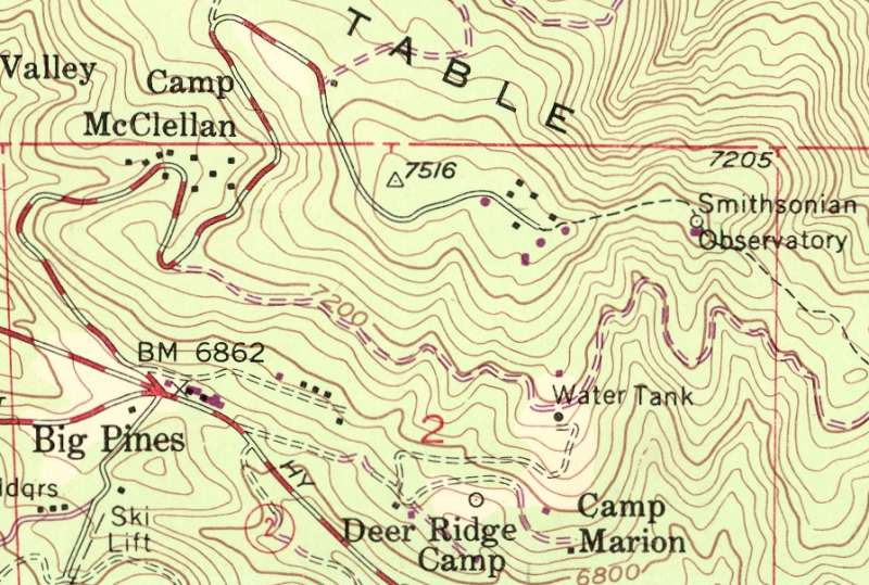
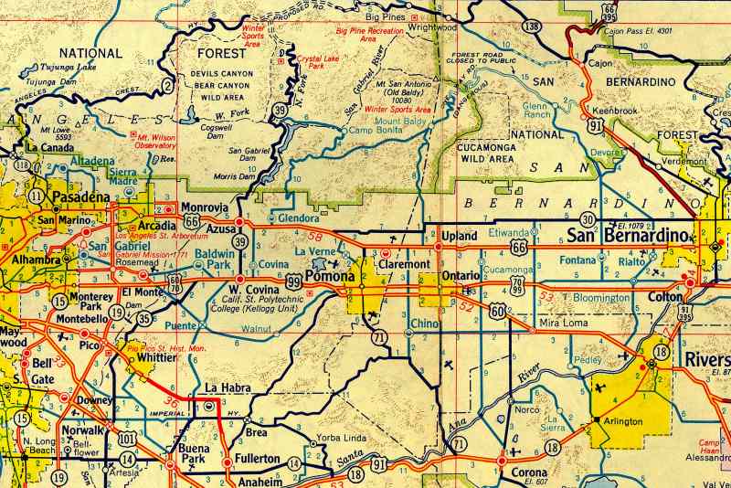
In this most recent USGS topo map, dated 1956 (with revisions in violet color for 1968), it shows
several new buildings at Table Mountain (JPL owned/operated as of 1962), and a mistake that has
showed up elsewhere over recent years. "Smithsonian Observatory" is listed 1/2 mile east of the
actual facility. The violet colored dot (1968) refers to the JPL solar test building constructed
there in 1965. Smithsonian never was out on that point with any instrumentation or building during
their 1924-1961 occupancy of Table Mountain!
End of Part 1 Part 2