Welcome to
Young's Photo Gallery
James W. Young, Professional Photographer
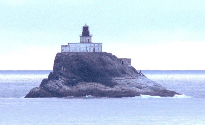
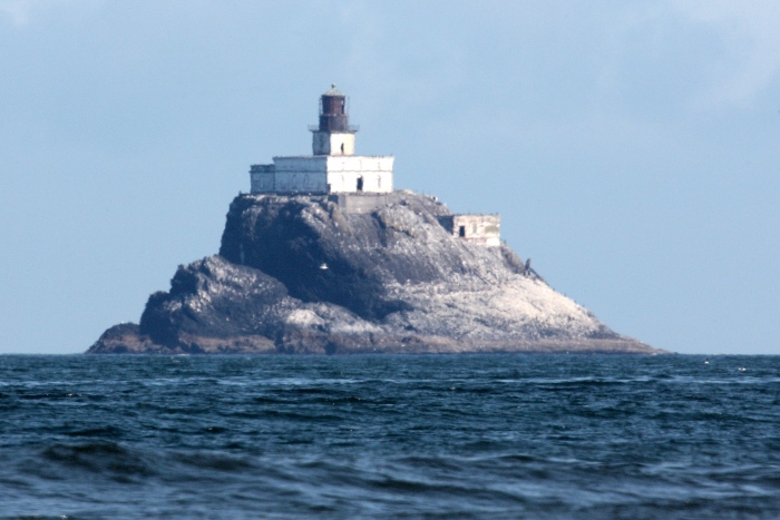
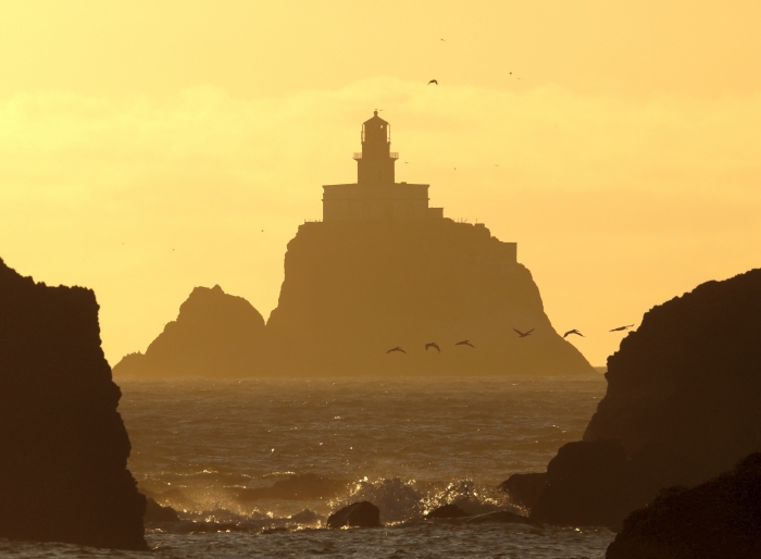
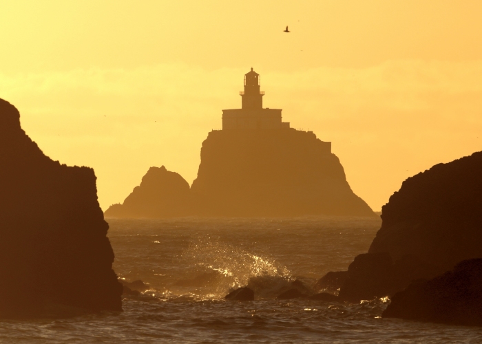
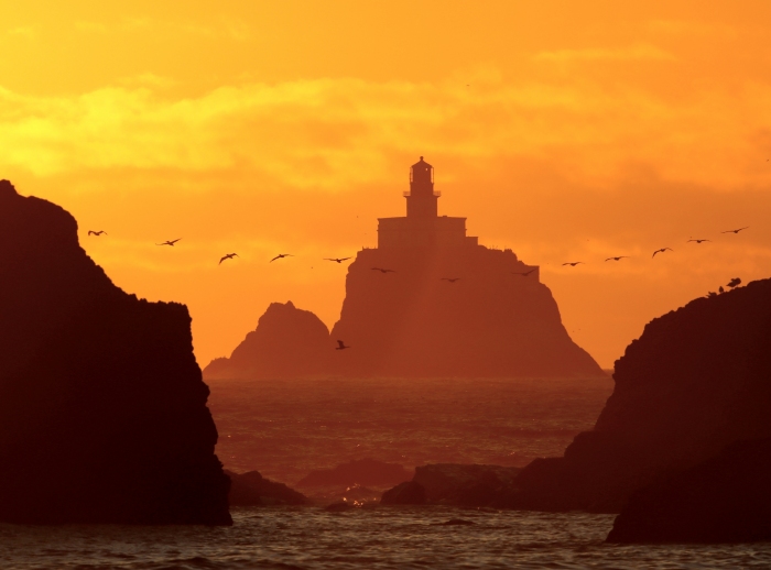
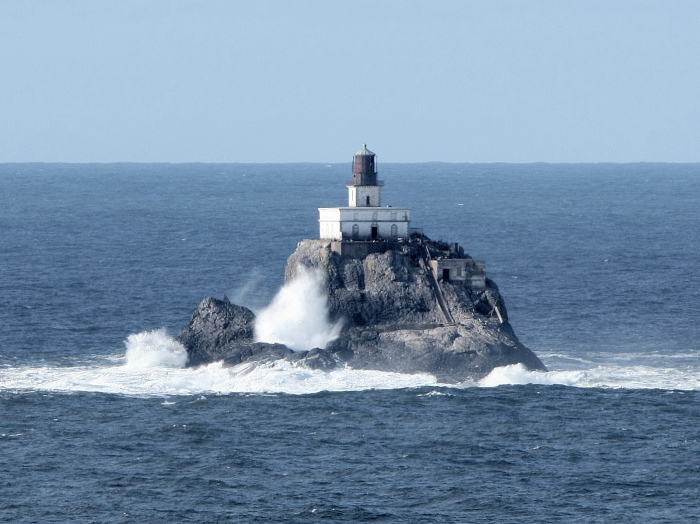
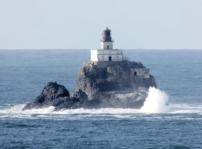
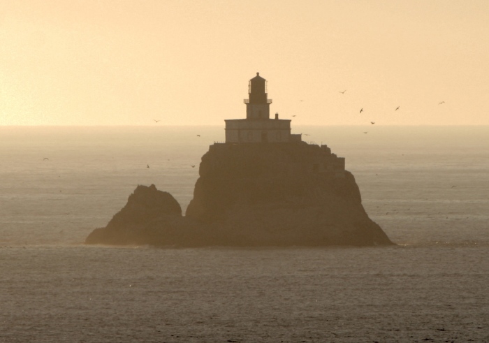
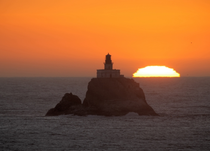
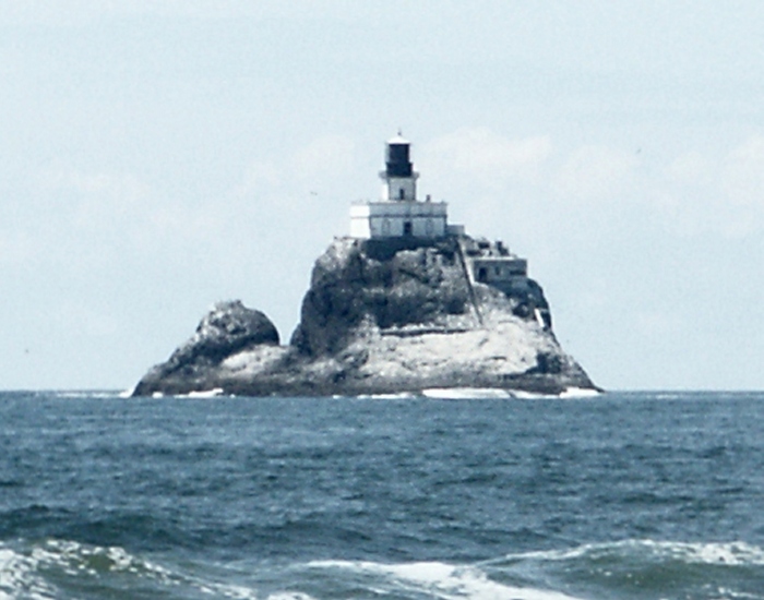
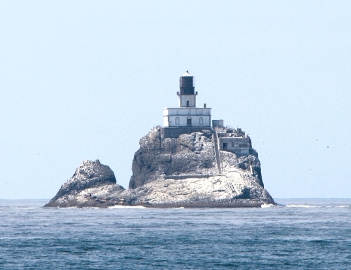
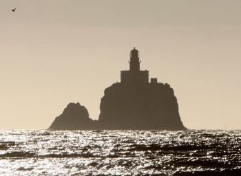
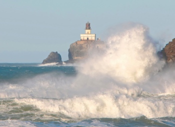
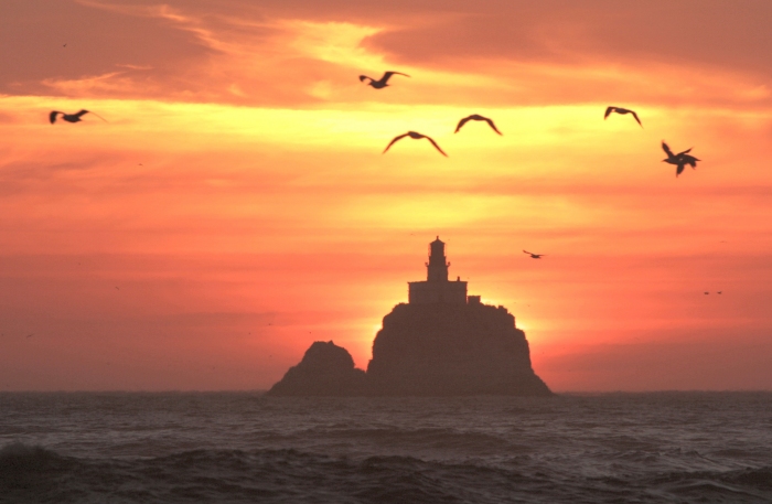
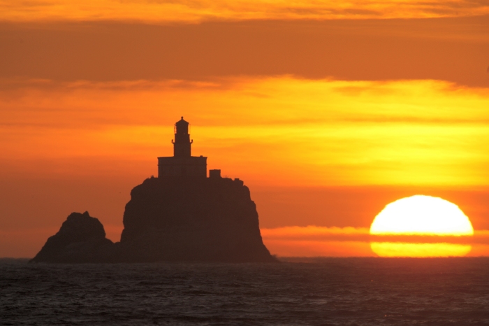
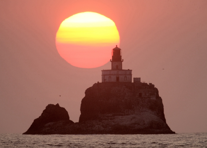
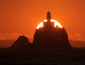
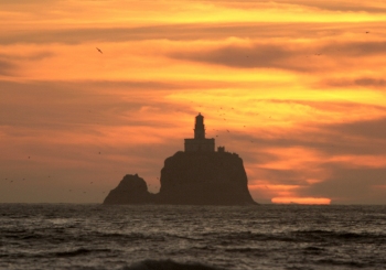
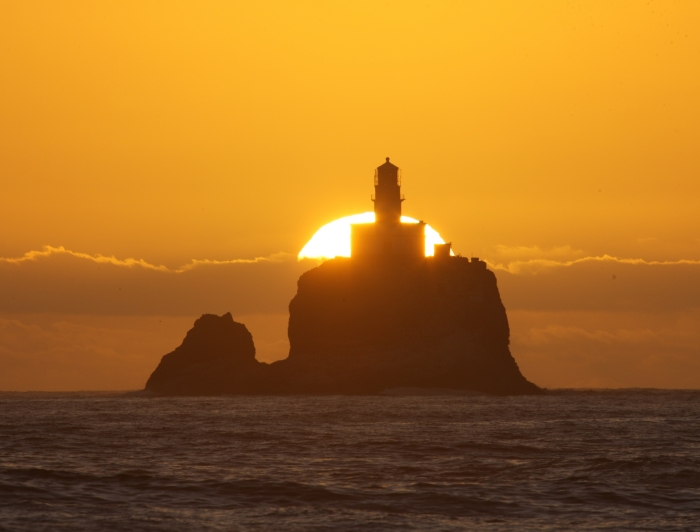
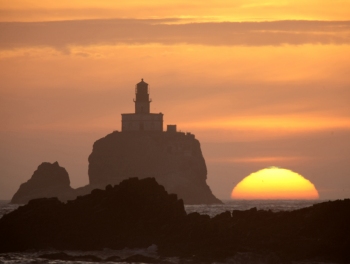
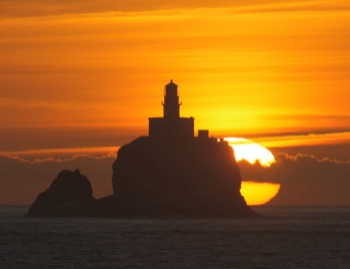
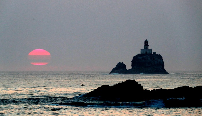
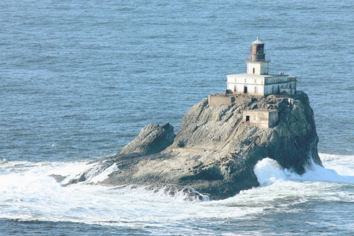
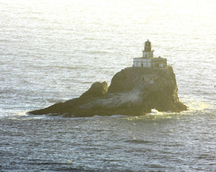
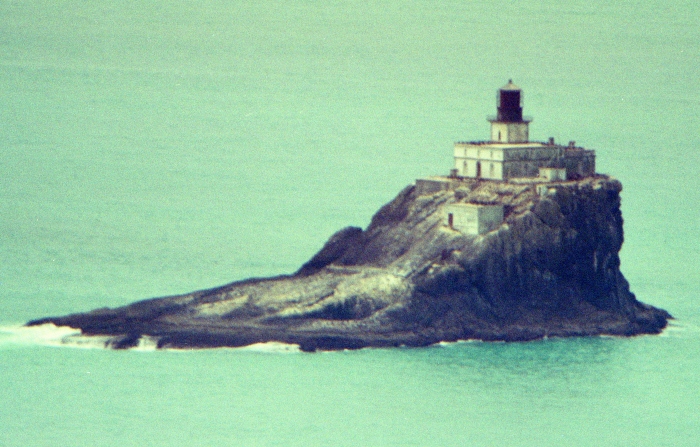
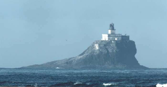
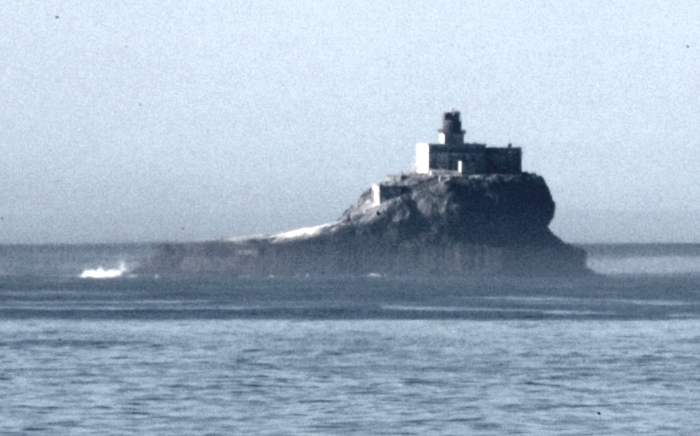
Tillamook Rock Lighthouse
The United States Congress
commissioned the construction of the Tillamook
Rock Light in 1878. The
construction began in 1880 on a small basalt rock
1.2 miles west of
Tillamook Head, and 20 miles south of the entrance to the
Columbia River in
northwest Oregon. It took more than 500 days to complete
the lighthouse
facility, and it was officially lit on January 21, 1881. At the
time of its construction, it was the most expensive west coast
lighthouse ever
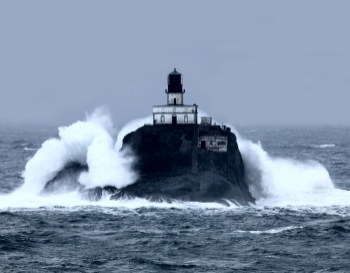
built. Because of the extreme weather conditions over its lengthy
history, the
lighthouse became known as 'Terrible Tilly', with damage to the light
and the
structure itself on many occasions. It was decommissioned in 1957
after 77
years of service.
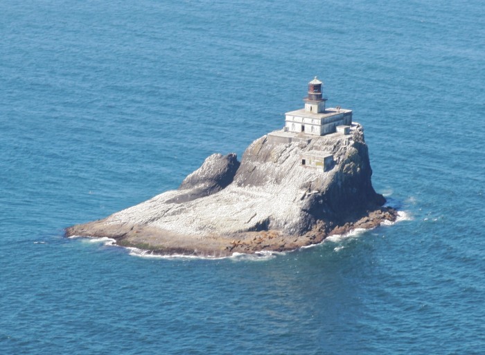
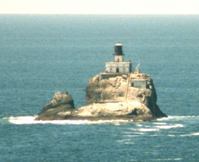
This image was taken from an aircraft I chartered in July,
2014
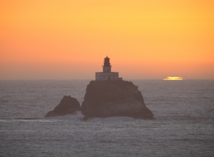
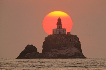
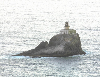
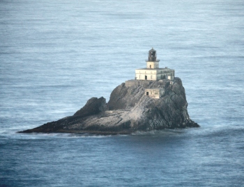
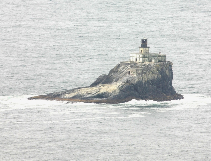
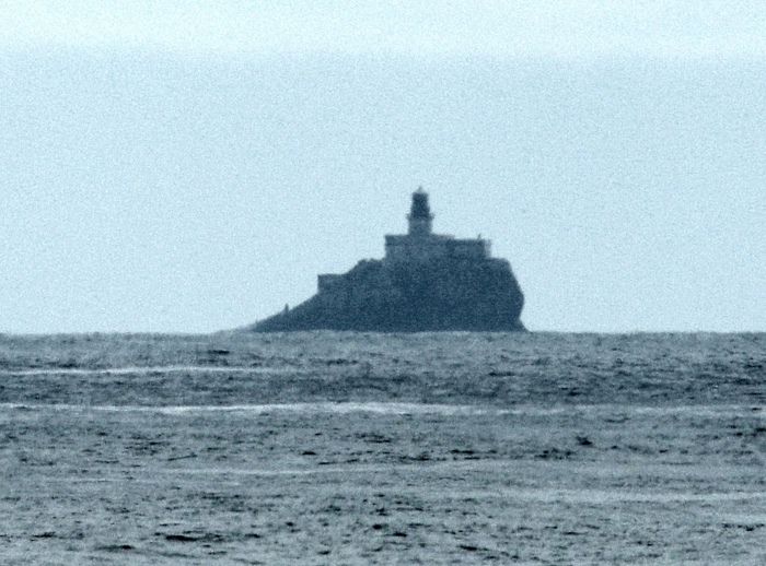
The following images
show the lighthouse from numerous locations on the
Oregon Coast from near Cape Falcon to the south (11 miles), then to the
South Jetty of the Columbia River (20
miles) north of the lighthouse. I
started with film cameras in 1982, and without the best lenses, some of
the earlier dated images
are of poor quality because they were obtained
without the use of adequate telephoto lenses...but still represent
areas
of interest. These images were taken from over 40 different
locations,
and are displayed from south to north over 31 miles of coastline.
Please
note that the curvature of the Earth is very evident as seen in the most
northerly images, especially when close to sea level. Some images
show
atmospheric distortion resulting from heat waves along the path above
the
water's surface.
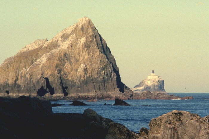
This image was taken from above Falcon Cove, 11 miles to the south of the
lighthouse. This is the most southern image obtained, and acquired from
Elk Flat Road, just west of the Fire Mountain School, at an elevation of
around 215 feet.
This image taken from the north end of Falcon Beach, on Falcon Beach Road
about 10 1/2 away at an elevation of 97 feet.
Still further north, here is an image taken at 28 feet, at 10 miles distance
from Cove Beach (just below the Highway 101 tunnel south of Arch Cape).
----------------------------------------------------------------
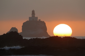
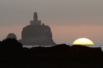
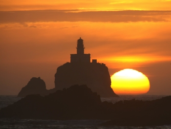
The following seven images were taken from the viewpoint along Highway 101
just south of the last exit to Tolovana Park and Canon Beach, about 7 miles
distance, and at an elevation of 147 feet above sea level. These date from
November 2011 to June 2016.
----------------------------------------------------------------
Just east of Haystack Rock in Canon Beach, is a stairway leading down to the
beach from S Hemlock Street, as well as another off the south end of Pacific
Drive. Further south from the second stairway is a short path down from South
Hemlock toward a wooded overlook on an undeveloped and empty lot. These are
individually identified.
Empty Lot at 28 foot elevation from 4.7 miles to the south
South Stairway off of Pacific Drive at 30 foot elevation, at 4.6 miles
The north stairway at 36 feet elevation, and 4.3 miles distance.
These three images are from the base of the north stairway at 10 feet above
sea level, and also 4.3 miles from the lighthouse.
The three above images were taken at sea level (5 feet) from on the beach just
NE of Haystack Rock at 4.2 miles.
Moving into the city center of Cannon Beach, the above three images were taken
from the viewpoint at the extreme west end of 2nd Avenue...22 feet above sea
level and 3.8 miles away.
----------------------------------------------------------------
Moving north from Cannon Beach, across Ecola Creek, and onto Chapman Beach
is where the 1st (south end) and the 2nd (middle) images were taken (south of
Chapman Point) at 3.5 and 3.3 miles from the lighthouse, and at elevations of
32 and 44 feet respectively.
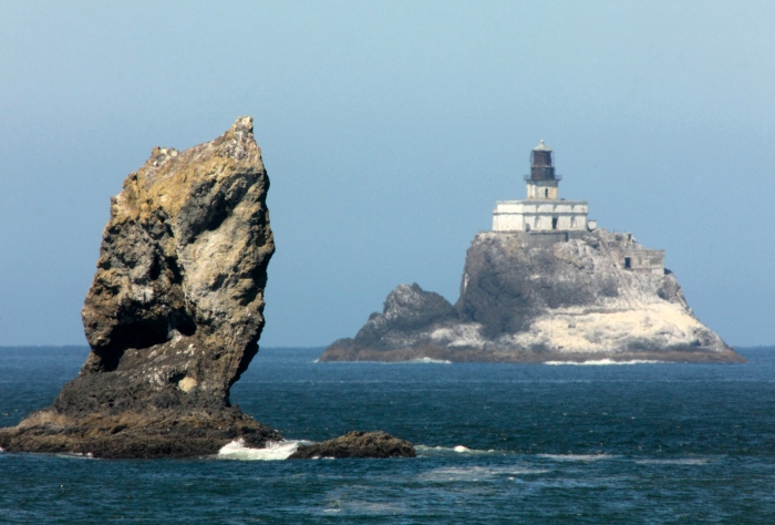
On the very north side of Chapman Point, near the water's edge, is a vertical
rock ledge accessible to 24 feet above sea level, and 3 miles distance. The
rock on the left is near Sea Lion Rock, west of Ecola Point. This is at the
far south end of Crescent Beach, and the southern edge of Ecola State Park.
Traveling further north on Crescent Beach, there was only one locations used,
but at two different elevations. The first image at 20 feet above sea level
on an embankment ledge, and the second (a series of three images spanning
20 minutes just before sunset) off the ledge, and 8 feet lower. This is just
under 3 miles from the lighthouse,
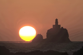
Sunset...
ECOLA STATE PARK - OREGON
Images acquired at Ecola State Park are from the picnic area on the knoll just
west of the parking lot, and nine other locations further downhill and further
west, as well as out on Ecola Point before 2015 (which is no longer accessible).
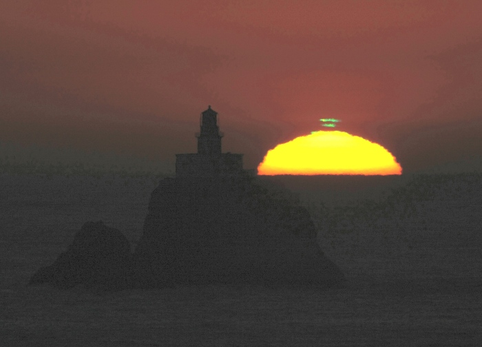
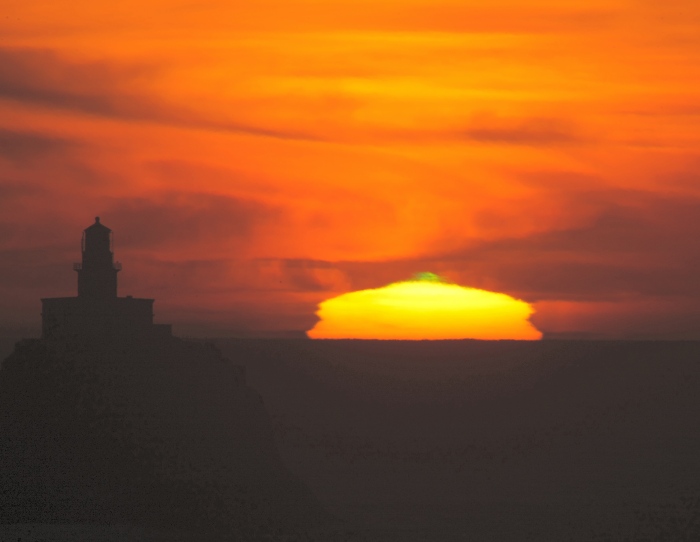
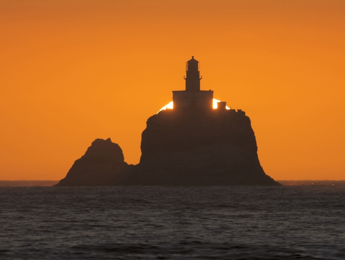
Another objective here was to capture the sun setting behind the lighthouse in
mid July (west of the parking area), as well as the infamous and elusive 'Green
Flash' (which is not related to the lighthouse).
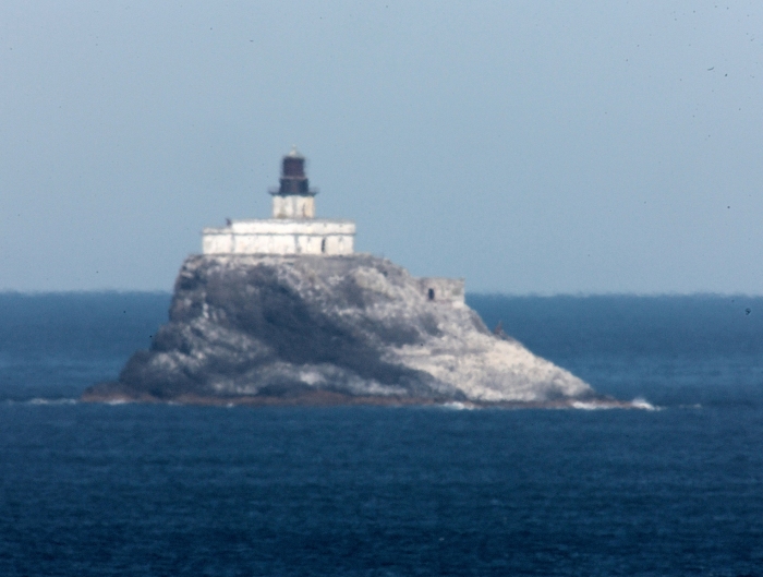
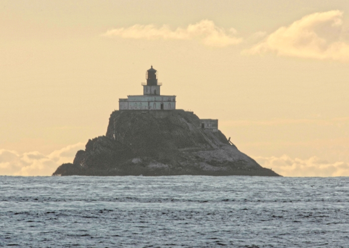
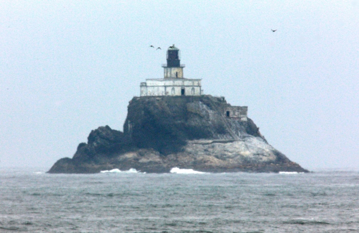
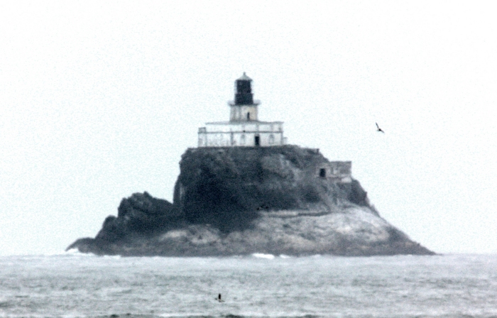
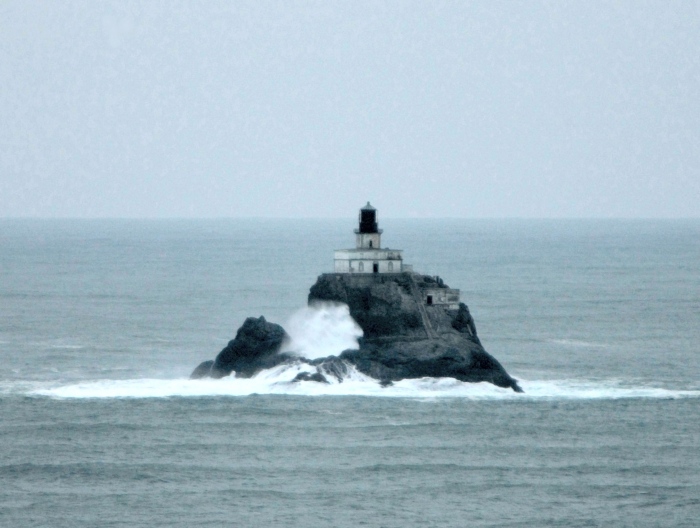
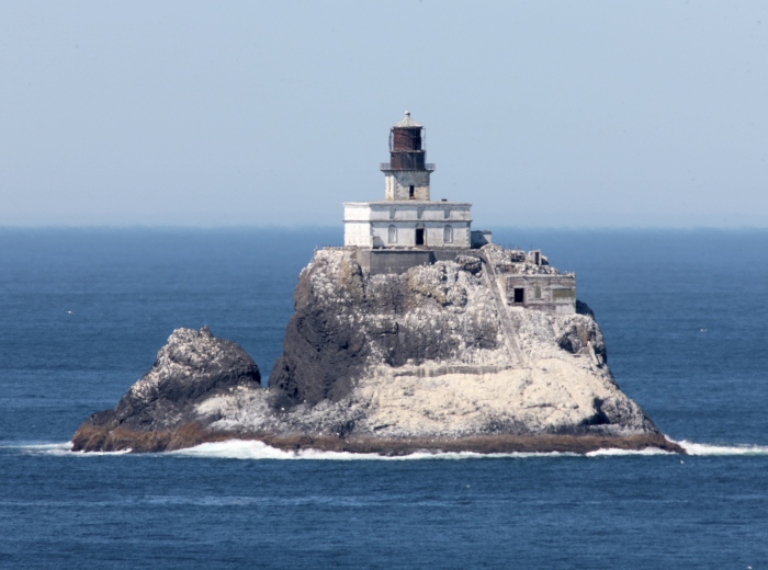
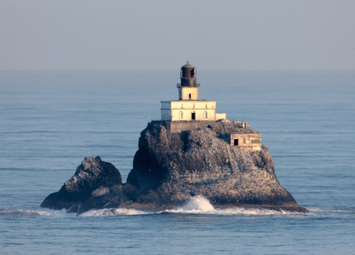
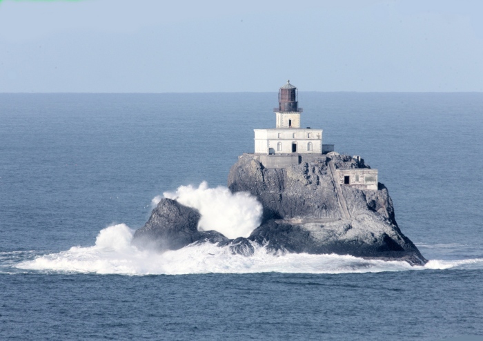
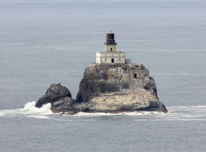
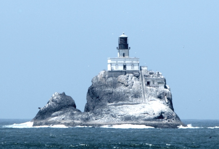
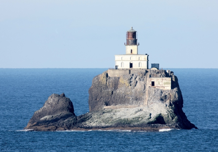
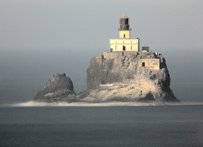
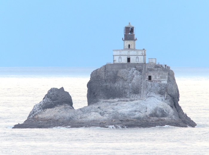
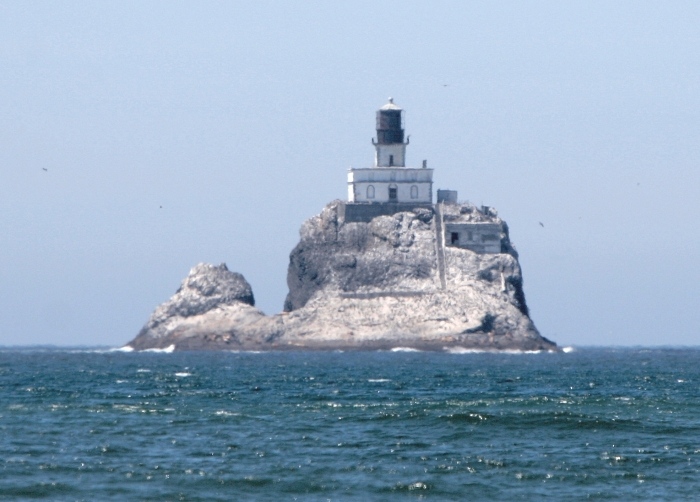
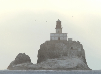
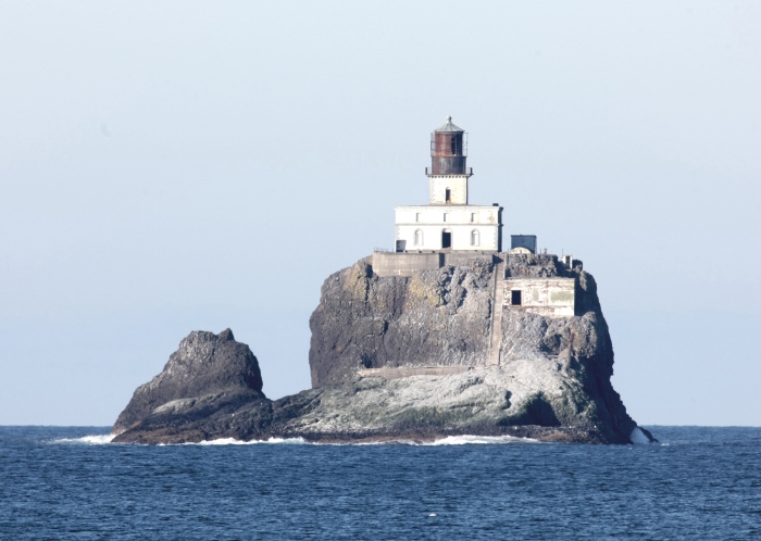
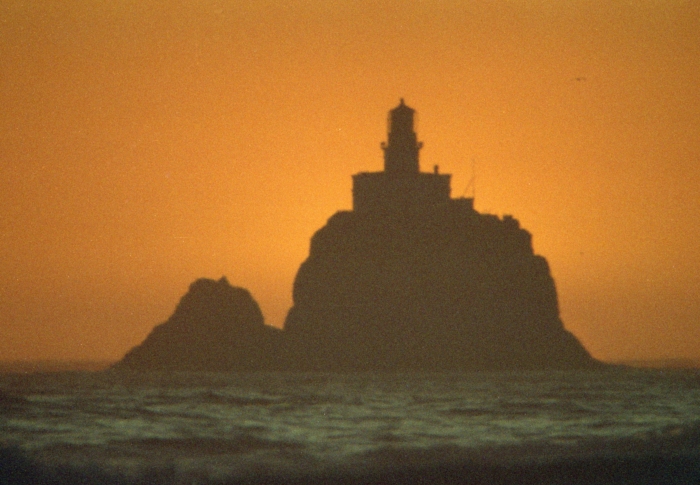
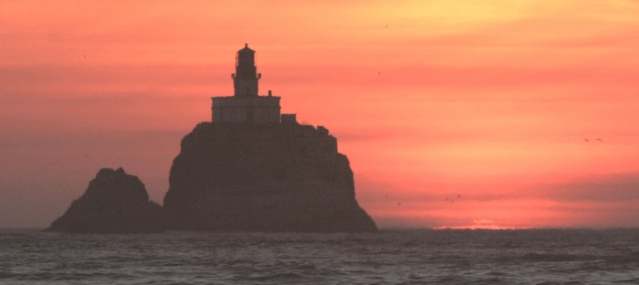
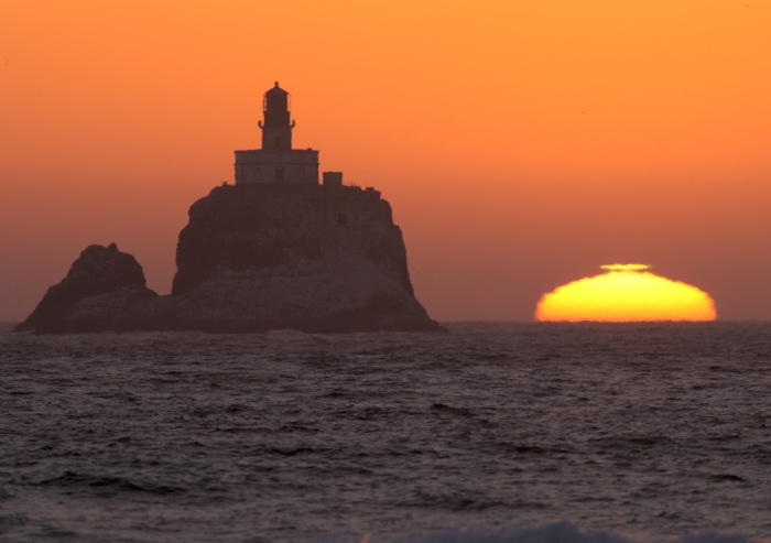
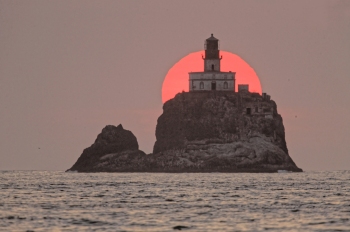
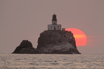
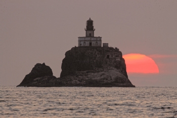
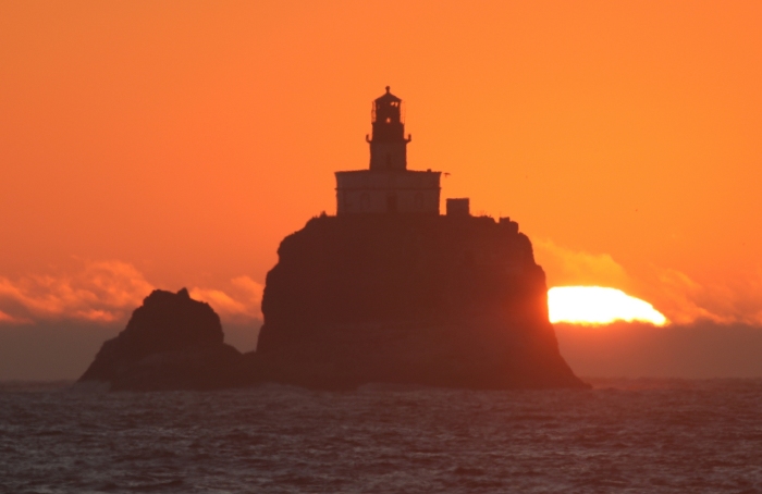
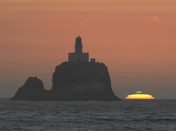
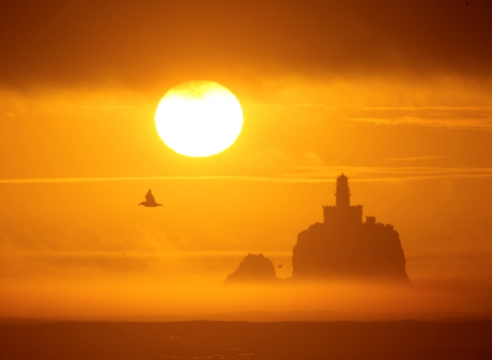
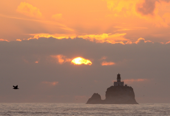
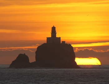
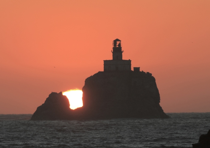
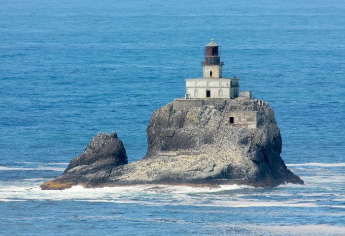
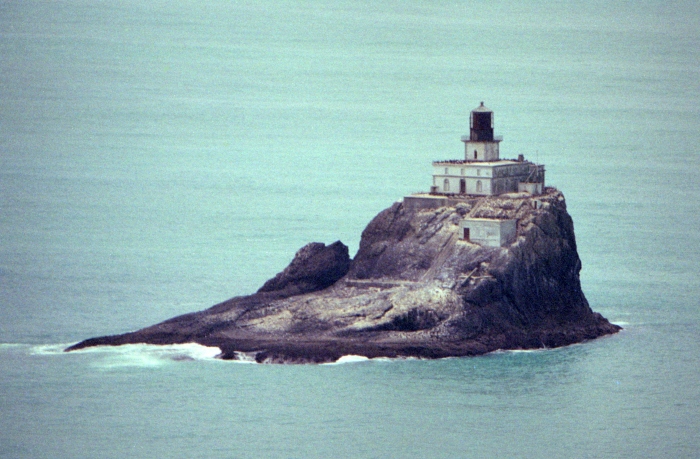
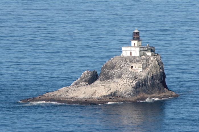
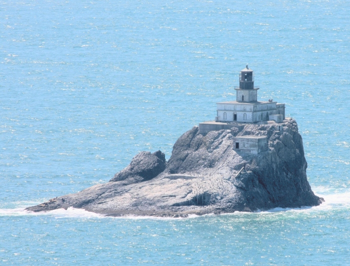
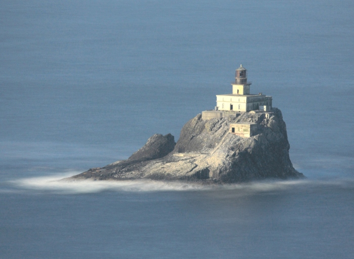
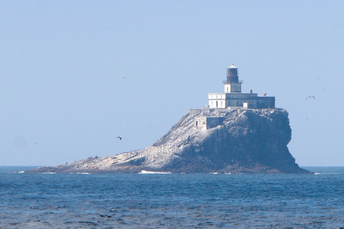
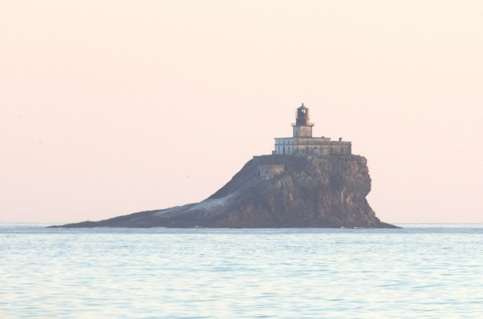
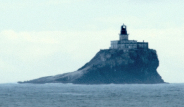
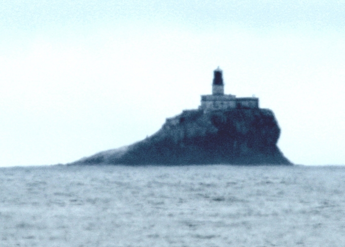
Some statistics of the 'rock' might aid you in understanding the subtle changes
of the appearance, shape, and background ocean heights as various images are
displayed. The basalt rock where the lighthouse was constructed was originally
120 feet in elevation, however the top 30 feet or so was removed to enable a
large flat and stable platform for the construction phase. As seen today, the
very top of the lighthouse itself is 154 feet above sea level. The rock is about
270 feet wide and 400 feet long, lying lengthwise in a ESE to WNW line about
16.5 degrees south of the true east compass point. The front of the lighthouse
(entrance door) is therefore facing slightly south of due east, and is best viewed
from the middle of Indian Beach, less than a mile from the main Ecola Park area.
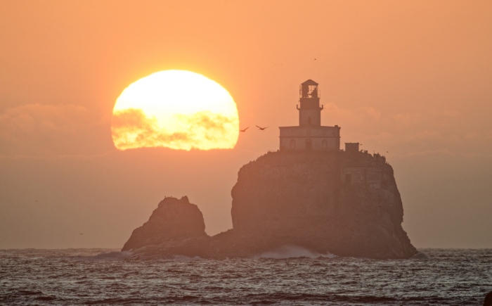
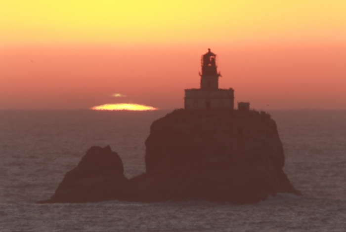
The entire rock has a distinctive gap between the larger portion to the north and
the much smaller south outcropping separated by about 22 feet, and also only 54
feet in elevation. While one moves north, this gap becomes a very noticeable 'V'
shape all the way to a full 'U' opening. Another very noticeable parameter that
affects the imagery, is the background. When close to the water's edge (sea
level), no ocean shows behind the rock. As one increases in elevation, the ocean
level behind appears to move up. These increases in elevation show a complete
ocean background as one attains about 200 feet (or more) above sea level. These
two obvious changes allows the determination of exactly where imagery was taken.
November 9, 2009
November 2, 2010
November 25, 2011
November 9, 2009
February 25, 2012
November 2, 2015
September 5, 2014
July 20, 2015
September 27, 2011
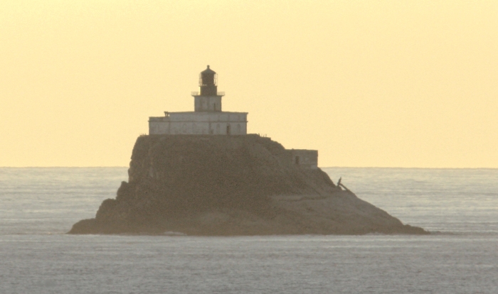
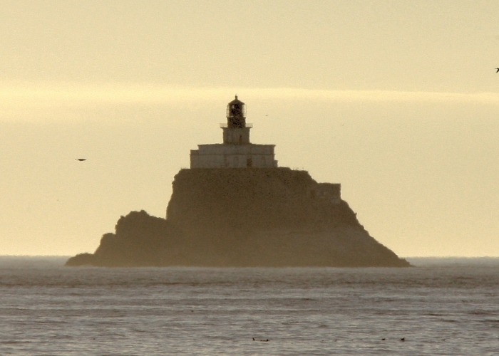
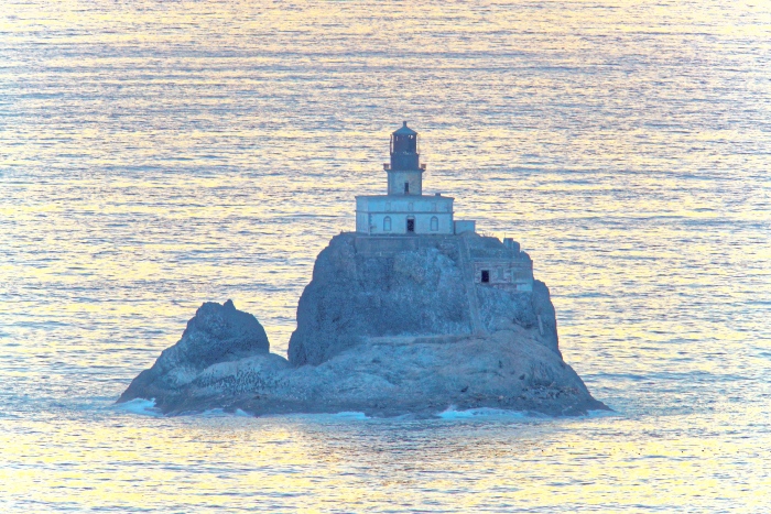
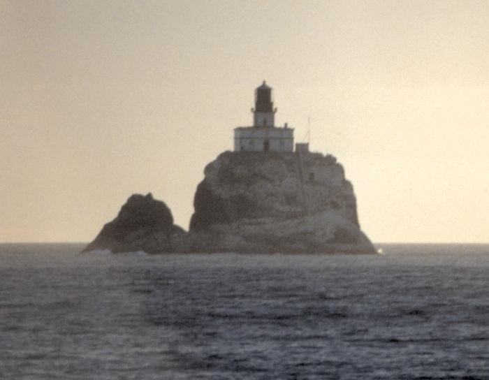
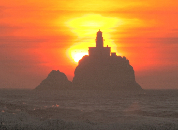
Late afternoon to sunset images...all in the month of July, 2015
A particular nice green flash...
....plus a weak green flash....
Additional imagery...
----------------------------------------------------------------
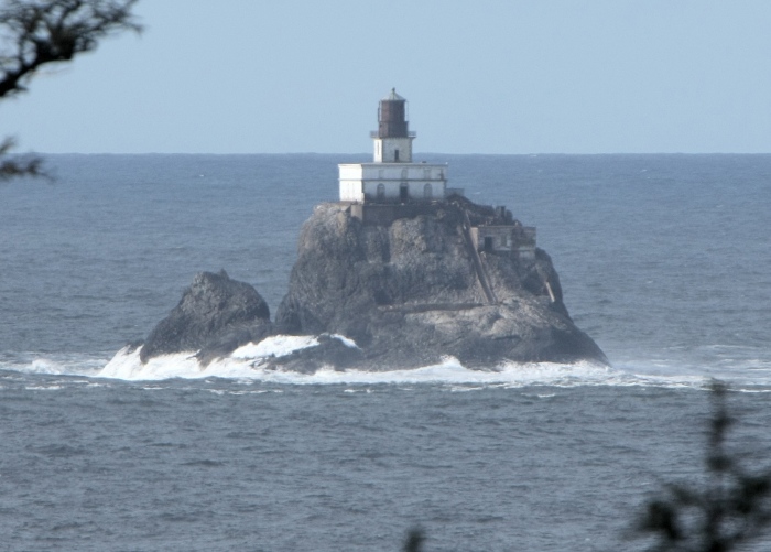
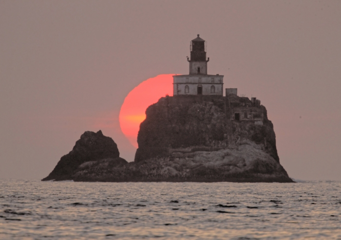
The next five images were taken from the trail that runs north to Indian Beach
from the Ecola parking lot, and marked accordingly by elevation and distance.
Note the 'V' gap between the two sections of 'rock', as it increases while one
goes further north. Also note the full background of the ocean as the elevation
is greater than about 200 feet in each image. All five images are about 2 1/2
miles from the lighthouse.
261 feet above sea level, and 500 feet north of the parking lot.
294 feet above sea level, another 250 feet further north.
345 feet above sea level, and another 300 feet further north.
195 feet elevation, and another 500 feet north
----------------------------------------------------------------
INDIAN BEACH
I have been visiting Indian Beach in the Ecola State Park since I was a small
child in the late 1940s. My family would take picnic lunches to this beautiful
and not-too-well-known beach during our annual summer vacations to Seaside
from our home in Portland. I remember seeing the lighthouse flashing light
from the Prom on a few occasions before 1957 (when it was decommissioned)
because I was only there during the summertime. I have no memory of ever
seeing the lighthouse, day or night, from anywhere else along the coast. One
cannot see the lighthouse from Ecola Park (unless you walk out on the bluff
from the parking lot), or Indian Beach (unless you walk well south from the
beach parking and picnic tables).
The beach directly below and slightly west of the main Ecola Park area is very
difficult to access, but can be from Indian Beach by walking south around Bald
Point at low tide. The following images are from areas north of the main Ecola
Parking area, toward Indian Beach, and mostly on or close to the beach itself,
but south of Bald Point 10 feet above sea level.
July 3, 1990 (film)
July 10, 2004 (DSLR)
August 14, 2015
At Bald Point on a rock at 18 foot above sea level.
July 2, 1990 (film)
August 17, 1995 (film)
July 24, 2005 (DSLR)
June 30, 2009
----------------------------------------------------------------
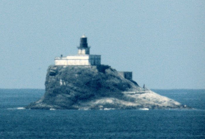
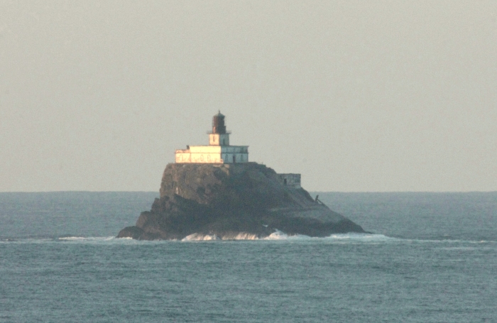
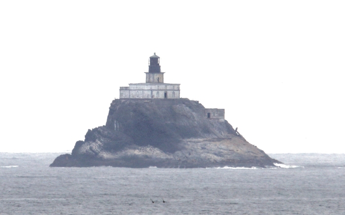
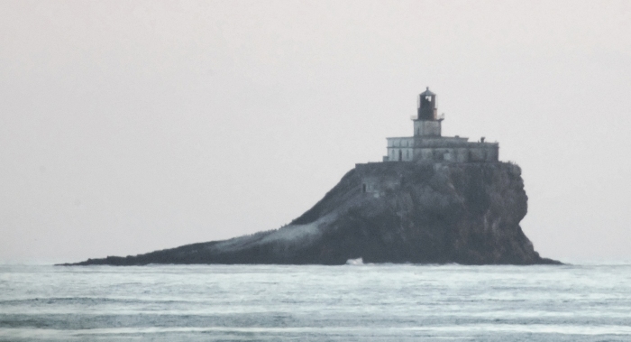
The following were taken on the Ecola Park/Indian Beach Trail 160 feet above
sea level, and just 2 miles from the 'rock'.
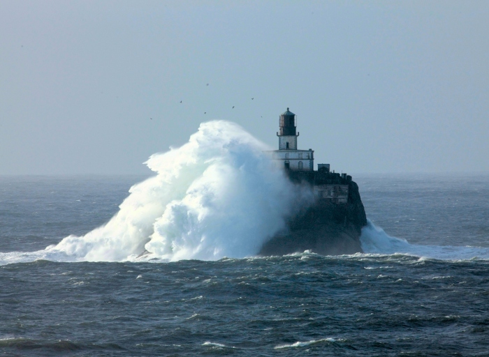
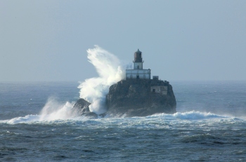
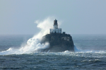
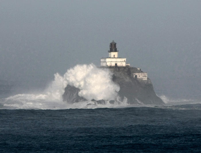
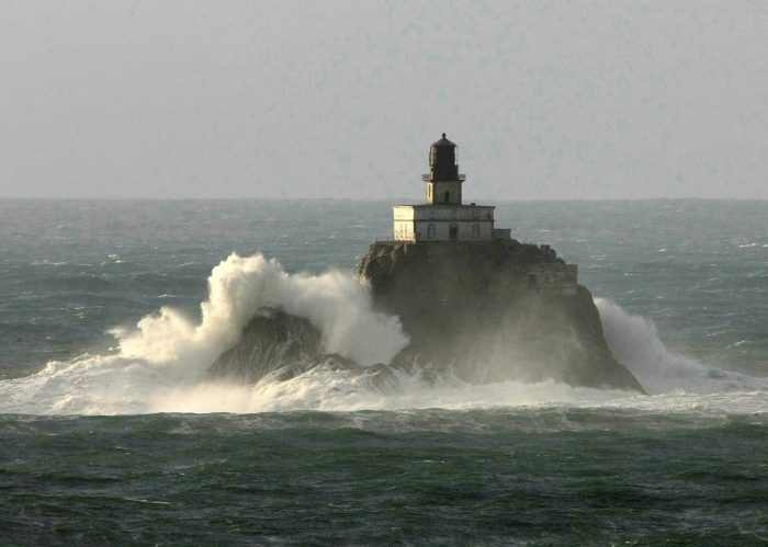
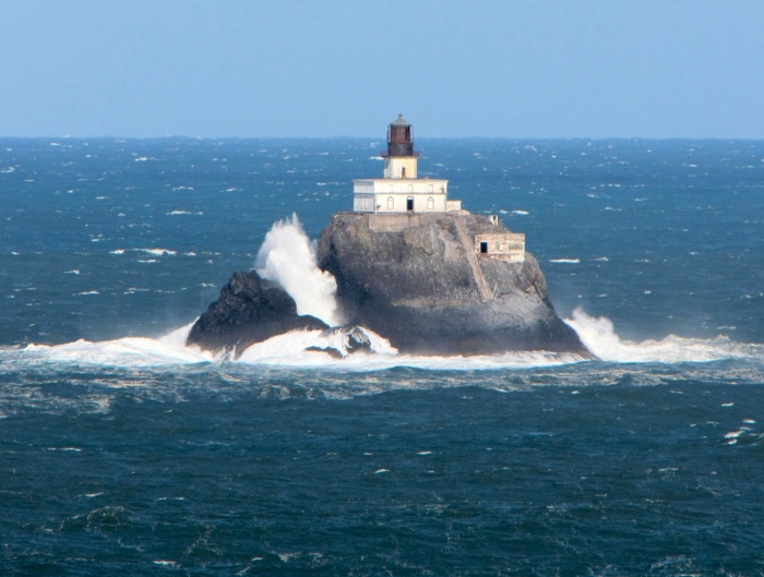
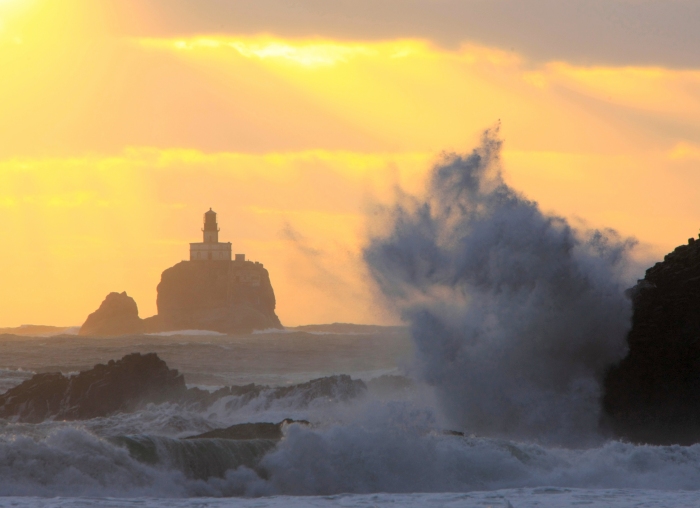
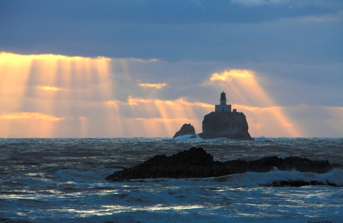
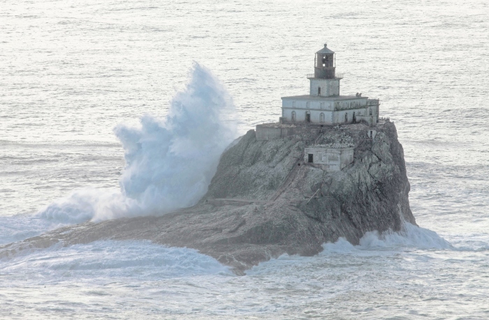
November 6, 2009 Storm
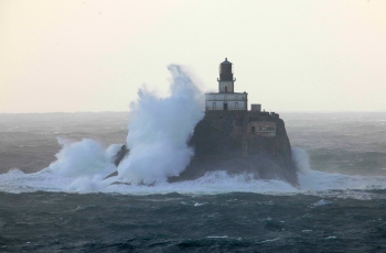
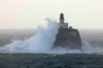
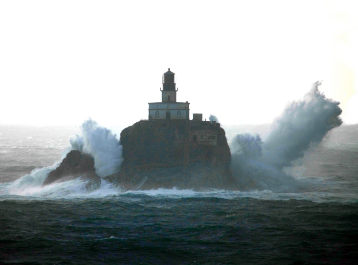
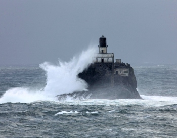
April 2, 2010 Storm
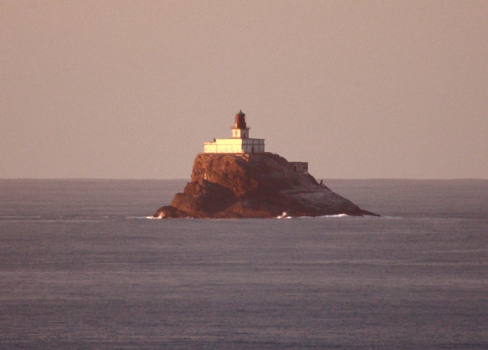
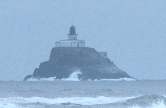
Additional images from the trail....
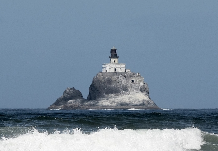
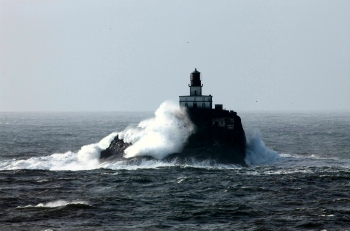
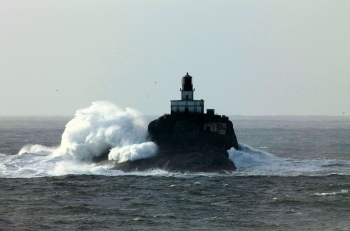
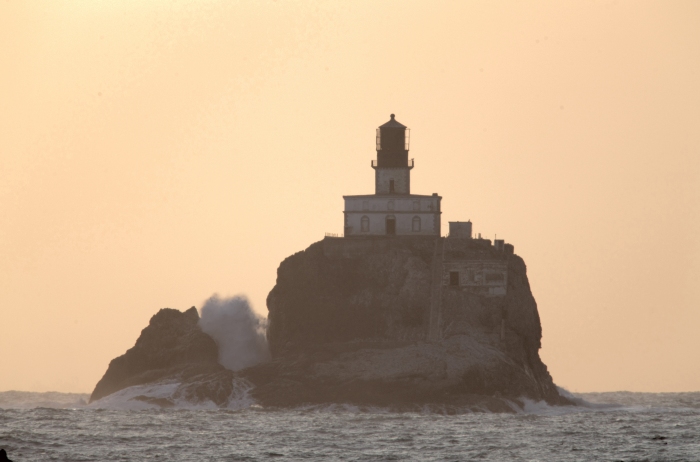
Stormy seas
Calm seas
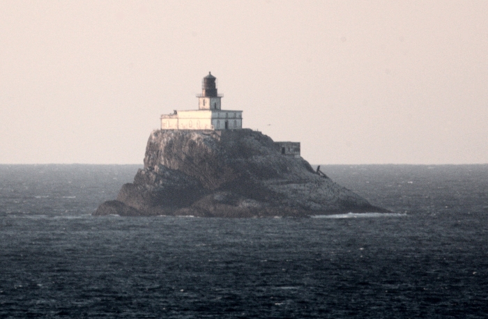
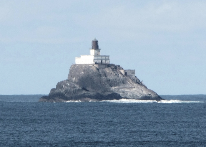
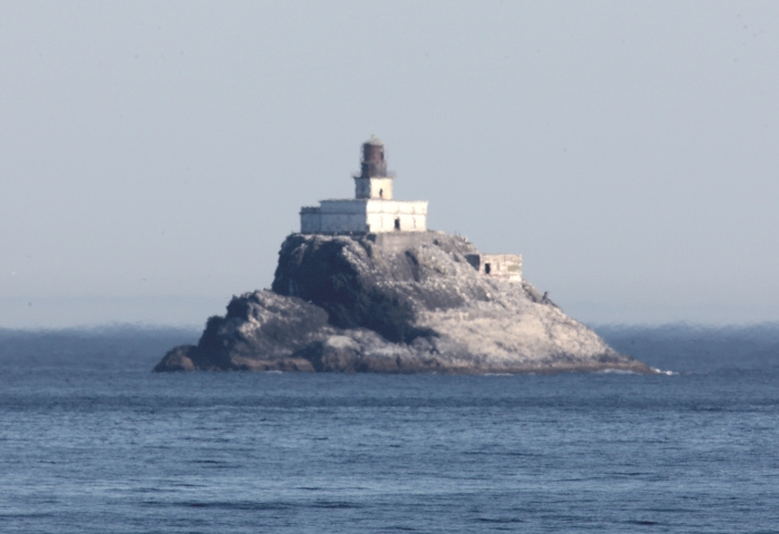
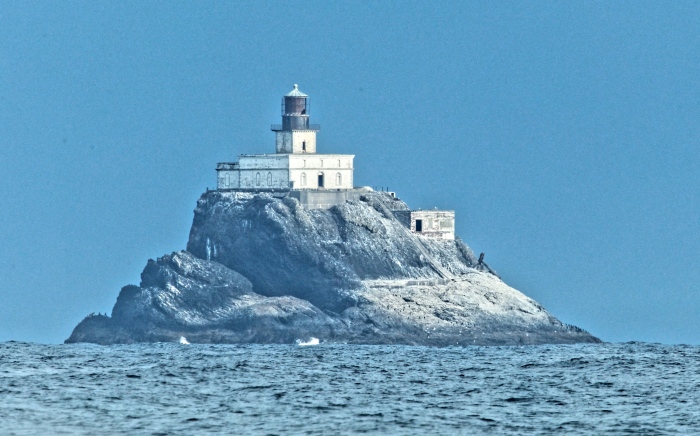
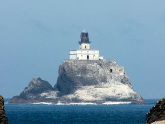
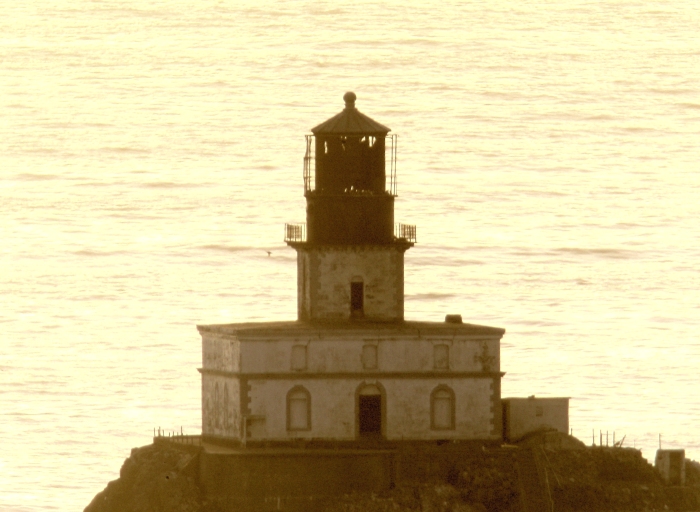
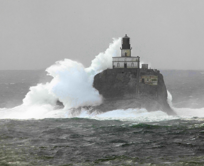
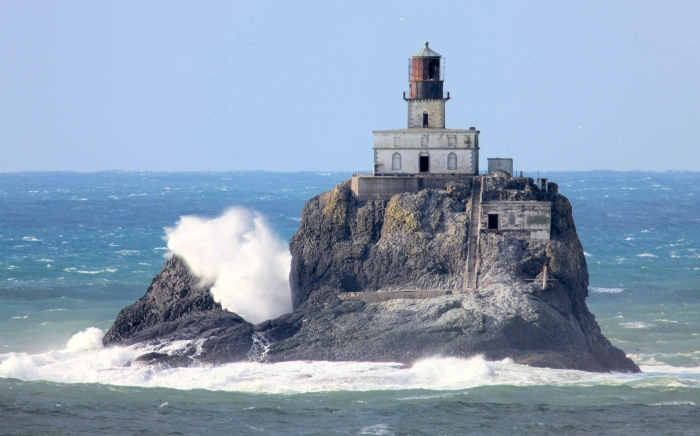
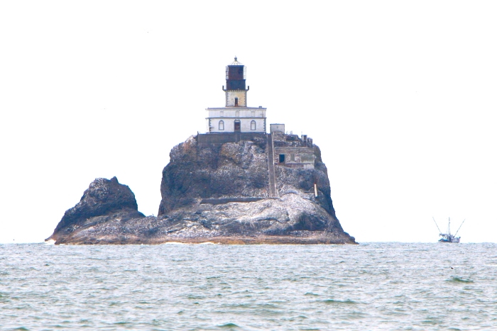
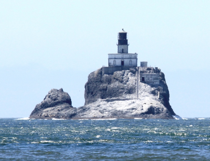
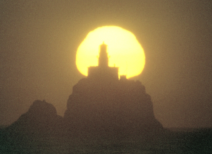
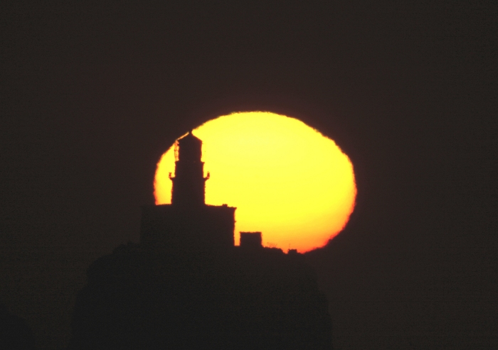
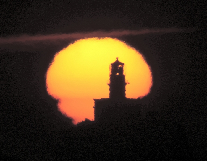
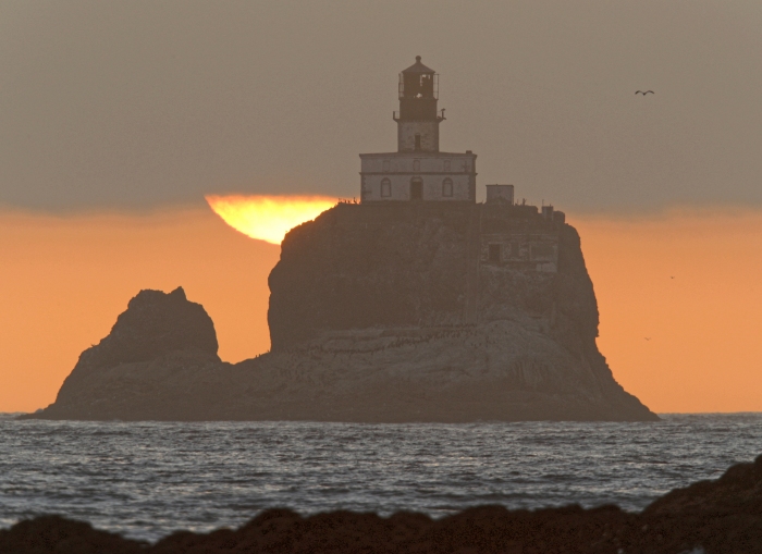
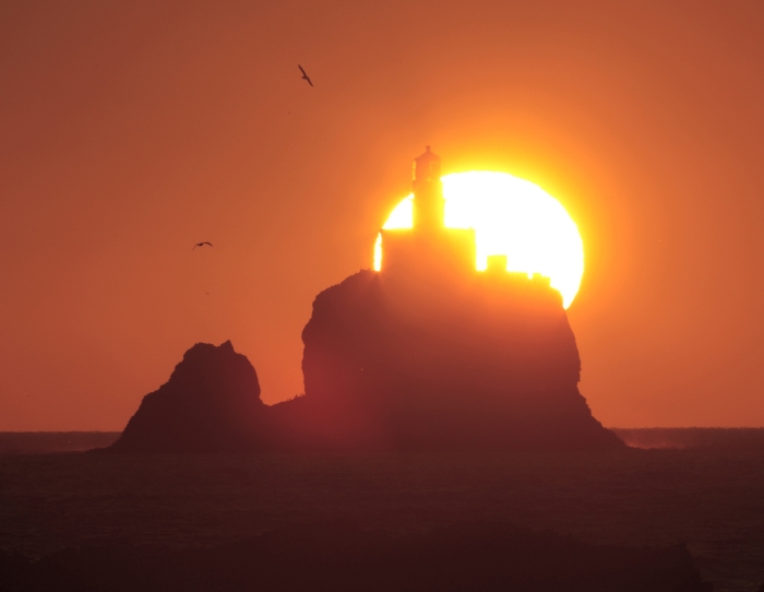
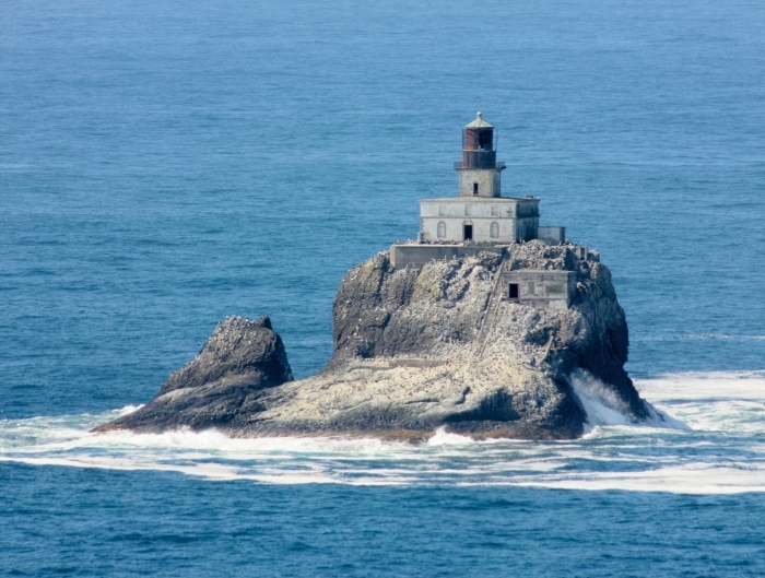
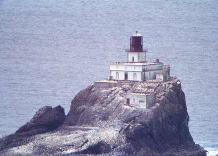
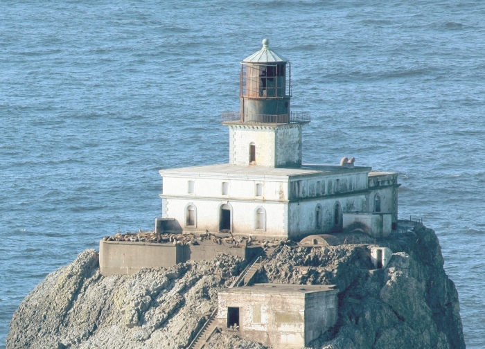
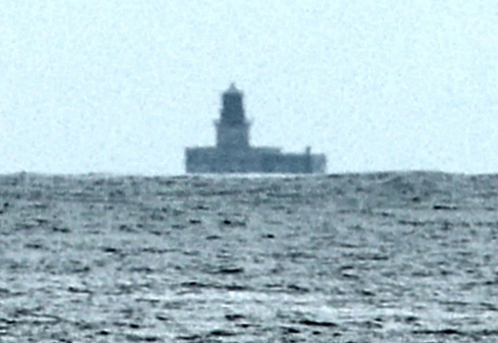
Very good atmospheric conditions, allowed the following closeup...
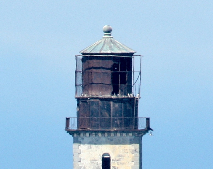
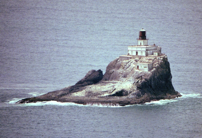
Close-up of Lantern housing... Notice the damage to the lantern housing in
this image from July, 2014.
Nighttime illumination by the full moon...
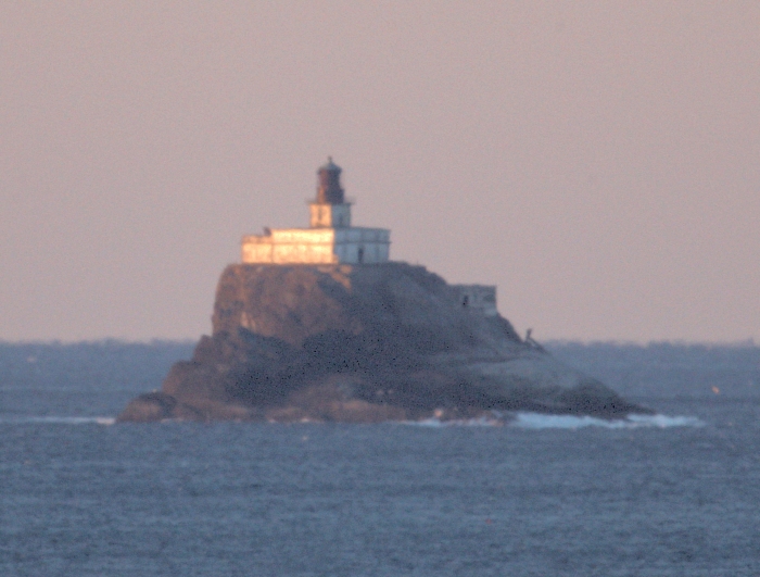
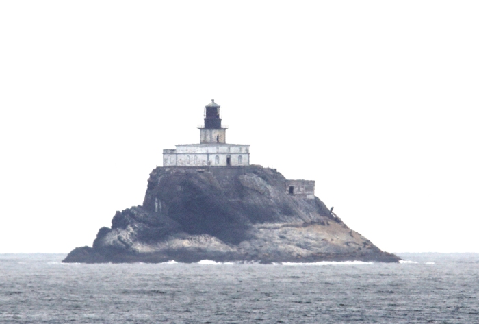
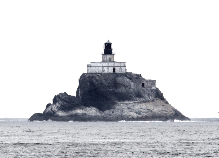
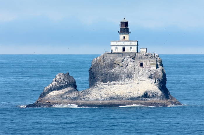
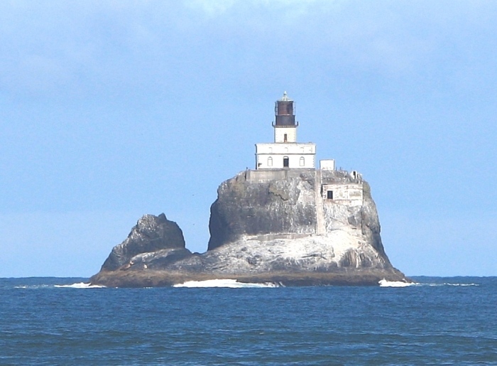
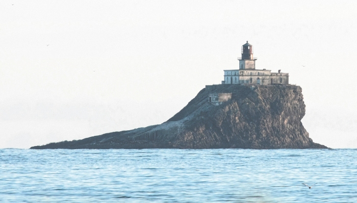
The best atmospheric conditions ever seen...allowing the following close-ups...
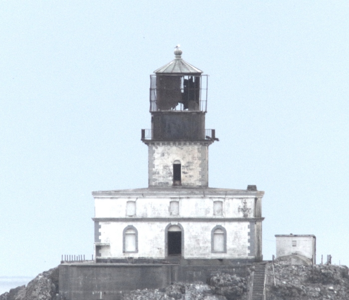
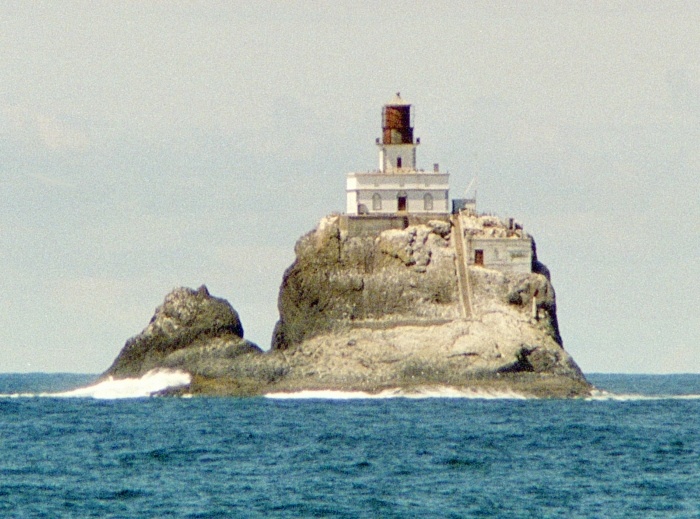
The lighthouse building
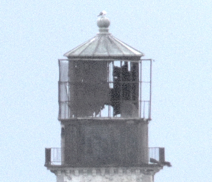
Extreme close-up of Lantern housing... Notice the increased damage to the
lantern housing (this image is from July, 2016).
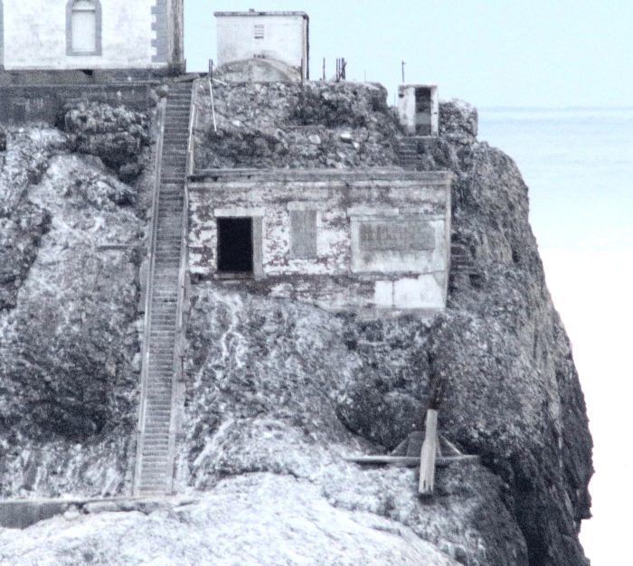
The derrick operation building...
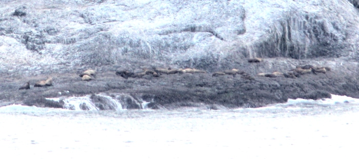
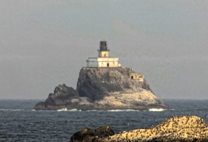
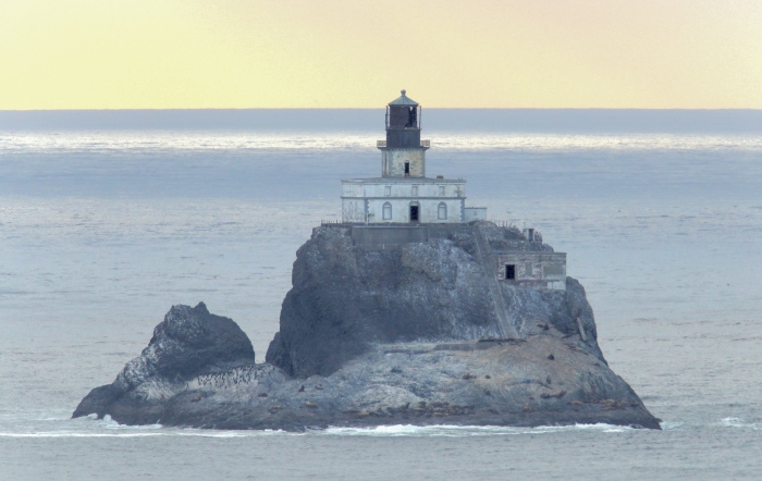
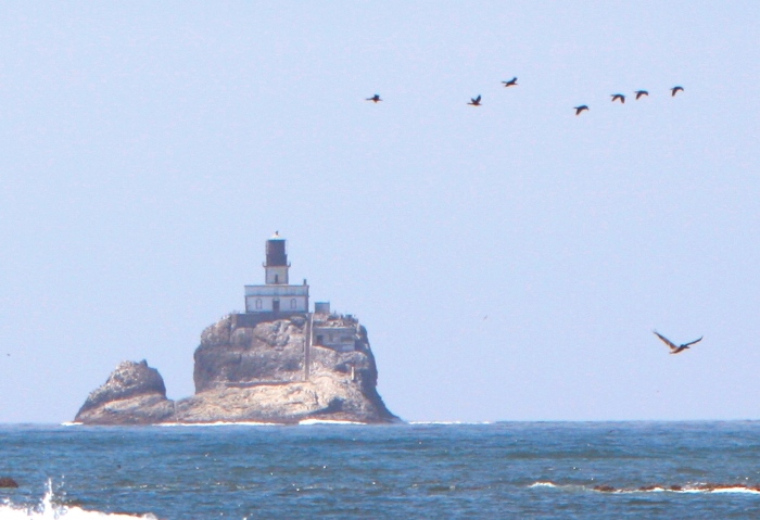
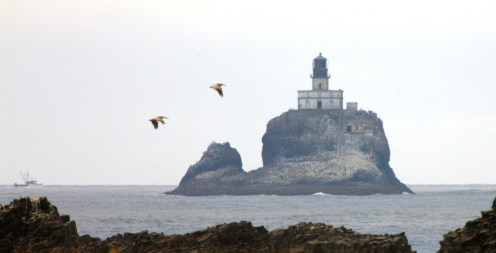
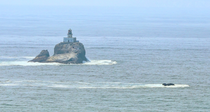
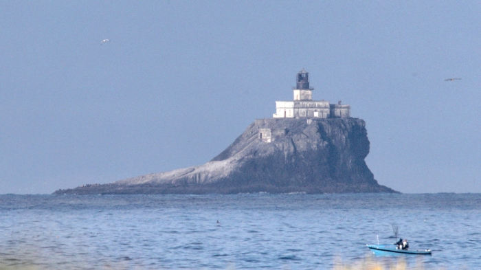
Sea Lions and seals lying around the base of the rock...
----------------------------------------------------------------
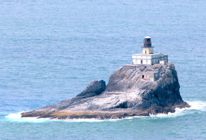
This next series of images were taken on Indian Beach starting at Bald Point,
and moving north for the full length of the beach (about 1200 feet) until the
lighthouse disappears behind Indian Point. A few of these images were taken
from the ledge above the actual shoreline, as one can see from the amount of
ocean behind the base of the rock (especially with the last image).
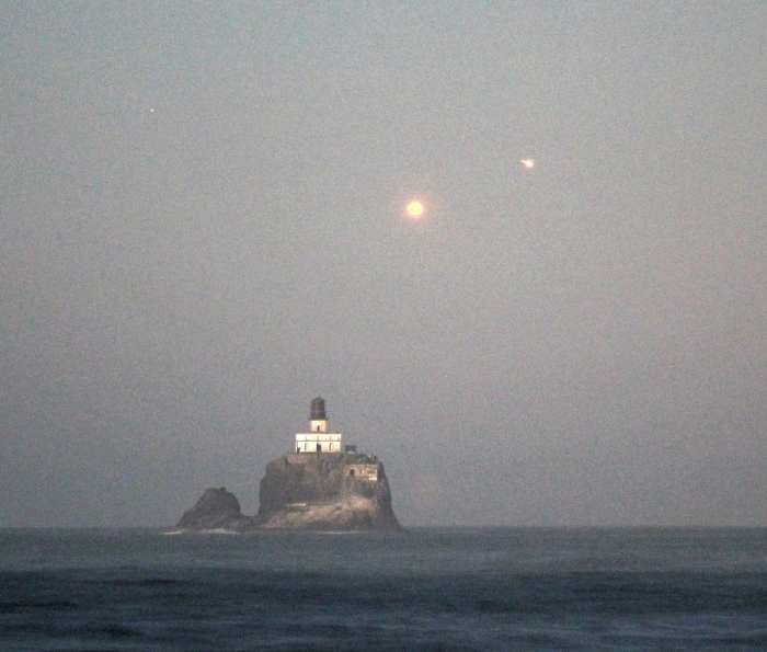
Illuminated by the full moon, with a conjunction of Venus and Jupiter (right).
----------------------------------------------------------------
The next series of images were obtained during April, 2010...looking for the
sun to set behind the lighthouse.
April 9, 2010
April 15, 2010
April 20, 2010
April 21, 2010
----------------------------------------------------------------
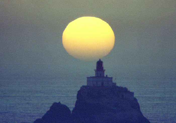
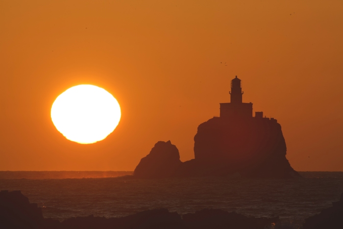
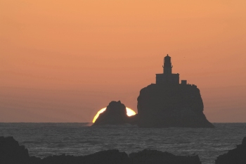
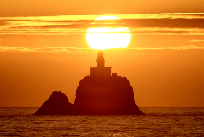
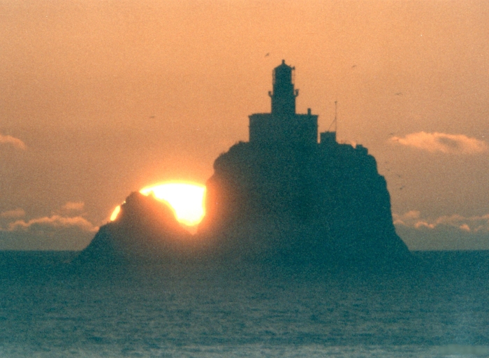
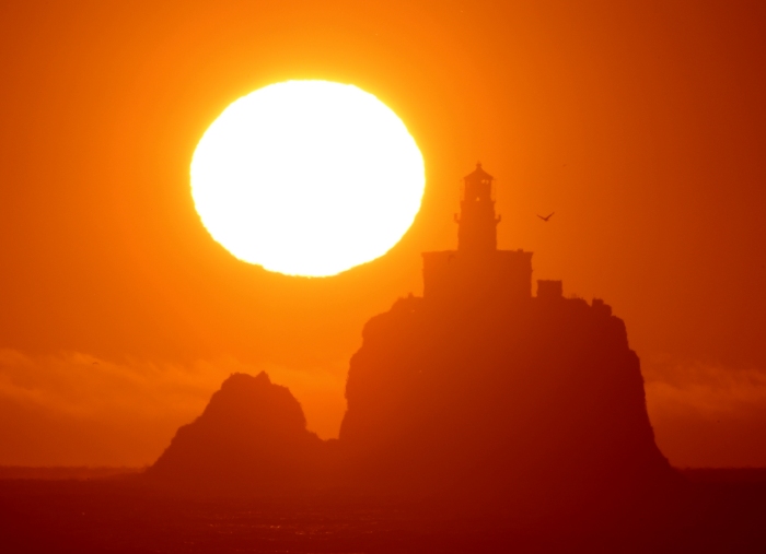
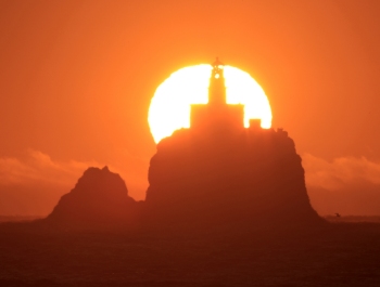
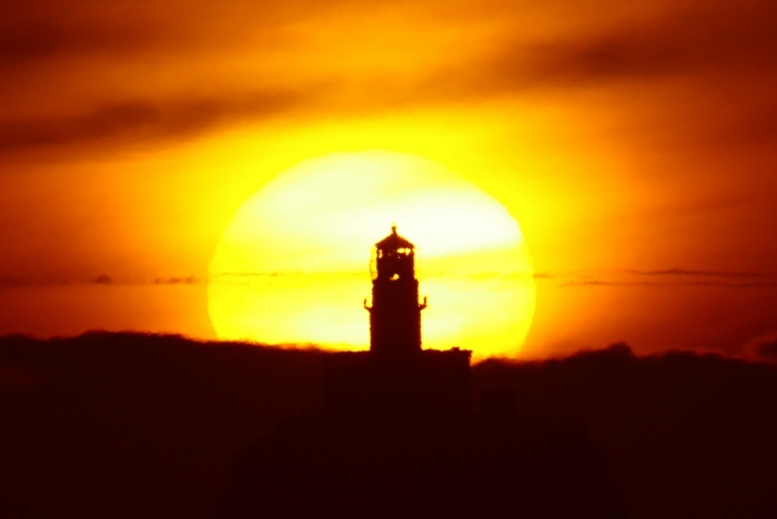
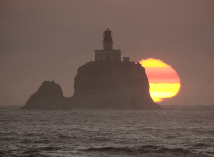
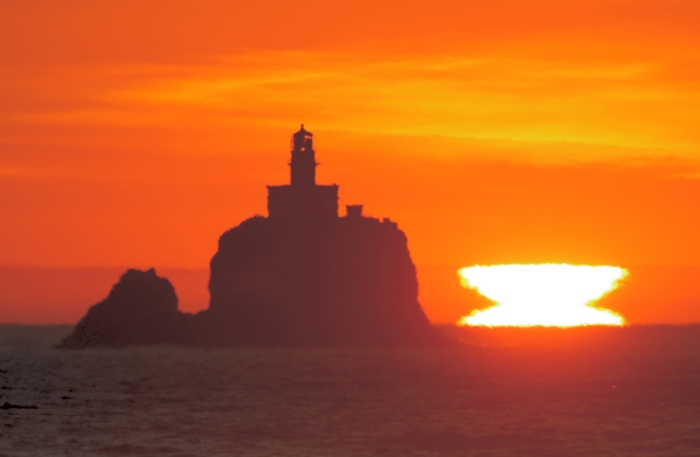
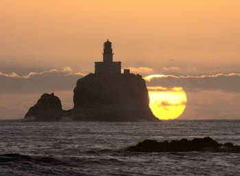
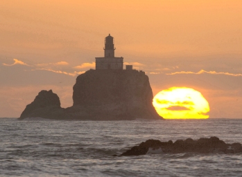
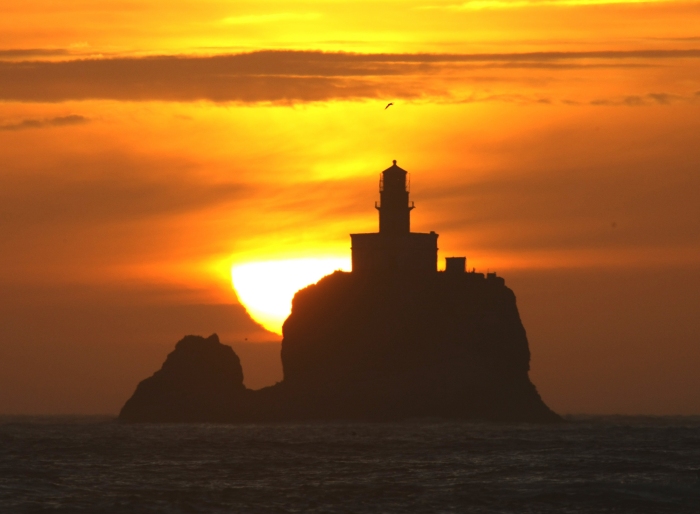
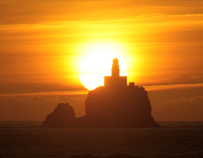
The main reason in photographing the sun setting behind the lighthouse was to
fully document the daily change in the sun's position on the horizon, since the
earth's axle tilt causes the sun to set further south each day. From Indian
Beach, this annual circumstance can be best viewed from the very south edge
of the beach (Bald Point) starting around August 9. If one reaches further
south of Bald Point (such as walking around Bald Point at low tide, or climbing
over the point to gain the beach to the south), the event can be seen starting
in late July. With each passing day as the sun moves south, one has to move
north about 100 feet to view this event, and can do so over the next 15 days
give or take a few. The series of images that follow were acquired starting in
early August (south of Bald Point at low tide), and continues till August 24, and
over a span of 23 years. The images are dated, and particular information is
provided where interesting and/or necessary, and all are just less than 2 miles
from the lighthouse.
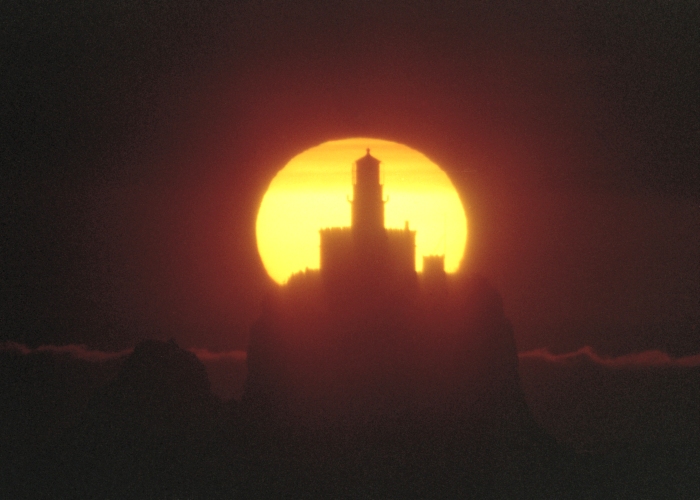
![Lighthouse]\](02aug93-0002z.jpg)
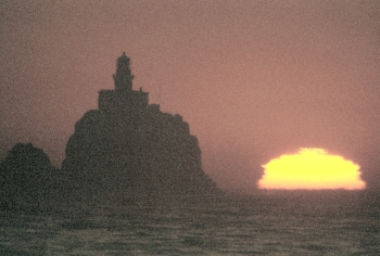
August 2, 1993 - South of Bald Point (film).
August 3, 2005 - South of Bald Point (DSLR)
August 6, 2016, after climbing up a ledge on Bald Point to an elevation of 23
feet above sea level.
August 8, 2014 at sea level.
August 9, 2014
August 10, 1993 (film)
August 10, 2014
August 11, 2015...the fires in Washington State sent lots of smoke out over
the ocean, making for this interesting set of images.
August 11, 2016
August 12, 2016
August 13, 1991 (film)
August 16, 2015
August 17, 2009
August 17, 2015 (and a nice green flash)
August 18, 2015
August 18, 2016
August 19, 2016
August 20, 2014
August 21, 2015
August 22, 2016
August 23, 2015
August 23, 2016
August 24, 2015
August 25, 2019
August 26, 2019
August 27, 2017
( taken from the trail above Indian Beach)
August 28, 2017
(taken from the top rock ledge at Indian Beach)
----------------------------------------------------------------
The Ecola Park/Indian Beach Trail continues north, up and over Tillamook Head,
from the Indian Beach Parking Lot. It is 6 miles to the 'Cove' in Seaside, and
has four overlooks that one can see the lighthouse from. (In July, 1989 I made
a rough trail up to the very northwest end of Indian Point to see the lighthouse,
but have never tried doing that again!) There are two viewpoints on the trail out
of Indian Beach, and about a 30 minute hike. They are separated by about 100
feet, but offer good views. The third (normal) viewpoint is west of the Hiker's
Camp, and affords the closest and best view from anywhere along the northwest
Oregon coastline. It is about an hour from Indian Beach. It is also accessible
using the steep road (also from the parking lot, but not open to public vehicles),
but one misses the two other viewpoints already mentioned. The trail route can
be wet and muddy, therefore somewhat slower than the road. Continuing north
on the trail (toward Seaside), the fourth and last viewpoint, which is difficult
to locate is the 'Lewis and Clark' Viewpoint, as designated on some maps. The
last time I visited this location (2015), the forest brush, bush, and small trees
made it almost impossible to find. Now, follow up the trail with these images..
July 6, 1989 - From the west end of Indian Point, at an elevation of 278 feet
and 1 3/4 miles distance.
September 17, 2015 - The first viewpoint at 260 feet elevation - 1 3/4 miles
September 17, 2015 - The second viewpoint at 273 feet elevation - 1 3/4 mile
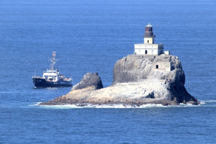
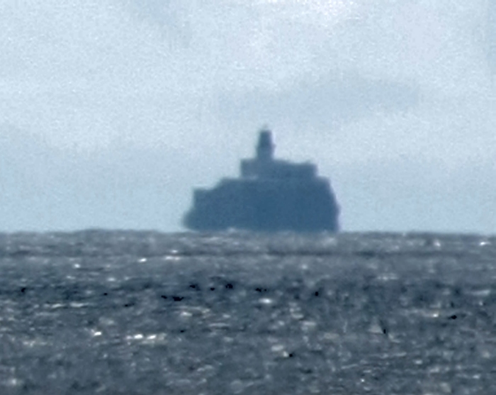
August 25, 2016 - While I was on board the ship, IRONWOOD, as pictured
here rounding the lighthouse, my wife, Karen captured this image, as well as
acquired some video clips. Images taken from the IRONWOOD will be under
a different heading....later. This was also taken from the second viewpoint
at 1 3/4 miles.
July 7, 1992 (film) - From the second viewpoint 1 3/4 miles distance.
July 7, 1992 (film) From the Hiker's Camp Viewpoint. This was my first photo
from this locations which is closer to the lighthouse from any other land-based
position along the coast. Distance to the lighthouse from here is about 1 1/2
miles, and at an elevation of 610 feet.
July 5, 1995 (film)
August 2, 2002 (DSLR)
July 31, 2005
July 5, 2007
November 11, 2009
November 2, 2010 - Stormy weather.
July 23, 2012
The images above were taken on July 30, 2015 - Before sunset - just after
sunset - in twilight - and lastly, illuminated by the full moon at 10:30PM.
----------------------------------------------------------------
These last two images are from the Lewis and Clark 'Viewpoint', more than a
mile further northeast from 'Hiker's Camp', and at an elevation of 980 feet,
and about 2 miles from the lighthouse.
July 7, 1992 (film)
September 15, 2015
----------------------------------------------------------------
An interesting hike to take is along the shoreline west of the 'Cove' in south
Seaside. It is very rocky (and slippery when wet!) all the way, and as far as
one dares go. About a mile west southwest, the shoreline affords the first
view of the lighthouse at what is called 'West Point', and 3 miles from the
lighthouse. If one leaves the cove area 2 hours before a very low tide, one
can go past West Point, heading south southwest, 1 1/4 more miles to a spot
where the lighthouse starts to disappear behind the rocks of 'Three Finger
Jack', or now just under 2 miles from the lighthouse. This is most likely the
last 'safe' place to view the lighthouse from the north along the shoreline.
July 2, 1985 (film) This was out along the shoreline west of the 'Cove' of south
Seaside...about a three hour hike just before low tide. Elevation about 8 feet,
and just under 2 miles from the lighthouse. The rocks on the left are referred
to as 'Three Finger Jack'.
August 2, 2005 - 2 miles distance at 22 feet elevation. This image was taken
after a 1 1/2 hour hike from the 'Cove' to West Point.
----------------------------------------------------------------
The next four images were taken near the Seaside Promenade at 9th Avenue
in 2015-16....all 6 miles from the lighthouse at an elevation of 25 feet.
Cloudy day
Sunset
Sunrise
June 24, 2012 - Taken west of the Seaside Promenade at 10th Avenue at an
elevation of 23 feet, and still 6 miles from the lighthouse.
September 3, 2016 - Little Beach (south Gearhart), elevation 16 feet, and
7 1/2 miles from the lighthouse.
August 9, 2016 - This view is from the south edge of Gearhart Beach, about
7 miles north of the lighthouse 41 feet above sea level.
August 25, 2015 - West Gearhart Beach at 32 feet elevation, and 7 1/2 miles
from the lighthouse.
June 26, 2012 - North of Gearhart Beach at 8 miles and 25 feet elevation.
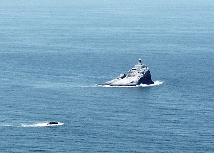
This from Del Ray Beach, 9 miles distance at 41 foot above sea level. Notice
the atmospheric layer above the water at the base of the lighthouse.
August 9, 2016 - This was taken from Sunset Beach, about 12 miles to the
north, and at an elevation of 52 feet. Beginning to see the curvature of the
earth, as it now cuts off some of the base of the lighthouse.
Here is an image from the ridge above the Peter Iredale wreck, about 17 miles
to the north. This photo was taken at an elevation of 60 feet. Here one can
especially see the Earth's curvature effect upon this image with comparison
to the previous image.
And on another date, from the same general location, from 40 feet elevation.
This image is also from the Peter Iredale site, but standing near the water's
edge...about 6 feet above sea level. Because of the heavy atmospheric layer
distortion, the top of the lighthouse looks very elongated.
Here is the very top of the lighthouse, seen from the observation deck at the
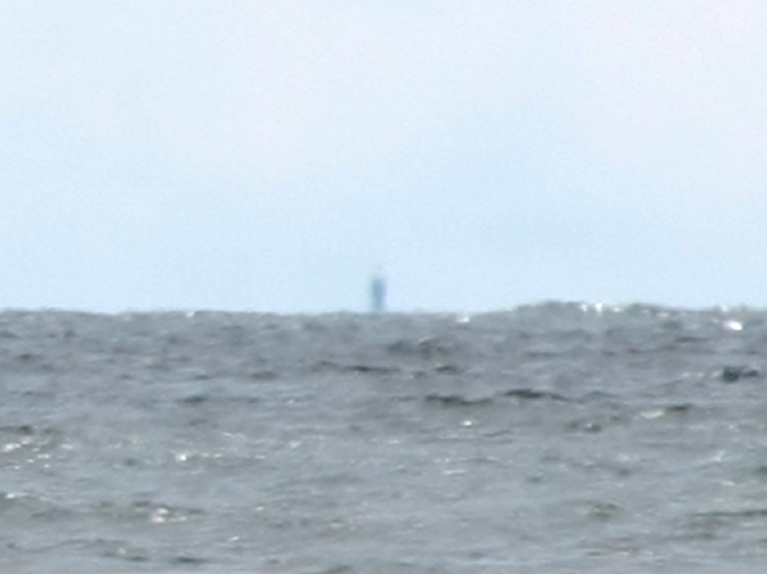
South Jetty of the Columbia River, some 20 miles to the north. This is the
most northerly image, and was obtained on an exceptionally clear and calm
day. The curvature of the Earth here is most evident! This one is from
an elevation of 35 feet above sea level.
----------------------------------------------------------------
Do you want more?
Click here for aerial imagery
Click here for 2016 boat trip to the lighthouse